
phil
Visited these after tip off from Johan.
After crossing on the passenger ferry from Fowey, we walked along the narrow (& steep!) road out of Polruan for half a mile till we came to the fork in the road after a further 200 metres along the right fork, you can see the first big stone on the left hand side. Looking down the the right you can see the smaller stone near the edge of the field.
They are unlike any other stones I have seen in Cornwall.
I saw 2 other similar stones in neighbouring fields of a similar type.
I also found some similar stones in the hedges around the fields.
The stones are mentioned in Robin Payne’s book which I use for alot of my references.
He says that in 1813 the first ordnance survey map for this area shows a mound at SX141510 which is just to the south of these stones. Could this be the source of these strange stones?
While looking at the Essa stones 1 and 2, I found a stump (“Essa 3”) in the field to the east. It looks very similar to the other two apart from the fact that it’s much more squat.
Again no mention on the map and NO mention in Robin Payne’s book.
If this is an ancient stone then I claim it!
Phil’s stump! :o)
“Essa 4” – Noticed this from the roadside on the way to visit the Essa stones. It looks lighter that the Essa stones so may be a spar stone.
I thought it may be a rubbing post but why is it so close to the hedge when most rubbing posts are in the middle of the field?
The pic I took was using the full zoom on my camera.
Lack of access prevents closer examination.

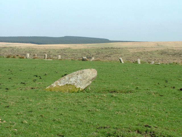
Essa 1 in the forground, Essa 2 in the distance, sheep in middle.
The alignment looks towards Bodmin Moor on the horizon.


Essa 1 – This largish stone is unmark on o/s maps
Judging by the weathering it looks like its been standing for a couple of thousand years at least.
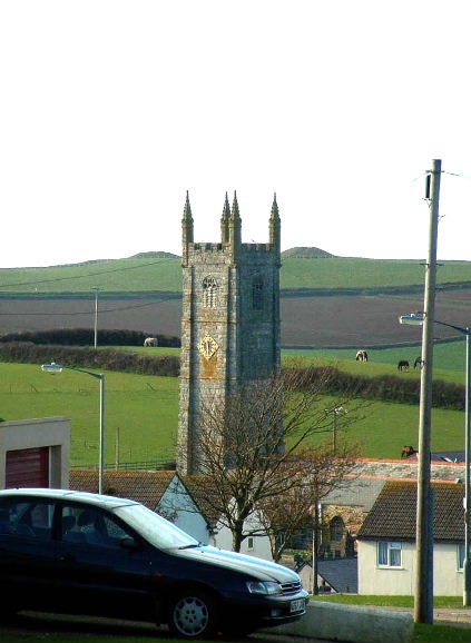
This site is not far from the Eden project.
A very pleasant walk thru the woods but unfortunately the site is on private property. I did try driving around to get a good view from a nearby hillside but you still can’t beat an aerial view of this type of site.
Anyone have a helicopter handy?
have a look from above at....
uk.multimap.com/map/photo.cgi?client=europe&x=206000&y=56000&scale=10000&width=700&height=410&gride=205900&gridn=55700


This just totally dominates the whole landscape between St. columb and the Goss moor

A group of rare examples of slate menhirs.
They are sited in a field, just above the village of Polruan.
Essa Stone 1, is the most impressive at 1 .6 metres high.
Turf war over Byers’ white horse
politics.guardian.co.uk/localgovernment/story/0,9061,675788,00.html
A white horse, 100 metres high, is to be carved into the chalk downs at Folkestone to greet Channel tunnel users because Stephen Byers, the transport secretary, believes it will “boost local pride”.
Objections by environment groups, including the government’s advisers English Nature, were brushed aside because Mr Byers considers the horse would have an emotional and symbolic value for the town.

If you’ve ever been to Newquay you’ve probably driven past this site. It’s on the hill just above the river Gannel.
It’s called a round on the map, but looks to me more like a big hairy eyebrow.
It was quite difficult to get a good view of it but by driving around in carparks and housing estates on the hill opposite the river I was able to get a few clear shots of it.
i know it was excavated a few yaers back and there is a report on it somewhere.
What I love about looking out these kind of sites is knowing that so many people know nothing about its existance. Even people living in the houses looking down to the river.
(I’ll get get me anorak)


The double barrows of Trevelgue viewed from St. columb Minor. the church itself is said itself to be built on a pagan site.

Links to Cornish Stones Circles / Menhirs / Hillforts / and Earth mysteries etc.


The original ‘Cup marked’ stone, now in Truro Museum.
The one at Tregiffian is a copy!

My own version of a map dated 1888 showing a stone at Delford bridge. See the original map at
old-maps.co.uk/large_ind.htm?currentWest=10580.7752204482¤tEast=11532.3751701768¤tSouth=18540.4781176970¤tNorth=19054.3031176970&countyGridMap=10corn061
5 pics of this rarely visted site on Bodmin moor.
(no other info)
5 colour pics of Fernacre Circle, Bodmin moor.
This is an arty website rather than a guide, but the pics are good.
I passed this site totally by chance.
I just noticed it over a hedge as I approach the clapper bridge at Delford.
I took several photos with zoom lense from the road side.
Looking at the stone from different angles it looks to me like a fallen Quoit stone, other stones scattered around it would add weight to this theory.
Looking on the map I found that the neighbouring farms go by the names
Penquite, South Penquite, Best Penquite, Higher Penquite and Lower Penquite
“Pen” = Hill or Head “quite” could be a corruption of quoit
hence: Quoit on the hill
Anyone agree?
Phil

Looking towards the northwest.
Buildings at the back are at West Rose.


Side view of the stone.
This photo was taken from the roadside at......err Delford bridge

What a site.
Different from any other!
If you want come by car, we managed to park near the end of the road at Casehill or if you want to come from the south you should be able to pull over on the road that crosses Emblance downs leading towards the water works.
The route from all directions is quite dry under foot.
(Mind you, the footpath from Lower Candra looked a bit sticky)


Tricky one to get to due to fences, stone hedges and cattle.
I was visiting Arthurs hall and it was too close to miss out.
Much more impressive than the ruined circle on Arthurs downs.
footnote
I’m not sure on the rights of access but I didn’t cause any damage or frighten any animals. There is gate to the field from the west, (which I found on the way out).
This stone to the south-west is not shown on the map but looks like an outrider.
The woods in the distance are at the bottom of Garrow tor.


The stones look very “blocky” compared to other circles on the moor.
Such craftsmanship!

Hedge cuts right through this one.
The hill in the background is Carkees tor
24/03/2002

A 2,000-year-old sword and an ancient mirror are to be returned to the islands where a farmer found them.
He was working with a tractor in a potato field on the Isles of Scilly, off Cornwall, when he uncovered a burial site.
see the story
news.bbc.co.uk/hi/english/uk/england/newsid_1858000/1858788.stm
Also 80 feet in diameter
80 feet in diameter!
A semi circle of recumbent stones lies on the edge of the clitter.
ref: Parish of Northhill checklist
the grid ref given here is 24537730