Looking North West, towards the Midwinter sunset position.

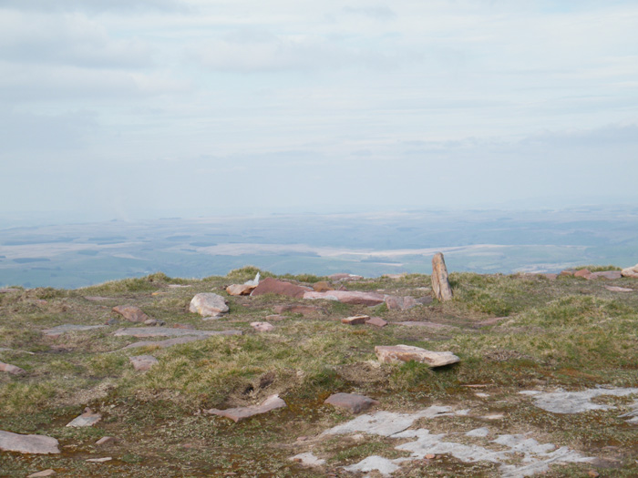
Looking East, towards the Black Mountain, cairn topped hills for miles.

Looking West, towards Pen-y-Clogau cairn to the right of centre, with Tair Carn uchaf in the far centre skyline. This area has many similar monuments.


Looking from Fan Brycheiniog, with the walkers shelter in the foreground.

Looking West. Garn Caws, with Garn Fawr to it’s left, in the distance.


This stone has an uncanny resemblance to the slab stone at Trellech.
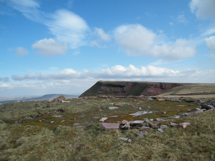
Good views from here, to the South and West, with the central beacons to the East.

The slab stone, from the other direction. Again resembling a hooded figure,this time with a face.(okay, you need an imagination. Try it, won’t hurt you)

the smallest of the 3 stones. A slab rather than a pillar. It always reminds me of a hooded figure walking towards the other 2 stones, presumably turned to stone for some crime.
The circle can be reached by taking the West bound lane off the A470 Builth Wells road,opposite the bridge that goes to Erwood and Painscastle. This lane will take you up to the top of the hill where you take a right turn onto the moors,through a farmyard ,and on for another mile or so,where there are plenty of parking spots as you will be very much alone here. A GPS would be useful as the circle is a small one with few stones left,and not too obvious until you’re right on top of it. The going is very gentle,only a 20 minute walk from the road over grassy moorland.
One of the stones has shattered with the frost,as has most of the others. This has left small pieces of stone scattered around. I held one for a while and it made me sick, only eased by replacing it.The cure was instant. These souvenirs bite,they don’t want a new home.
Great views from here though, the whole of the Brecon Beacons can be seen to the South. So take some photo’s,they’re ok, but anything else will cost you.I’ve never had a headache like it,and i wouldn’t wish it on anyone else. You have been warned.

This stone lies outside the circle.It has a surrounding ditch with a low embankment,approx. 12 feet diameter.

This is the largest of the 3 remaining uprights.The others suffering extensive frost damage.

This is looking South East, down a mist filled Wye valley, towards the Black Mountains. The only surviving uprights shown here.
Sunrise on a frosty January morning.
The site is very overgrown now,hardly recogniseable .I didn’t realise I had found it at first,the large boulder giving it away,the heather hiding all the other stones. The mound can be made out only because of it’s surrounding ditch causing a gap in the undergrowth.
A bit of a trek to get here up very steep slopes,and not easy to find without a GPS. It’s about 100 meters from a track and a small pond,but invisible from more than about 50 meters away.
Good views though.

Looking North East,towards the large boulder,just visible in the heather.The whole site is very overgrown.

Looking south,towards the mound.This is the only visible stone.


It seems to me that Maen Llia is not a natural shape. In the distant past it was almost certainly tooled, and sited, very deliberately.
The reasons for this aren’t clear to me , but some of its secrets have emerged.
The stone is oriented north/south. this isn’t approximate, it is n/s.
the diamond shaped top is a right angle. The slope that runs uphill from north to south is 38 degrees, which means that at midday at the equinox it is pointing directly at the sun.
The slope that runs downhill from the apex to the south is between 51 and 52 degrees. which means if you look up it to the north on a clear night you are looking directly at the pole star.
this means that the angle of this slope is the same as the latitude of the site, which it is.
Anyone who has a horizontal sundial will be familiar with this shape. To work properly the sundial must be aligned n/s and the slope of its nodus must equal the latitude of its site, otherwise it doesn’t accurately measure the hours. Maen Llia might just be the oldest horizontal sundial in the world( if i’m right)
Strangely enough if you stand by a small triangular shaped stone about 40meters south west of maen llia at sunrise on midsummers day( about 10 meters from the road) the shadow cast by the apex of maen llia just touches the stone, and the azimuth of the sun at that moment is spookily between 51 and 52 degrees.
At the southern edge of the stone from ground level is another slope, this one believe it or not is once again the same angle?
I think this angle was important to the people who sited this stone, but i havn’t come up with any use for it , other than a very crude calender.
There must be more to it than that. someone with a bit more grey matter than me can maybe take it further, (or discredit what i’ve come up with) i don’t mind which as long as the argument is sound.
One more thing, this angle has been used on other ancient monuments too. Theres one in Egypt that uses it 4 times. there may be others, i dont know.
There are other angles on maen llia too. I can’t find anything for them yet.
If anyone can suggest anything else going on here i’d like to know about it.
Please don’t take my word for it , these are just my observations and i’m just an amateur at this. Check it out for yourself, theres more to be found here i’m sure.
Good luck