
The South-western cairn has been seriously mucked about with – nevertheless it remains an evocative monument.
Image credit: Robert Gladstone

The South-western cairn has been seriously mucked about with – nevertheless it remains an evocative monument.

The (main) north-eastern cairn at SN92165948. CPAT cites other examples here, but things do get confusing. The great Drygarn Fawr with its twin beehive cairns can be seen background left

Summit cairn... despite the standard vandalism, this is a very substantial monument in a brutally uncompromising location.

Upon the margins; aloof from proceedings; on the outside, looking in... of limited interest to general society. Yeah, it might be argued there’s not a lot to recommend being ‘upon the periphery’, is there? Then again, peripheral vision is perhaps the most perceptive, the fleeting glimpse ‘out of the corner of one’s eye’ more liable to detect what is hidden in plain sight, the lingering residual capability of human senses once attuned, finely calibrated, to the live or die of the hunt. The moment. Let’s face it, what of true artistic merit has ever arisen from the mainstream? The glorious exception of ABBA proving the rule.
Now depending upon your point of view, Foel Goch, an unassuming, 2,004ft peak overlooking the Afon Dyfrdwy (River Dee) to the south and Cerrigydruidion to the north, was either given a raw deal... or blessed with a narrow escape... when administrators saw fit to define the eastern extent of the Snowdonia National Park back in 1951. Thus excluded from popular consideration, only dedicated ‘peak baggers’ and locals would appear to wander its slopes nowadays. Out of sight is out of mind, right? There is one further category: the Citizen Cairn who, having noted a distant characteristic ‘hump’ upon the mountain’s elongated western ridge while hanging out upon the summit, was curious enough to check the map and realise he must someday return for an audience – the two-mile plus detour clearly prohibitive at the time. Just to see what’s there, you know? Said ‘hump’, it transpires, is known locally as Garnedd Fawr: Big Cairn. So why don’t the archaeological intelligentsia eulogise such a large, well-placed prehistoric monument? Guess one has to learn to use that peripheral vision, to consider the wider picture. Utilise the inner Bowie over the background static nonsense generated by today’s monoculture of moronic rappers and Ed Sheeran.
I approach from the aforementioned Cerrigydruidion – yeah, that one familiar to owners of Cope’s ‘You Gotta Problem With Me’ opus – the B4501 subsequently guiding the traveller south to access a single-track road signposted ‘Llangwm’. Shortly beyond the buildings of Henblas, a track services the farm of Aeddren-isaf where it is possible to verge park a little way prior to the entrance. Now I tend to lose my bearings within farmyards – not to mention many other places, as it happens – so a sign to my left confirming my exit point to the hills is reassuring, if ultimately misleading. In retrospect, this is not the official footpath heading for Bwlch yr Greigwen, via Rhyd yr Ewig, but a concessionary track heading more-or-less south. Whatever, that’ll do. Upon crossing the Nant yr Hengwm and cresting a rise, the bulk of the mountain rises above and beyond. Just a question now of not succumbing to the temptation, the overpowering urge, to make that impetuous direct full-on ascent, the sensible line clearly being an approach via the bwlch. Haha. Yeah, right.
Now – as with Mr Wilde before me – I can resist most things except temptation... resulting in the climb being much tougher than it could/should have been (there actually being a track a little way beyond, regardless of the route from the bwlch). Furthermore, just as I begin the final approach, I note two figures arriving from the south to attain the summit before me. Here, of all places. Damn them to blazes! As it happens, two nicer people I challenge you to meet... but then out here on the periphery of things you no doubt already assumed that would be the case? I learn they are either locals or know the area very well (one doesn’t wish to pry too much), this being their favourite walk. Or something like that. They, in turn, discover that the grassy mound they regularly make a brew upon – the chap packs a portable stove in his rucksack for suchlike – is in fact a large Bronze Age funerary cairn, the insipid little modern marker cairn notwithstanding. They appear pretty chuffed at the knowledge; but again, you already guessed that. Soon they continue on their way toward the summit of Foel Goch, rising above to the east, leaving me to hang out as I see fit in the sunshine. Not to mention the pretty violent wind.
The monument is deceptively large and, all things considered, relatively intact with a protective grass mantle, albeit acting as a boundary of fencelines which divide it into distinct ‘segments’. Indeed, the cairn’s significance in the landscape is affirmed by the presence of a boundary stone inscribed Llanfor/Llangwm. One is tempted once more, this time to muse that such singular prehistoric cairns may have served this function back in the day? To demarcate territory, act as focal points for meeting with neighbours, trading, effecting inter-tribal marriages etc. Hey, the distant origin of the Country Fair, perhaps? Thankfully in this instance the great cairn is clearly not ‘mainstream’ enough for moronic vandals to have considered carving a muppet shelter out of the fabric. Out of sight, out of limited minds, as they say.
Garnedd Fawr is certainly an imposing vantage point with sweeping vistas to be had in all directions, save up the ridge toward the mother mountain: The Arenigs rising to the west above the glint of the waters of Llyn Celyn; the mighty Arans to the south; Y Berwyn to the southeast; more-or-less the whole of Northern Snowdonia to the north-west. So many upland cairns with so many no doubt similar stories to tell concerning who we are and what we’ve been in times past... if only stone could speak. In a manner, of course, these ancient rock piles CAN ‘speak’. But only if the visitor is prepared to look, listen and not jump to conclusions.
I’m aware a storm front is due – one can literally sense it upon the wind, regardless of meteorological forecast – yet such is the vibe up here I make no attempt to cut short my visit. Some things, some moments, simply have to be savoured while one has the chance. Hence, when I do finally begin my descent, it is with a wary eye upon an imminent downpour liable to catch me just before reaching the sanctuary of my steel carbuncle. Well, it’s ‘Sod’s Law’, isn’t it? So, in anticipation of a drenching, I follow the logical route down to Bwlch yr Greigwen, with superb views of The Arenigs, prior to striding out along the actual public footpath shown on my map all the way to the farm. I reach the car and am in the process of removing boots etc when the rain arrives. Sweet.
Reflecting upon the day, the quality of both the destination monument and the surrounding environment is only too apparent. Right up there, in my admittedly extensive experience, with some of the best the National Park itself has to offer. In fact, it seems to me that, once again, being upon the periphery is not such a bad thing. Quite the contrary. The Herd Mentality might well be fine for your Ovis aries – but not Homo sapiens looking for that little more insight.


To the approx south-east(?) of the ‘circle lies this...
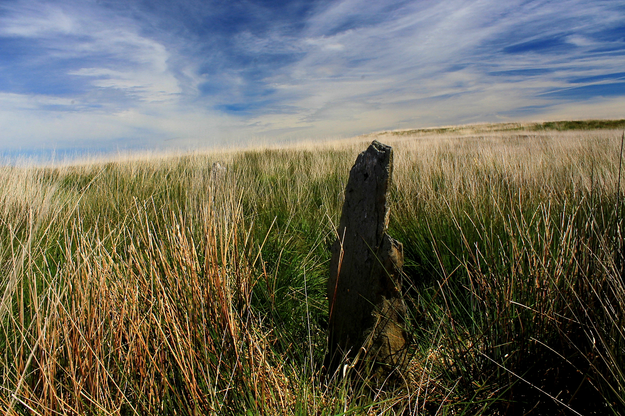


In classic Welsh upland circle mode, a number of the stones barely break the (existing) surface... But hey, it’s the demarcation of space that counts, end of.

The stones seemed to have the right idea: take it easy and relax in the sun. So I took their heed.

Such is the wild, inhospitable hilltop location chosen for this site I could only discern 8 remaining circle stones still in situ, the earth having reclaimed the rest. Nevertheless, the vibe here knocked that at almost every other ‘circle I’ve yet seen away. Cerrig knows what I’m talking about....
No echoes of the past owing to the wind... but you know what I mean.
Moel y Ci – “Dog Hill” – is a north-western outlier of Y Glyderau, rising to 1,345ft and boasting panoramic vistas across The Menai Straight to Anglesey... as well as – looking the other way – the mountainous heartland of Central Snowdonia. All in all, well worth the short, sharp ascent undertaken from Rhiwlas, set below to the west. Hey, there’s even an apparent Romano-British hut circle to be seen on the way.
However if one is of the ‘Antiquarian persuasion’..... the presence of a massive Bronze Age round cairn (Carnedd Moel y Ci) complete with cist/possible kerbing still in situ, makes a visit a real ‘no-brainer’. Not that the traveller won’t have to use his/her brain rather a lot to take in the excellent upland vibe to be enjoyed here... but you know what I mean.

Worth a visit for the expansive views alone, to be fair.


Not the best weather... but then that’s why I was there.


Highlighting what looked like internal ‘kerbing’ structure still in situ?


Looking across the cist to the high tops of Y Carneddau

The monument possesses a fabulous panorama looking across The Menai Strait to Anglesey.


Looking across what I took to be a rather obvious cist.


One of two(?) additional cairns to the immediate approx north-east...

The monument is far more substantial than I had anticipated.

Cwm Moch can be found at more-or-less the northern tip of the northern Rhinogydd, arguably among the most brutal, testing walking country in the whole of Wales.
The cairn depicted upon the map – although by no means a large, nor impressive monument – occupies a fine spot within the landscape. Indeed, the placement is just what the doctor ordered, frowning crags beckoning the more adventurous ever upward, Llyn Trawsfynyyd resplendent to the east. Structurally-speaking I was in two minds about this one. Marker cairn... or later material upon an original base?
It would appear there are apparently more cairns in the immediate vicinity not shown upon OS mapping? However, having been one of those drawn further up into the hills, I was happy with ‘just’ this one.

This – I believe – is the monument actually marked upon the map. To be fair – unlike that crowning Moel Ysgyfarnogod to the west – I was not convinced of the pedigree of this one. However, there are, or so it would appear, others not marked upon the map which may well be more compelling.
It’s amazing what you might find roadside in Snowdonia. No really, it is.
Take the ethereal remains of the prehistoric settlement near Cefn Clawdd, not far from Llyn Trawsfyndd. Sure, no doubt the structure has been adapted over the course of millennia to serve the changing requirements of successive farmers? But nevertheless....
Indeed, while wandering around the site in the soft early evening light, I pondered that the odds might be pretty short that the erectors of the fine Bronze Age cairn some way to the northwest (SH68383416) may well have lived here back in the day? That the head of the village ended up within the cist within the cairn?
Just a little way from the road and obvious parking spot for the cairn (unseen from here), bonus site!


A nice bonus site when visiting the excellent nearby cairn/cist


Sometimes one is just drawn back, you know? You have no say in the matter.


North-west(ish) across Bwlch y Greigwen to Carnedd y Filiast.

Llyn Celyn and The Arenigs can be seen beyond... cairns as far as the eye can see.


