
Highlighting the ‘orthostats’ that looked rather like the remains of a kerb-like arrangement to me.
Image credit: Robert Gladstone

Highlighting the ‘orthostats’ that looked rather like the remains of a kerb-like arrangement to me.
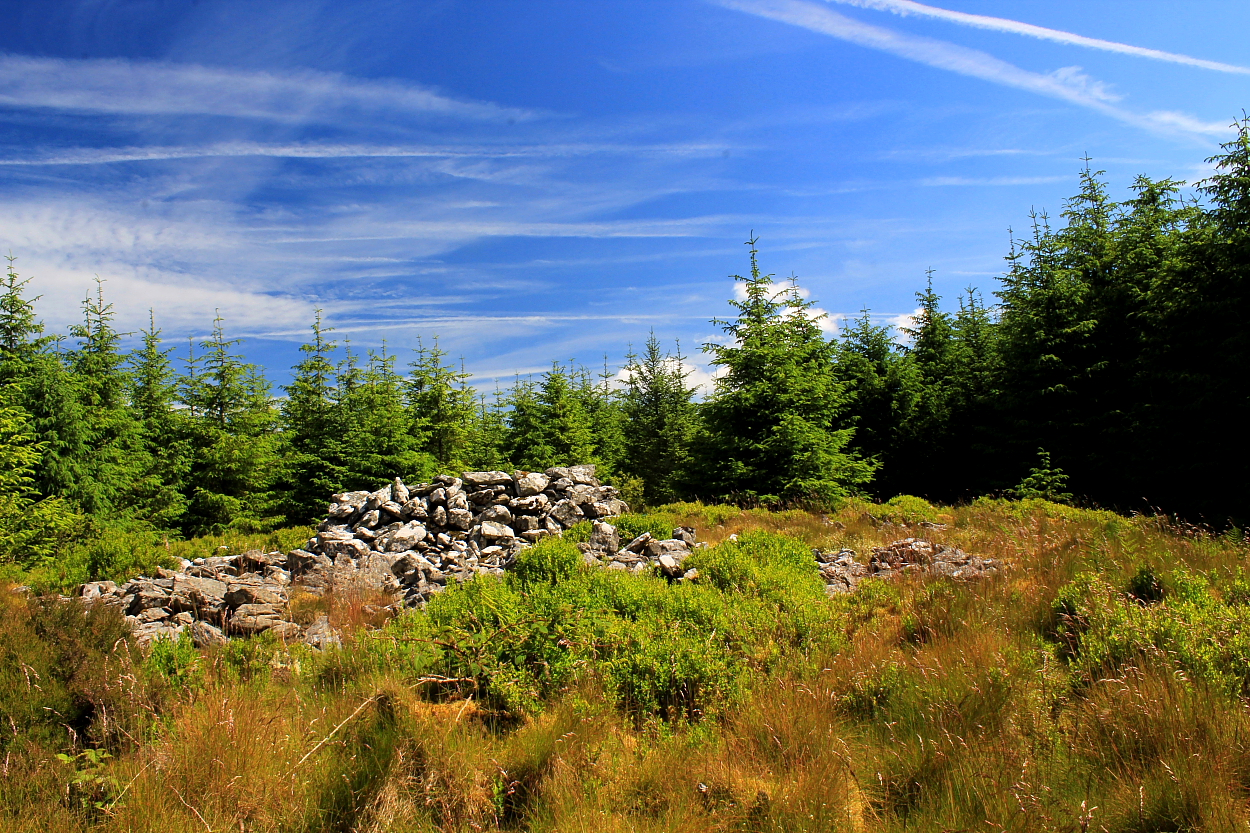


Q: When is a long cairn not a long cairn? A: When it’s in Wales, apparently

It is noticeable that the stones are in a location where Pen-y-Fan and Corn Du (summit peaks of The Brecon Beacons) just happen to sit perfectly upon the horizon. Add a treeline and the fit would appear even more precise. Given the topography of the area and the otherwise ‘why here?’ questions raised by placement, my suggestion is that there may be an association here.
Saith Maen translates as ‘Seven Stones’ in English... which may or may not be true since the very disturbed nature of the terrain underfoot – possibly a combination of bovine action and dodgy ‘excavation’ (for some reason the trenches were not back-filled) – ensuring my arithmetic is even less precise than usual. The disintegrating, not to mention mostly collapsed, ‘protective’ wooden enclosure surrounding the site also does it no favours.
Nevertheless, ‘a number’ of stones can still be found here still in position among quite a few others, suggesting the possibility of former multiple rows? Whatever, the location is excellent, overlooked by the bleak mass of Gorllwyn some two miles to WSW, Y Gamriw to NW and the enigmatic Hafen stone setting to east. In short, there is a surfeit of prehistory in the locale. Just check the map.
As I sit and take it all in two things become apparent: 1) I really must re-visit Gorllwyn some day before it becomes physically beyond me; 2) is it me, or is the rather idiosyncratic location of this stone row governed by the fact that Pen-y-Fan and Corn Du feature perfectly up the skyline. Coincidence? Well, no doubt some muppet or other will insist Google Earth (or whatever) shows no such thing. My view is: “Come and see for yourself” since, funnily enough, prehistoric people didn’t have access to satellite imagery. As far as I’m aware.


Toward Gorllwyn... was there an association between the row(s) here and the great (now fallen) stone upon Pen-y-Gorllwyn?

Toward Y Gamriw and its cornucopia of upland cairns......

Cwm Ystwyth is not exactly ‘Piccadilly Circus’, to be fair.... those outlanders who are out and about seemingly just a’ passing through. As tourists do. One reason for this, perhaps, is that, despite being home to the nascent Afon Ystwyth, the scenery is not all Mid-Walian sublimity, the scars devastating Bryn Copa upon the valley’s northern flank evidence of successive copper mining enterprises stretching right back to Bronze Age times. Yeah, this is a ‘working valley’, always has been. It was here that the magnificent Banc Tynddol ‘sun-disc’, now within the Museum of Wales, was discovered in 2002. Perhaps upon a day like today?
To the south of the small hamlet of Cwmystwyth, rising to as near as dammit 2,000ft, are a group of green hills forming a secret wilderness rarely trodden nowadays – to gauge by The Citizen Cairn’s experiences – with even the local farmers relying upon the ubiquitous quad bike to get around. Lethal in mist, the rewards for the antiquarian-minded are not obvious from OS mapping, with only the prehistoric cairn of Canryrhyrddod (ironically arguably the least upstanding) cited upon the latest 1:50k version. Bryn Dafydd’s summit cairn (1,873 ft) is assumed to be modern... suffice to say, in my opinion, it is most certainly NOT.
I approached from the north, limited verge parking available (for the considerate) upon the very minor road accessing Cwm Ffald. Follow said road as it crosses the wondrous Afon Ystwyth to pick up a public footpath accessing the open hillside above. When it is eventually attained, following quite an uphill slog, Bryn Dafydd’s summit possesses everything I look for nowadays: fantastic upland vibe, great views, ancient cairn with substantial underlying circular Bronze Age footprint – as usual, ignore the parasitical modern marker – plus that indefinable ‘something else’....
Coflein reckon:
“A large Bronze Age cairn, which is now a very low stone spread, about 12 metres in diameter. A large marker cairn, NPRN 522211, has been built on the site, using material from the funerary cairn.” [R.P. Sambrook, Trysor, 22/3/2012]
I gaze across to Trawsallt – about a mile distant and clocked a couple of years back – and make a mental note.

Looking across Cwm Ystwyth towards Bryn Copa (centre right) descending from the great cairn surmounting Bryn Dafydd to approx south-west. Pen-y-Garn, with another large Bronze Age cairn, surmounts the far left summit of the ridge (centre), with Pumlumon’s ultimate Bronze Age cemetery looming background left.


I thought this was a top-notch upland cairn... ticks all the boxes I look for.


Looking towards Trawsallt about a mile to the Southwest... I took the opportunity to visit the very next day. Again, just look at the footprint.


It does sometimes beggar belief how some upland cairns are not recognised for what they are.....

The monument surmounting Bryn Dafydd is (discounting the parasitical modern marker cairn) of low profile, but with a substantial, obvious footprint.
Subsumed within bloody forestry a couple of miles south-east of Abergwesyn, the mass of stonework surmounting Pen y Garn-goch was once thought (by W. F. Grimes) to have been a Severn-Cotswolds variant chambered cairn... but now generally accepted as three co-joined summit cairns. This is splitting hairs, perhaps, since whatever the original configuration may have been, the impression nowadays is of a pretty impressive long cairn set within a ‘lost world’ clearing that might have even freaked out Conan Doyle.
Now I had planned to approach from the north, via the public track from Bwlchmawr – however, the occupant of said farm advised me to instead follow the road towards Pistyllgwyn and ascend via the obvious forestry track. In retrospect, I wish I’d stuck to Plan A, so to speak, the seemingly interminable plod not what the doctor ordered in the baking heat of June. Nevertheless, the ‘three-into-one’ stone pile is well worth whatever effort must be expended to reach it, the exquisite vibe reminiscent of a Scottish site and helping to dissipate the ‘what ifs’ that inevitably arise when sight lines are curtailed by trees.
Of the three cairns, the central would appear the best preserved, both its neighbours having been defaced by the usual muppet shelter, the whole clad by that weird gray(ish) moss one sometimes finds covering stone within woodland clearings.
So yes... great vibe (check), great archaeology (check), no midges (check), no rain (check). And almost the place to myself. Having said that, my only visitors during four or so hours hanging out in the pitiless, concentrated glare of the sun (yeah I know... in Mid Wales?) were two local trail bikers who – quite unexpectedly – were actually friendly, decent blokes for once and, furthermore, more than happy to learn the prehistoric foundation of their local hill. Imagine Vin Diesel swopping his Dodge (or whatever) for bike and discussing Bronze Age burial rituals? Surreal, but everyone’s a winner.


Now I don’t normally show much interest in solitary standing stones – fallen or not. But this one surely possesses the finest location in all Wales, bar none? If someone out there disagrees, please share...

The monolith viewed from the south-western cairn.

What a position for a (formerly) standing stone!

Now lying a short distance to the South-west of Gorllwyn’s South-western cairn, this substantial formerly standing stone – as evidenced by packing stones still in situ – must have formed one of the most mind-blowing monuments of its type in all Wales. Incredible position.


As can be seen here, the north-eastern carn (SN92165948) is a substantial distance from the summit of Gorllwyn. Incidentally, the little stone pillars are boundary markers...


Gorllwyn possesses – in my long experience – THE finest panorama of South Wales’ Old Red Sandstone Escarpment.... seen here from the summit cairn. Utterly exquisite.


East(ish) across the North-eastern cairn towards Y Gamriw and, oh, all sorts of things going on in the vicinity of Drum Ddu


Looking approx west towards Drygarn Fawr from the Southwestern cairn...

