
This is the end of the barrow that faces more or less east.
Image credit: Anthony Adolph
This is the end of the barrow that faces more or less east.

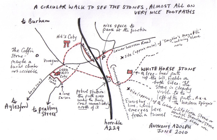
This is a map showing how we managed to find a perfectly good lay-by to park in, with lots of space, and then walk around the stones using mainly public footpaths: a few stretches involve roads, but they were not too bad, and the drivers who went past were considerate. It is a lovely spot for a walk and the ancient sites are splendid.

This is a map showing how Kit’s Coty and the other local stones can be visited using footpaths, and a minimum of busy roads, and also a good lay-by for parking. Some of the other posts here, though very well-meant, are quite off-putting by emphasising the amount of roads in the area: the spot is beset by transport links, to be sure, but they’re not all that bad, and it is possible to ignore them, for the most part – it would take more than a few roads and railways to spoil the outstanding beauty of the North Downs.