
drewbhoy


Three iron age settlements in Shetland are in the running to win Unesco World Heritage status.
More info : bbc.co.uk/news/uk-scotland-north-east-orkney-shetland-65231943
G. Rosscuithnidh ; headland, referring most probably to the promintory on which Invergordon stands, now called ‘ An Rudha. ‘ The latter part is rather difficult. Dr Joyce notes in Ireland such names as Quinhie and Feaghquinney, from Ir. cuinche, pronounced nearly queenha, the arbutus tree. This suits the phonetics of Roscuithnidh, which would thus mean arbutus head. In a field by the roadside, near the Parish Chuch, is Clach a’ Mheirlich, the thief’s stone.
Rosskeen Parish Place Names
Like Nick I worked quite a lot at Invergordon and was also often in the area playing gigs with one of my bands, so would see this stone quite a lot. Having been at Novar House this was a chance to have a good look.
Badly eroded carvings are barely visible, being honest if I didn’t know they were there I would never have bothered to look for them.
Standing at 1.8m tall this is an easy site to find. Park in the sailing club car park across the road (B817).
Visited 27/12/2022.


The eastern wall. Iron Age or of a later date, whatever age it was built on top of original defences.
Image credit: drew/AMJ


Do not jump the fence to the north, I almost ended up where my shadow ended up!
Image credit: drew/AMJ


After visiting Carn Liath I headed back into Evanton and took the B811 heading North East. The entrance to Novar House is easy to find. Head through the gates until a wee row of houses. Bizarrely when I asked to park, which was allowed, the person I spoke to didn’t have a clue what I was on about and thought the mound a wee hill.
Anyway the cairn or barrow, marked tumulus by the OS, is massive sitting at 25m wide and 4m tall. Boulders on the west and north west corner are field clearence.
I thought this a tremendous site despite the turf, trees and waste all around it.
A great location.
Visited 27/12/2022.
Hugh Miller has always intrigued me and Rhiannon’s folklore post made this a must visit site. Chamber cairns are popular in this area and there is a large but badly disturbed chamber at this site, an Orkney Cromarty type cairn.
At 24m wide and still standing at 1.8m, this must have been huge, as the remains of the chamber prove. A lot of dry stane dykes in the area suggest a lot stone was recycled elsewhere.
From Evanton, take the road heading west at the shop and park just before Drumore Farm. The cairn is in the the north corner of the field. Just to the north is the River Glass as it passes through the Black Gorge.
No Lady Balconie today, just a nice frosty winter’s day.
Visited 27/12/2022.
On a cold and frosty morning I pulled in at Cnoc A Teampuill. After crossing the Cromarty Bridge, follow the A9 over the roundabout and take the first minor road heading north west, then head south west towards Dingwall, then take the next minor road heading north west. Look into the field to the east, the cairn is easily spotted.
The site which is more oval than circular is 21m long, 18m wide and at its tallest 1.5m tall. There isn’t to much to look at, a few stones and slabs here and there. Stunning views of the Cromarty Firth are worth looking at.
Sadly nearby rock art couldn’t be found hopefully it’s still there. However, a pile of stones shoved into a ditch didn’t raise hopes.
Back for another look in the future.
Visited 27/12/2022.


The south wall looking down down onto grass well kept by the sheep.
Image credit: drew/AMJ

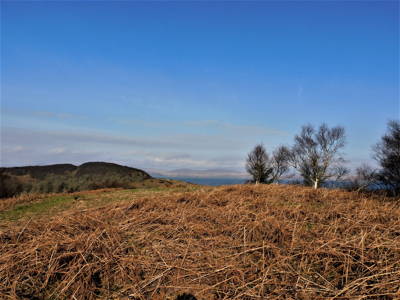
Looking south west as Loch Bhealaich, around which is located Tayvallich, moves into Loch Sween.
Image credit: drew/AMJ


Inside the fort looking south west, a walkers cairn.
Image credit: drew/AMJ


The south west, looking towards Carsaig, beyond is over the sea to Jura.
Image credit: drew/AMJ


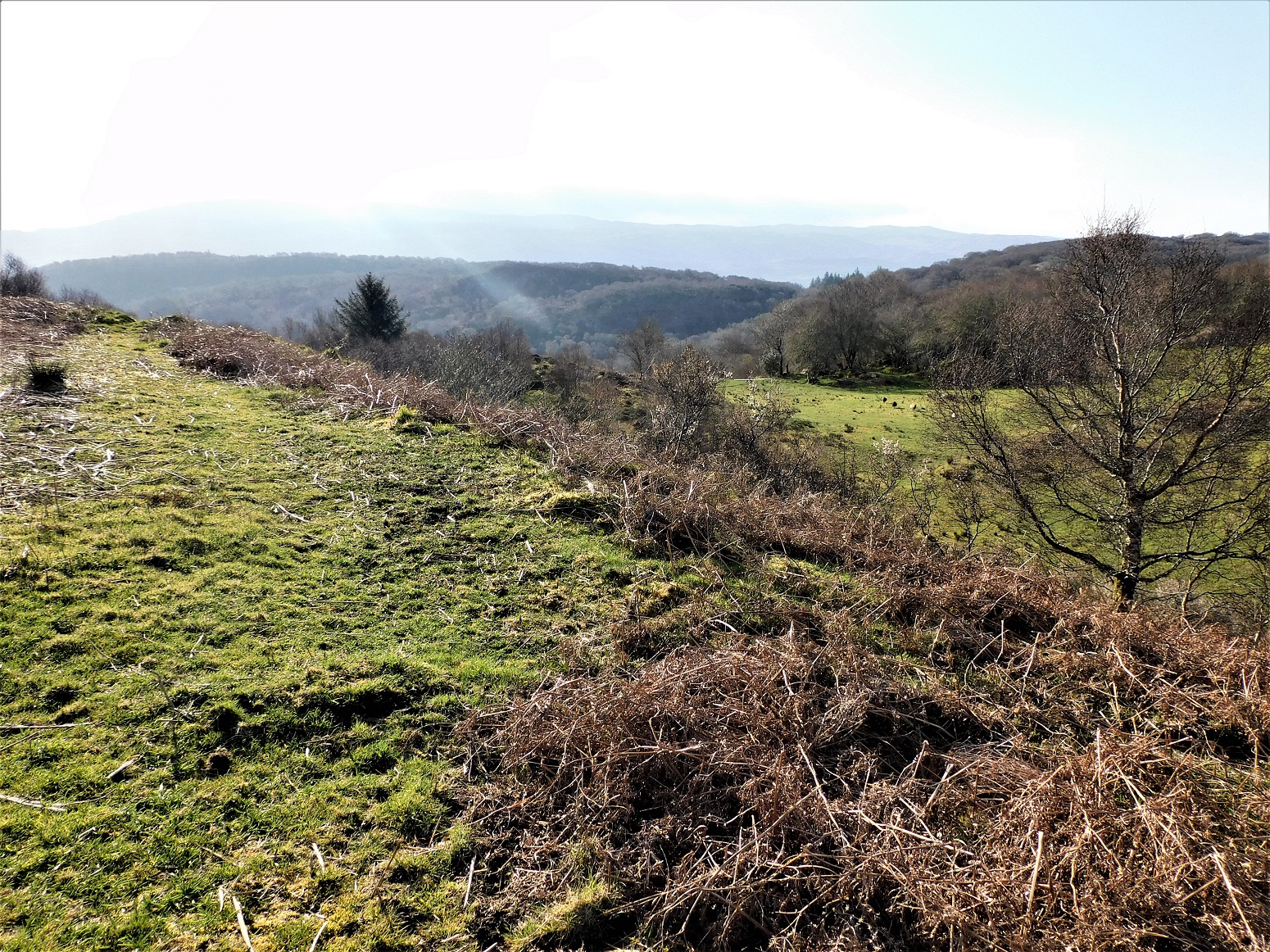
Storm Arwen and her friends that followed have caused a lot of damage to the fort at Castle Downie. Perfectly placed for a promontory fort, slopes on the north west and south east act as a defence, a gully on the west has been used as a natural ditch / rampart. You jump this to reach the fort. Ramparts on the north east and south west are still there as can be seen with some stonework. However, Storm Arwen and co have uprooted trees causing massive damage to these ramparts. Probably more stonework is tangled up in the roots of fallen trees, hanging about in mid-air.
There is a gap in the in the south west rampart which I assumed was the entrance. The forts interior is covered in fallen trees.
I parked at the small parking place to the west of Eathie Mains, Hugh Miller the folklorist has an info board here. Follow this path until the first fence heading east, and jumping a few fences heading south east aiming for the south side of the trees. Castle Downie is a short but, because of Arwen, awkward climb picking a route through fallen trees.
Worth a trek down to the shore to see what Hugh Miller was looking for.
Visited 27/12/2022.
A flat walk of about 500m east on thankfully drier and firmer ground leads to the second of the two long cairns.
Not much remains of the 19m long by 8m west/10m east wide by 0.5m tall long cairn. A few stones poke through the turf. The east end, the widest section, has a mohican of gorse which probably helps protect the site, it certainly makes it easier to spot.
Worth looking at if searching for The Grey Cairn.
Visited 27/12/2022.
Located a short distance south of the nearby Glenurquhart Cairn, the Grey Cairn is massive in comparison. However, on a day with a lot of melted snow and very muddy ground, proper footwear required which, for a change, I had. Once past that, only the gorse/furze/jabby stuff to crawl through.
As usual the cairn is circular in shape, 20m wide and 2m tall, it must have been seen in all directions until the much more recent plants obscured the view.
I had a look for the White Bog Cairn, to the west, but sadly I found nothing, perhaps something remains under the forestry.
Impressive site, probably robbed but still in reasonable condition.
Visited 27/12/2022.
Practically next to the Grey Cairn, the long cairn has been all but forgotten about, I luckily took a few photographs thinking that it was a long cairn. For a change, Canmore agreed.
Shaped like a wedge it is a short long cairn, 20m in length, 12m wide and at its highest, 1m. The only excavatory work has been undertaken by rabbits, who have forgotten to Canmore their reports.
A nice bonus, as the Grey Cairn would be visited as well as the other Glenurquhart Long Cairn.
From the Callachy Cairn I headed towards Peddieston House, returning to the A832 to drive North East. Peddieston House can be found on the first minor road heading west. There is room to park near the house. Head west on a track, jump the fence and head south west. Being frosty, underfoot conditions were reasonably dry to walk to the site, however conditions at the site were a boggy mess, direct sunlight had melted frost and snow. Thankfully I had on wellington boots.
Plenty nearby sites, this is worth a look as well.
Visited 27/12/2022.
After leaving Ormond Castle I headed east following the minor road into Avoch, keep following the A832 through Fortrose then Rosemarkie. Once through Rosemarkie take the first minor road heading east. After a steep twisty start follow the road, by this time dead straight ands top at the first forestry road heading north. Plenty room for parking.
Normally this would be a safe place to park and then walk. Today it was a skating rink, but I made it unscathed to the track that heads back west. This, also is very straight, is an easy walk of about a 1/2 mile. The site is situated in a clearing just to the north of the forestry track.
Snow always makes a site look better to me, adding atmosphere and when the sun breaks through it highlights the site and atmosphere even more. However, one thing it can’t hide is the amount of damage done.
Previous digs have left the cairn badly trenched, probably a lot of stone has been robbed – probably the main reason for no chamber or cist. They’ve most likely ended up as gateposts or lintels. What remains, there are a lot of remains, stands at 14m wide and at its highest is over 2.5m tall. Trees block the view south but there would have superb views south over the Moray Firth.
I loved this site, a beautiful place, a summer return visit required as well.
Visited 27/12/2022.
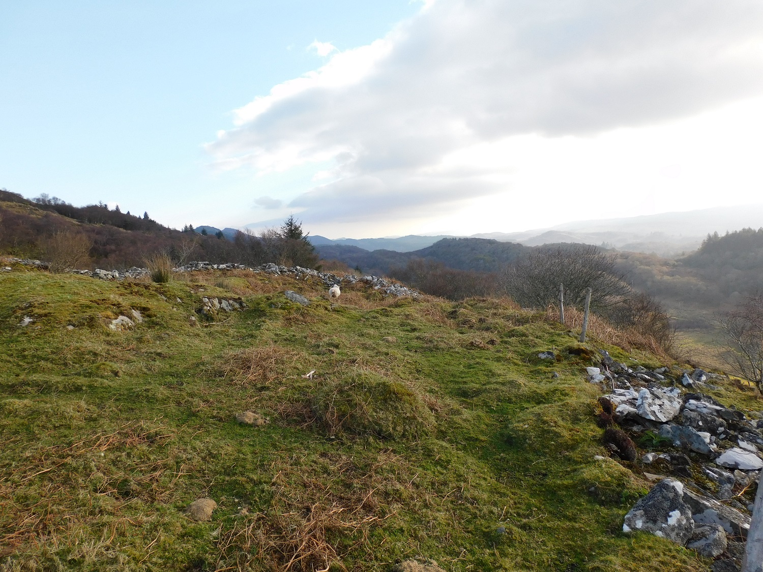
Head east on the A832 going through Munlochy, take the minor road heading south, some severe corners, take the turning to Castleton Farm. Permission was given to park.
The fort is only a short walk south from the farm and is easily spotted, it’s the only small hill. Tremendous views south over the Moray Firth can be seen, in fact tremendous all round views, the small town of Avoch is to the east hugging the coast.
Ditches on the east side have placed the fort into the Iron Age, it would have astonishing to think that Iron Age folks wouldn’t have taken advantage of this location.
It’s a fairly flat walk from Castleton Farm, a path leads to the top.
Later use saw a Medieval castle plonked on top, now there is a bench and a Saltire.
Visited 27/02/2022.
After crossing the Cromarty Bridge, south, into the Black Isle we headed west on the B9163, turning south on the second minor road and park once we were clear of Easter Oak Wood. Once parked we walked, west, across a field to Oak Wood.
Keep an eye on the higher trees, this marks the dun’s location.
Sitting at over 18m wide the site is covered in vegetation which covers most of the remains. However, there is enough stonework to hint at what once was. Most of the stones have been taken away to build dry stane dykes. The remnants of ditches on the north and east are easily found as I discovered, by falling into them.
If clear of vegetation this might be an impressive site, however it is more likely to join the ‘what if’ brigade.
Visited 22/10/2022.
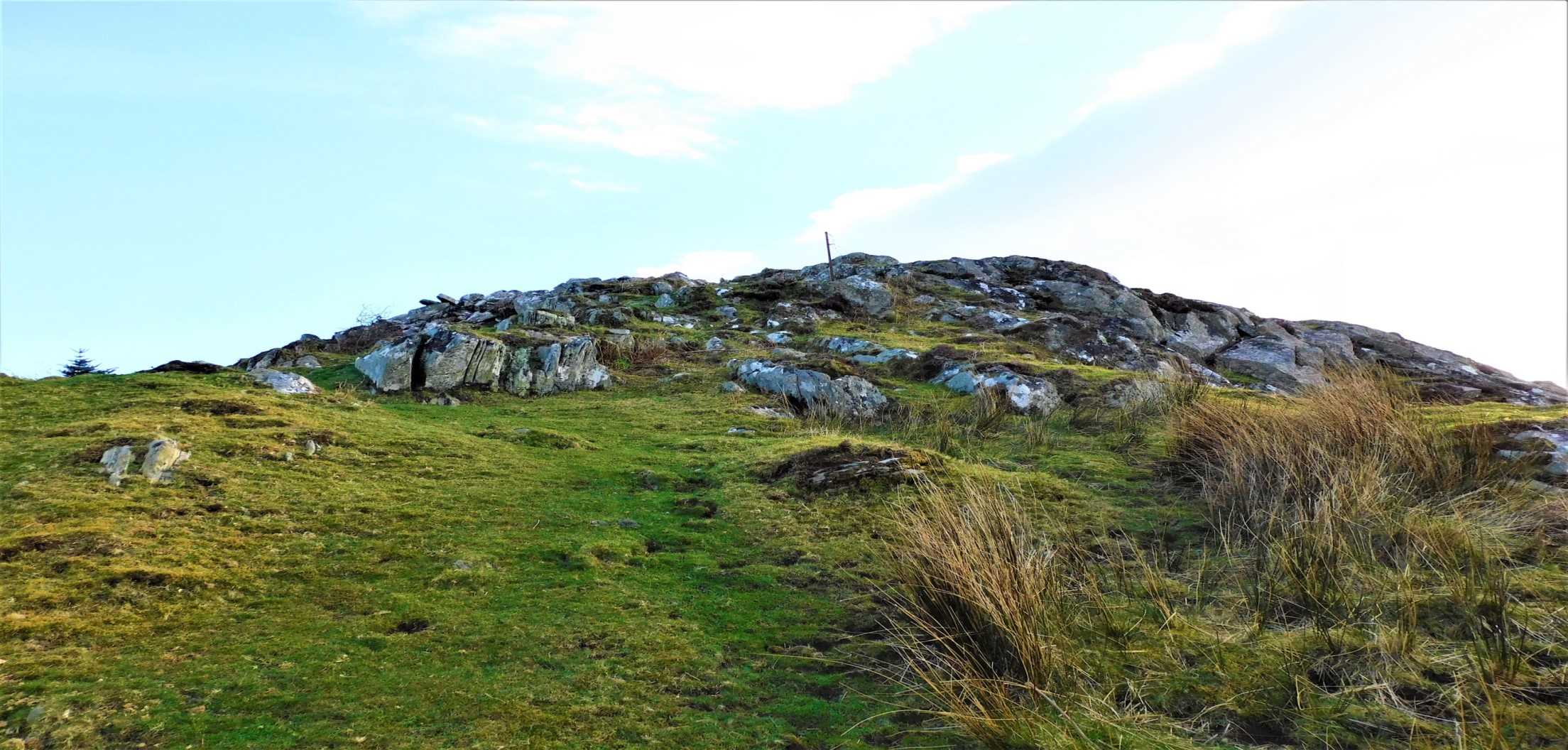
Cnoc Ravoch is a ‘what if’ site, stunningly located looking south over the Cromarty Firth to the Black Isle, to the west, if you have binoculars you can watch Ross County in Dingwall when they play at home.
The site is largely ruined with one stone appearing to be earthfast whilst a couple of others appear to kerbs. Two boulders might also have been used as part of the site, more slabs indicate cists possibly four. However, I think it was perhaps a chamber cairn that was recycled, the area as most know is covered in this type of site.
From the west, Strathpeffer, take the A834, look for Back Road on entering Dingwall which leads straight to the Old Evanton Road. About 500 meters north east of Dingwall pull into the first gateway, plenty room to park.
Head North East, a fairly steep climb and head towards the mast. The site is just on the other side of a gate.
Despite the site’s condition I found this quite an inspiring place, just enough to let you imagine what was once here. Also you could see the weather approaching from the West, the clouds looked full of rain but somehow they’d missed me.
Worth a look if only for the view.
Visited 20/10/2022
For a change we took the easy option and parked at the car park at the west of the fort, a sterner challenge would present itself later so this proved to be a lucky piece of foresight.
Strathpeffer is slightly to the west, Loch Ussie to the south, beyond that a multitude of prehistory, Dingwall to the east and to the north more prehistory, especially chamber cairns and rock art.
As described by Mr G, a stunning site, one I’d been meaning to visit for a long time.
Visited 20/10/2022.
A collection of Bronze Age finds are returning on loan to the island where they were found
More info :
Replicas of Bronze Age artefacts discovered at a site dubbed “Britain’s Pompeii” have been created by experimental archaeologists.
More info :
An archaeology project is to make its final excavation of a 5,000-year-old Neolithic site in Orkney next year.
More info :
Skeletal remains of six men found under a kitchen floor in the Highlands have been revealed to date back to Scotland’s Iron Age.
More info : bbc.co.uk/news/uk-scotland-highlands-islands-64756840