


Looking north, Tap O Noth sneaking into the background.


These stones are at the eastern gate of Rhynie Square. (opposite the shop on the A97) Originally they stood at the opposite side of the road, with garden of Rhynie’s Free Church manse surrounding them. Sadly the southern stone has been broken. A repair job of sorts has happened.
Visited 20/5/2012.


The ‘great unwashed’ lurks in the background.


A map of how Orkney looked 10,000 years ago is beginning to paint a picture of how the islands appeared to the first settlers who came here at the end of the last Ice Age.
More info :
orkneyjar.com/archaeology/2012/05/18/painting-a-picture-of-scapa-flow-10000-years-ago/
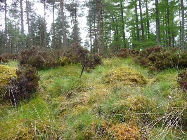
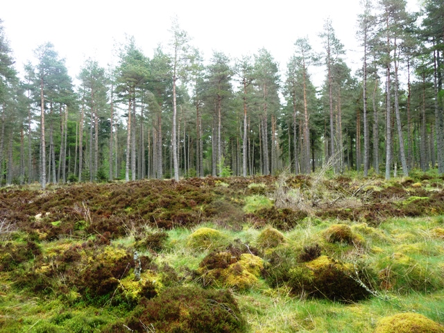
Just like the last time I parked at the layby just north of Mains Of Afforsk, this time with a lot of gorse, grass etc being cut down or flattened by snow a forestry track could now be seen. This isn’t the safest of paths, it is littered with fallen trees and branches, the recent rain has turned it into a series of small lochs. Still as it meanders west all over the place it climbs steadily until it meets another track in a clearing. In the south east quadrant at the crossroads sits the ring cairn.
It reeks of age probably due to the trees and Mither Tap which looks down on top. (It was busy today!) Although badly overgrown and damaged by forestry the ring cairn survives. Sitting at 14 meters wide and 1 meter tall. The inner section isn’t central and is 4 meters in width. I wonder what a ‘dig’ would show.
The other cairn complete with cross incised and ogham marked stone is also quite difficult to find but can be found by heading west and uphill amongst another clearing.
Lovely area, lovely walk but drenched on the way back.
Visited 17/5/2012.


From the ring cairns inner court, shows it’s height.
South to north, the cairn is behind the fallen tree.


Beware this isn’t a very easy place to find.

Pine needles highlight the cross, with the cairn behind.


Sadly only scattered cairn material and one stone of this circle remains and even it is drill damaged. It is housed in a fenced section just north of the steading at Westpark. The other stones were taken away to help build the nearby Mill Of Tynet. Like the King’s cairn there is excellent views south, the views north somewhat hidden by trees and the Meikle Hill.
The easiest way to get here is to go south on the B9016 and take the first minor road east thru the wee village of Clochan, shortly afterwards head south at the next minor road. This road comes to an end but head east on the track stopping at Westpark. Here I was met by the occupant who kindly allowed me park. The remains of the circle are behind the building, a short walk of 200 meters to the fenced section.
Visited 15/5/2012.
Opposite the Buckie junction (A942) on the A98 take the minor road south to Drybridge and keep going until the road stops at the Redburn Farm track. Unfortunately, for me, I misread the map and headed up the wrong track and ended up having to go cross country to the correct track. However I was rescued by the farmer who told about me about Meikle Hill, local musicians and re-energised me with a cup of tea. I should have gone by Redburn track and then taken the first track south. This heads up over the Addie Hill into the trees. At the top the trees clear with the cairn being to the east of the track just before a forestry track about a 1/4 mile south
King Indulphus wouldn’t be to impressed with what has happened since he was laid to rest. The cairn has been houked, ploughed and even worse drilled and blasted. It is somewhat nothing short of a miracle that anything remains but somehow despite everything it survives, just. To the east a sunken path contains cairn material which has fallen, to the west the forestry people haven’t been to careful. It stands at 8 meters wide and almost reaches 0.5 meters in height. Two very large boulders remain, as well as cairn material, showing damage caused by drilling. The old king certainly had beautiful views to keep him company.
With that it was back over the hill and back to the car via the proper route, which was much easier and much, much shorter.
Visited 15/5/2012.
Cairns and stones circles have often been recycled for places of execution, courts, towers, beacons, bases for crosses, roads, houses etc etc. This is the first one I’ve seen rebuilt into a windmill on the spot where it stood. Originally a stone circle probably surrounded the cairn, also in the same field, to the west, a barrow stood. Wonderful views to the Moray Firth and south to Durn Hill.
Situated to the north of the A98 between Portsoy and Cullen just east of the Sandend junction. Pull in at the Glasshaugh Distillery (tragically closed, or it looked closed as it was deserted). The unusual remains of the cairn are in the field to the west.
Visited 15/5/2012.

From the top of Addie Hill, the cairn is to the left of the track near the change of colour in the grass.


The oldest footprints of modern day man are seen in the Chauvet cave discovered in 1994. Experts have long debated whether the sophisticated animal drawings are in the oldest of their kind in the world.
More info :
Near the distillery lies the affectionately named ‘Cup And Saucer’. This tower like structure is the remains of a windmill, built in the mid-eighteenth century by the local proprietor, General James Alexander of Glasshaugh. Abercromby was at one point Commander in Chief of the British forces in North America, but returned home after a humiliating defeat in battle at Ticonderoga. His windmill was built on top of a Bronze Age Cairn using much of it’s stonework. It ceased production during the first half of nineteenth century but stands as a reminder of times gone by.
Mark Leith, Knock News Issue 61
March 2012.
New scientific techniques reveal how large tribal gatherings swept Neolithic Britain.
More info :
guardian.co.uk/science/2012/may/13/scientists-stone-age-boom-festivals
Sensational new archaeological find reveals paddles and bow in an underwater Stone Age settlement.
More info : sciencenordic.com/organic-tools-found-stone-age-camp
On the map this was the easiest of the sites to find. In reality it proved rather different and more than slightly chancy. Chaos surrounded the entrance to Glencarse with roadworks everywhere, entrance to Inchyra House was blocked, I asked permission from the workmen to park and walk thru but was promptly denied by a jobsworth wearing a tie (much to the disgust of the workmen) so I turned around headed south and pulled in on the St Madoe’s side of the dual carriageway, the A90. From here I ran across the carriage way, jumped the central barrier, ran to the other side, scissor kicked the fence and walked the short distance to the barrow.
The barrow has been excavated on the northern side, with urns (unfortunately lost) being discovered. Local men also took away ‘several cartloads of stones’. Other finds are kept in Perth museum. The turf covered barrow sits in the grounds of Inchyra House, is 18 meters wide and over 2 meters high. It is surrounded in pleasant countryside (except for the carriageway) and interestingly shaped trees.
With that it was back to the car via the chancy route I’d came only to discover the police pulling up. When I was asked for the reason why I’d parked they received an answer that they probably wouldn’t have expected and quite a bit longer.
Visited 3/5/2012.
Rait hillfort, Iron Age, is very easy to find as it is situated on the north eastern quadrant of the Rait crossroads. I crossed a small burn, the Carse Burn, and clambered up the fairly steep but short climb to the top of the hill. This climb forms part of the small forts south west defences. The three ramparts, all at various heights, are situated mainly to the north with the entrance in a central position. Great all round views are now obscured by trees but to the south the River Tay is easily spotted.
The fort is still used by children using tyres as swings at the northern end. Instead of climbing down the south west flank I jumped a fence and landed in amongst bramble branches which made for some wonderful patterns on my legs. Still a path slightly further south leads uphill to allotments and downhill back to the small mill, Carse Burn and car.
Visited 3/5/2012.

