Very decent photographs of the site with less or hardly any vegetation.

drewbhoy
From the standing stone south of the B8085 I headed back, north, towards the church, crossed the road and walked past the hotel on the track heading towards the aptly named Turraman Loch. Long before the well named loch head west, following a fence, at Scalasaig Farm. A short walk of no more than 100m awaits.
Thanks to the gorse I spied the stone when I was directly below the site. (You can see the top of the stone from the B8085.) Luckily you can get to the stone via some clearings.
It is an impressive stone standing at 2m high and 2m wide. The smaller stone in the Canmore photos is still there.
Towering over me to the north west is Dun Eibhinn, a decent climb ahead.
Visited 11/08/2024.
From the Dun at Scalasaig head back to ferry port then walk west following the B8086. Directly opposite the hotel there is a road to the church, follow this track south for about 500m then head west. I could only see one standing, another stone I spied was a boulder and another possible standing stone mentioned in Canmore was invisible.
The stone that remains is just over 1m tall and has great all round views despite being slightly hidden by the undulating land. Dun Eibhinn, dominates the skyline to the north and was to be my big target for the day. Before that, another standing stone.
Visited 11/08/2024.
The skeleton of a Bronze Age woman is set to be archived in a museum after being unearthed at a Kent building site.
Fragments of copper alloy unearthed at one of Britain’s most important archaeology sites have been revealed to be parts of an incredibly rare Iron Age helmet.
Every petrol station on Colonsay should have a dun, there is only one petrol station on the island. Parking is very easy, there is a car park at the post office and excellent shop. Simply walk across the road and jump into the ferns behind the pumps.
There are large rocks marking the dun’s edge to the south and east, not much stonework remains elsewhere. A gap in a ruined bit of wall is probably the entrance in the north east section.
Not that much to see, the covering ferns didn’t help but a good start to the looking around Scalasaig’s prehistoric monuments.
Visited 11/08/2024.
A rare Iron Age horse brooch has been made the subject of a temporary export ban in the hope it will be acquired by a UK museum.
To get a birds eye view of Dun Meadhonach I decided to climb to the top of Beinn Na Caorach. It’s a worthwhile thing to do as the views are magnificent, you also look straight down (or north) to the dun plus the nearby Limpet Stones.
The summit of Caorach can be seen from the Limpets, a reasonably steep climb going up various wee valleys. Colonsay’s dry spell meant that underfoot conditions were good so it was a pleasant summer’s stroll up and then down to the dun.
As can be seen from the birds eye photo the dun is nearly oval shaped being 21m long by 13m wide. Walls still survive, best kept on the west. Some courses of stonework can still be seen. A gap on the north east would, to me, indicate an entrance but at this point the walls are badly ruined.
A great site and an opportunity to spy some other sites from high vantage point.
Visited 11/08/2024.
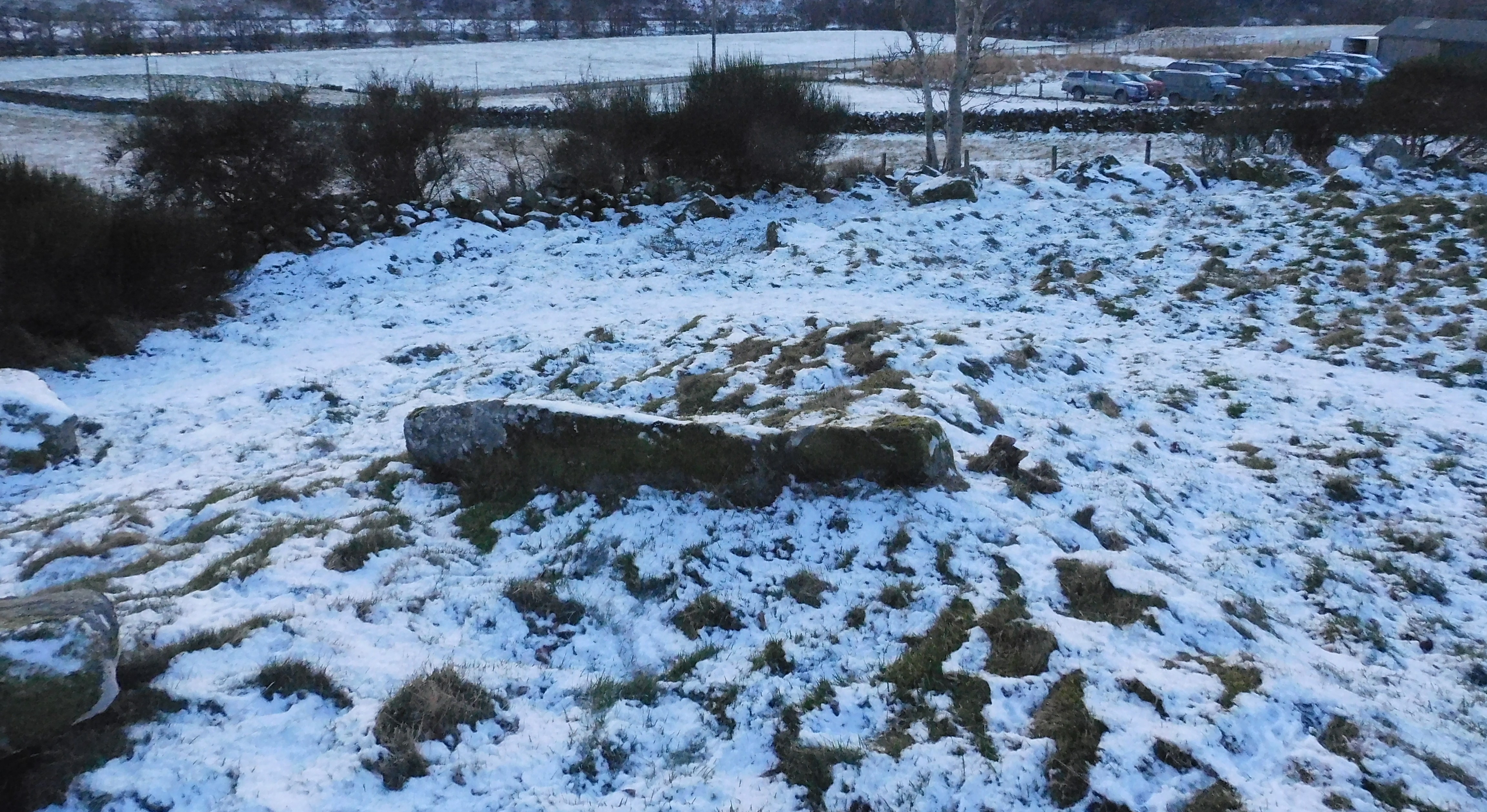
The cars behind were owned by the pheasant shooters. I’d experienced shooters at the Hill Of Edzell as well.
Image credit: drew/AMJ

Every time I see a photo of the circle ‘gentle restoration’ enters my head.
Image credit: drew/AMJ

Looking south east, the road sneaking into in the background.
Image credit: drew/AMJ

I dread to think how many years since I’ve been here, well before I joined TMA.
Image credit: drew/AMJ


Daylight just about holding on at the furthest south RSC.
Image credit: drew/AMJ

NO57808 70052 Edzell5, the houked centre looking north east.
Image credit: drew/AMJ

NO57808 70052 Edzell5, a pile of clearance plus the cairn’s footprint to the north west.
Image credit: drew/AMJ

NO57808 70052 Edzell5, looking straight north, the west side of the cairn.
Image credit: drew/AMJ

NO57863 69957 Edzell4, field clearance to the south west.
Image credit: drew/AMJ

NO57683 69957 Edzell4, the east side of the cairn’s footprint, note a rather flush to the ground kerb.
Image credit: drew/AMJ

NO57683 69957 Edzell4, the actual cairn is in front of the big stone, might be a kerb.
Image credit: drew/AMJ
Ancient monuments across the UK face “complete destruction” from off-road bikers illegally using them as ramps and racetracks, archaeologists have warned.

NO57575 69845 Edzell3 Medieval people onwards might have ruined the cairns, they couldn’t ruin the scenery.......................yet.
Image credit: drew/AMJ

NO57575 69845 Edzell3, south east section is the best preserved as regards outline.
Image credit: drew/AMJ

NO57575 69845 Edzell3 This looking north west has the best outline of all the cairns on the hill. definite footprint, couple of kerns in place.
Image credit: drew/AMJ

NO57520 69796 Edzell2, despite the destruction some kerbs are still in place, this photo, I believe, gives the best angle to see the original outline of the cairn.
Image credit: drew/AMJ

NO57520 69796 Edzell2, this looking south at least gives the cairns outline.
Image credit: drew/AMJ

NO57520 69796 Edzell2, looking north west, included in the havoc is a small trench through the middle of the cairn.
Image credit: drew/AMJ

NO57520 69796 Edzell2, the outline the original cairn can just about be seen despite the clearence being dumped on top.
Image credit: drew/AMJ
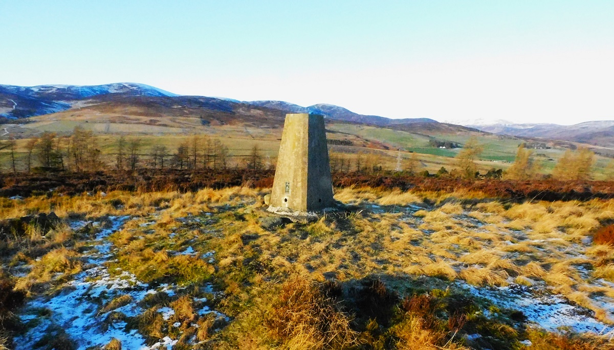
I was going to climb the hills behind, but oncoming darkness means another visit. Plenty to look for on this hill tho.
Image credit: drew/AMJ

Looking north near the kerb, I didn’t leave my phone on top of the trig :-)
Image credit: drew/AMJ

Looking north east, note the probable kerb on the far right of the photo.
Image credit: drew/AMJ

Looking south east, a trig sits on top of the much robbed cairn.
Image credit: drew/AMJ


Members of the public are helping to sustain digs across the country, even as volunteering declines
This has to be one of the easiest fieldnotes to write. From the house in Kilchattan walk 200m south, crossing the B8086, there is a gate leading into the field.
A great way to start every morning with Dun Meadhonach, slightly to the south west.
They say there was a stone circle here at one point, maybe yes or maybe no, one thing definite is that the two stones are in clear view Loch Fada, to the east, and the stony beach at Port Mor to the west.
Slightly to the west there appears to be remnants of a cairn, there is no kerb, however there is one large stone that might or might not have stood. Almost feels like Cultoon Stone Circle in Islay and its nearby site.
Time to head south west.
Visited 11/08/2024.
Nestled within the valleys, hills and open fields of Wales, lies one of Western Europe’s most remarkable collections of prehistoric Neolithic burial chambers.
Fingal’s Limpet Hammers are a pair of standing stones in Scotland that are associated with the legendary Celtic giant Fingal. The stones are named for their resemblance to limpet hammers, which are tools used to break limpets off rocks. The stones are also so large that only a giant like Fingal could wield them.
The stones are also known as Carrach An, which may mean “the pillars or erect stones”. During ploughing in the early 20th century, an underground passage was discovered, but it was later covered up.
BritainExpress
Cretshengan is a beautifully situated coastal standing stone. Achahoish is also in a fantastic location, next to the River Allt Cinn-locha, at certain angles it looks well camouflaged as a small tree covered in moss, sits amongst old looking trees and stands near a small graveyard. All these things give a sense of age.
From Cretshengan follow the B8024 as it heads north east, the spectacular views continue along the coastal road. Keep going until the first minor road heading north west. I parked at Lochead Farm, crossed the road and asked permission to visit the stone from the owner at Ceannloch House.
A track heading south leads almost to the stone, when a hut is reached head west past the small graveyard.
The moss and lichen covered stone stands at over 2m tall.
Despite injuries, a great day and great sites.
Visited 09/08/2024
The farm at Cretshengan proved an easy place to find, even better I was given permission to park. From there walk back to road and head south for a few metres. Through the gate and head west, gentle slopes and short grass made the walk, thankfully, easy.
This is a stunning place place with stunning views over to the island of Jura and north towards Kilberry.
The stone stands at 1.6m tall and probably was used by the ancient peoples to mark a safe place to land. Below on the beach, windsurfers were having a great time so perhaps the old stone is still doing its job.
After standing for quite a while to savour the view, also to rest the increasingly sore leg, I made my way back to car and decided that one more stop would be enough. Nearby sites can also wait until 2025.
Visited 09/08/2024.
Leaving the standing stones Carse I followed the B8024 as it headed north. I asked permission to park at Keppoch farmhouse which was kindly given. Also kindly given were some painkillers as by this time I was starting to limp noticeably.
Fortunately, the route to the site was easy – 300m, gates and short grass. The cairn itself is a grass covered mound standing at over 17m wide and is 1m tall. Canmore says that cists are all removed, one stone remains visible that looks like it might have been part of a cist.
After a short look around I headed back to the car, thought about heading back to Tarbert, thought again and continued on. Nearby sites can wait until 2025, I was going to press on to an impressive coastal standing stone.
Visited 09/08/2024.
From Achadh-Chaorann I headed back to the B8024 and headed west to park near the entrance to the old church at Carse.
A pair of stones and a single stone, about 110 metres to the west, contribute to this site. They are easily found and gates provide easy access.
The 2 eastern stones are both almost 2.5m high, the furthest west stone is slightly smaller being 2.3m tall. Some choke stones can be seen at the west stone, fortunately field clearence mentioned in Canmore has been removed.
Superb site.
Visited 09/08/2024.
My next stop exploring the south side of the B8024 would be to follow the first minor road heading south. As soon as a clearing in the trees is reached look south east, Achadh-Chaorann Standing Stone should be easily spotted.
The well shaped slab stands at 2.1m high in a field which has been well maintained by the local greenkeepers. Cup marks are still there but barely visible almost weathered to invisibility. Plenty room to park at the first corner south of the site.
Nearby Ardpatrick, a hillfort, can wait until 2025, the legs weren’t feeling very happy.
Visited 09/08/2024.
This year’s plan, 2024, was to visit the sites on the south or west side of the B8024, in 2025 it will be north and east side of the road. Barr Na Cour is on the west side.
Finding a place to park is easy, follow the road from Avinagillan until you pass the Dunmore Farm, look for a forestry commission road on the north side, plenty room. Directly opposite there is a barn, during my visit men were working improving the old barn, one of whom gave me directions to dun. He mentioned that I would be the first person to climb the hill since a field visit by people from Historic Scotland in 1982.
Be warned there is no path, there might have been such a thing a long time ago, but not now. The first thing I was told look for was a stile, which after battering my way through all types of vegetation I found. As soon as I put my foot on the stile, it fell down with me quickly following. Picking myself up I climbed the deer fence and stepped onto a dry stane dyke which like the stile promptly fell down. Unluckily for me some of the stones changed the colour of my legs.
However, the wall leads to the top of hill alongside a deer fence. Parts of the wall can be walked on when the vegetation becomes too dense. Eventually a cliff face is reached, this forms the northwest part of the dun. As soon as I put my foot on the fence, like the stile and wall -it fell down – once again I followed it to the ground.
Head to the northeast, to avoid climbing the cliff, and the entrance will be found. Facer stones can be found along with little guard rooms creating the galleried section. Sadly, the entrance and small rooms are filled with fallen stonework. The dun is 14m by 10m, the surrounding wall in parts reaching over 1.3m in height. As the walls head west, they become more ruinous until they vanish almost altogether on the northwest. Outer walls also reach a height of 1m and over but is obscured by massive ferns.
It must have been impressive when built, and in a way it still is. How it survives is something of a miracle – it has been robbed, used to build nearby dykes, fallen over the cliff edge and somehow survived me standing on it, previous man-made structures hadn’t coped so well.
Finding my way back was easy enough, a trail of destruction and flattened vegetation.
Visited 09/08/2024.

Taken from the Tap O Noth, the shadow in the middle of the photo is were the henge and dragon’s grave are situated.
Image credit: drew/A/B