
ginger tt
Exebury is a promontory fort defended on the West by
the River Beaulieu and on the East by a bank and outer ditch. Access to this sit is limited as it is on private property occupied by ponies. You can see the outer earthworks from the lane leading to the farmhouse and to the eastern end you can see the edge of a second bank suggesting that there were two banks and a ditch originally but part of this could be medieval. Nice spot overlooking the river Beaulieu and the Solent.


Idbury is an univallate plateau-fort on the Oxfordshire Border with Gloucestershire. It has been virtually ploghed out now. I walked the site and could make out the edge of the camp nearly all the way round and on the east and north sides where the land drops away more it was quite easy. The photos don’t really do the site the justice you need to visit it to appreciate it fully.
Access to the camp is via a permissive footpath off mud lane in Restrop near Purton. it is An Iron Age multivallate hillfort. What I found unusual about the site was that the northern side of the earthworks was almost completely straight, maybe to impress visitors to the site. The entrance to the east where the farm gate is would appear to be the orignal.


A large univallate iron age hill fort . The earthworks on the western side consist of 2 banks and a ditch which are in good condition but appear to have been flattened out in between by farm traffic. To the north there are various remains of ditch and bank but elsewhere there seems little sign of the original earthworks as there is a farm to the east and a farm track cuts across the southern side of the site. This track would appear to follow the original edge of the site. A nice spot though with really good views on all sides except the south.


Ilbury. Near Ilbury Farm takes name from Galoberie (Domesday Book) OE geolu burh – ‘Yellow fort’ – a reference to this camp. The ridge yields yellow ironstone
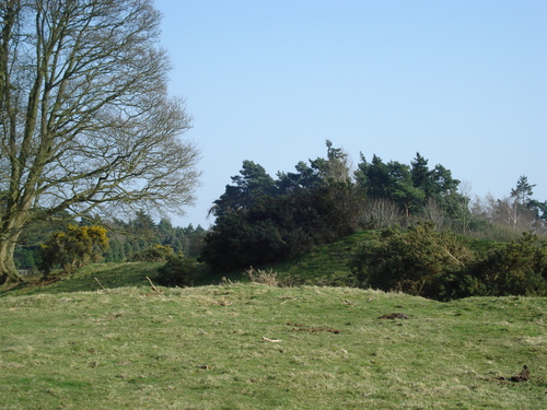
Ilbury Camp is a pear shaped univallate fort. It is well defined on its west side by a rampart About 3 metres high.The east side of the fort has been ploughed down but you can still work out the outline of the fort.
The break in the rampart in the centre of the southern side appears to be the original entrance.
The site commands good views all around and looking from the east is a very impressive looking site. Ilbury is believed to date from the iron age.


The quarry on the south side of the camp where skeletons were found in the 19th century .
Image credit: Ginger tt

Also listed as Lower Coxwell Camp on the pastcape web site. Neolithic axe heads and flint scrapers have been found within the site and are kept in the Ashmolean museum.


Also known as Castle Grove Camp Wyfold Castle is an Iron age plateau fort. it is now overgrown with beech woods and the north side is overgrown with Rhododendron and Holly bushes. There is still an original entrance visible to the sw off the site which is offset either side of the causeway, all other entrances are modern . The best preserved part is the eastern side where there is a nice uninterrupted part of the earthwork.

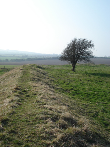
Close up looking west along Grim’s Ditch between Chilton and East Hendred
Image credit: Ginger tt

Close up looking East along Grim’s Ditch between East Hendred and Chilton
Image credit: Ginger tt

The Section of Grim’s Ditch Between East Hendred and Chilton Behind the Harwell Campus on the Chilton Downs.
Image credit: Ginger tt
Earthworks of an univallate Iron Age hillfort and attached annexe. Also Known as Green Wood fort

Hardwell camp taken from the center of the fort looking east
Image credit: Ginger tt

Hardwell Camp. View looking down from top of inner rampart on the western side of the fort.
Image credit: Ginger tt


Hardwell Castle or Hardwell Camp is classed as an Iron Age valley fort, although, like nearby Cherbury Camp, it is not clearly in a strategic or easily defended position. It lies halfway down the scarp slope of the White Horse Hills and is tucked away in a curve, invisible from most angles.
Access to the Camp is through a hole in the fence about 10 m’s from the gate on the main road. The northern facing earthworks are completely wooded over but are the most impressive with a ditch and bank up to 7 meters in height with 2 spurs coming off down to the level of the camp entrance. The eastern and western defences are natural gulleys enhanced by man made banks and ditches . The southern earthworks are about 8 ft in height as the inside of the fort is level with the countryside to the south. Well worth a visit but the site is used for pheasant pens so be careful.
Lyneham camp is four miles from Chipping Norton, located 650 feet above sea level on a ridge commanding a fine view all round except to the north. It is roughly circular covering about four and a half acres. A single rampart surrounds the camp and is about five feet high in some places. There is a gap in the ramparts to the north – a possible original entrance. The camp was surrounded by a ditch, but this is barely visible now. A quarry has been cut into the south end.
Excavations were carried out by the Oxford University Archaeological Society in June 1956. Iron Age pot sherds and a bone needle were amongst the small number of finds. The camp is known locally as Lyneham ‘Roundabout’ and is a scheduled ancient monument. In the 19th century skeletons were discovered in the south side of the hillfort (the quarry site).
Records of Archaeological Work held by the Ashmolean Museum
KIrkton Fort is Situated on Castle hill near Crawford in South Lanarkshire on the banks of the river Clyde. The fort is situated to the south of the site with the larger earthwork believed to be the site of the main settlement. It is one of three such forts situated on the same hill. It can be seen From the A702 and the M74 or close up from the aptly named Camps Road. Not to be confused with the fort of the same name just around the corner on the same hill.