
Yr Aran II. The main Yr Aran group is in the lighter area in front of the trees to the right.
Image credit: A. Brookes (24.3.2018)

Yr Aran II. The main Yr Aran group is in the lighter area in front of the trees to the right.

Yr Aran II, the finest cairn in the whole cemetery, topped with quartz blocks.

Rhyd y Gethin II, the southernmost cairn in the group.

Rhyd y Gethin III/Yr Aran I, looking towards the head of the Pennant valley (Cwm Crechwyl).

Rhyd y Gethin III (also Yr Aran I).
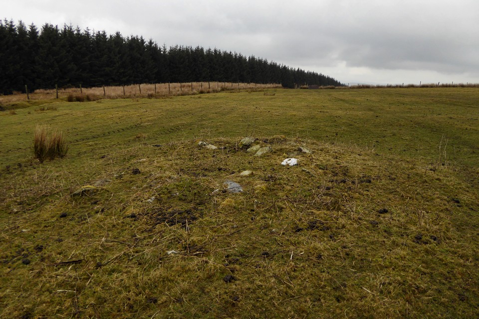
Rhyd y Gethin IV. The main Yr Aran group is in the more overgrown area beyond the fence to the left.

Rhyd y Gethin IV, the first of these cairns you come to when coming from the concentrated Yr Aran cairn field.

Yr Aran XI, looking NNE towards Moel Pearce and Cadair Bronwen.

Yr Aran XIII, looking southeast towards the more isolated cairns to the east of this group.

Yr Aran XIV, with what may be the remains of a kerb.

Quartz block incorporated into Yr Aran V.

The slabs on edge in the centre of Yr Aran VI.

Yr Aran VI, the best in the main group, with what appears to be a stone-lined cist in the centre.

Yr Aran VIII, damaged by excavation and erosion. The higher slopes of the Berywns are emerging from the low cloud.

Yr Aran cairn X. The northernmost in the group, it has an unobstructed view down Cwm Pennant.
Comprehensive survey of prehistoric monuments of Denbighshire and East Conwy.
Opens a pdf.
An Archaeologist at The Australian National University (ANU) has discovered a prehistoric Bronze-Age barrow, or burial mound, on a hill in Cornwall and is about to start excavating the untouched site which overlooks the English Channel.
The site dates back to around 2,000 BC and was discovered by chance when ANU Archaeologist Dr Catherine Frieman, who was conducting geophysical surveys of a known site outside the village of Looe in Cornwall, was approached by a farmer about a possible site in a neighbouring field.
“He told us about a ‘lump’ on his land and that nobody knew what it was, so he asked us to take a look at it,” said Dr Frieman, who is a Senior Lecturer in the ANU School of Archaeology and Anthropology.
“So we ran our equipment over a 1,600 metre square area and sure enough we found a quite obvious circular ditch – about 15 metres across – with a single entrance pointing south east and a bunch of pits in the middle.
More here: phys.org/news/2018-03-archaeologist-cornish-barrow-site.amp?__twitter_impression=true

The North East circle.

The North East circle.

Stones to the east of the North East circle.

Stones of the group to the east of the North East Circle, not at all convincing as an avenue.

Stones of the Great Circle.

Looking eastish down the Chew valley.

Such a shame stones like this are fallen.


Northwestern arc, looking towards Maes Knoll.


The southeastern section. The ground falls steeply to the Chew Valley and Stanton Drew. The bleached out hills on the left are the Mendips.

The eastern defences, looking down on Bristol’s urban sprawl.

In the shadow of The Tump, the frost unmelted. It’s a seriously impressive earthwork.


Looking out of the fort from the enormous cross-bank known as The Tump towards Dundry Hill.

The western flank. Here the landscape does all the defensive work.

The southern point of the rampart. Although it doesn’t look that much, it’s higher than my head.

A hazy, cold morning. Approaching from Guy’s Hill to the southeast.

Looking over the eastern cairn towards Ystradfellte reservoir.

Showing the damage to the centre of the eastern cairn.

The top of the eastern cairn, looking down on Nant Mawr itself.

The eastern cairn, looking towards Fan Fawr.

The eastern cairn, approached from the west.

Nant Mawr itself, facing Fan Llia. It’s scarcely conceivable that the placement of these two cairns either side of the stream does not directly connect with the watercourse itself.

The partially frozen Nant Mawr, with the southwestern cairn above to the right.

The southwestern cairn, with Fan Fawr behind.

Looking across the southwestern cairn towards the Ystradfellte reservoir.

The southwestern cairn, looking up Nant Mawr. The northeastern cairn is just beyond the crest to the left of the stream.
