
No need for defences on the north side, the site slopes steeply towards the sea. Looking towards Weston-super-Mare.
Image credit: A. Brookes (23.2.2019)

No need for defences on the north side, the site slopes steeply towards the sea. Looking towards Weston-super-Mare.

The eastern end of the rampart, disturbed by the military road.
There are two distinct groups of barrows on Brean Down, located on the eastern and western summits of the ridge. Pastscape descriptions:
Eastern group
Seven mounds are contained within the eastern field system on Brean Down. One of these is a round barrow, centred at ST 29325 58814. It is most likely to be the site that Skinner, writing in the early 19th century, found Roman pottery and human bones on the surface, and recorded that the primary deposit had been removed. The barrow lies just to the south of the Roman temple (ST 25 NE 6) and appears to overlie part of the field sytem. The NW side of the barrow has been damaged by ridge and furrow cultivation. A small hollow at the SE corner of the barrow represents the remains of a small building, visible on aerial photographs taken in 1948. Four small depressions on the W and E sides of the mound and to the S of the barrow probably mark the position of ApSimon’s trial trenches.
The mound centred at ST 29135 58925 may be a burial cairn. It is portrayed thus on a map of 1821. Silty clay has been dumped on the W end of the mound, obscuring its original form.
The remaining mounds are all small and are most likely to be clearance cairns or modified field banks. The mound centred at ST 2932 5881 is larger than the others, measuring 15m in diameter, has been interpreted as a round barrow or cairn which may be Bronze Age or Roman in date.
The other four mounds are centred at ST 2911 5893, ST 2913 5892, ST 2921 5889 and ST 2924 5887. They are predominantly sub-circular except for the largest mound and range in size, measuring between 3m in diameter and 7m by 10m. The largest of the mounds has been interpreted as a Bronze age burial mound. The other mounds may be clearance cairns which are possibly later in date.
Western group
Six mounds are contained within the western field system on Brean Down. Two of these are most likely to be small, Bronze Age burial cairns. The cairn at ST 28412 50920 is a low, circular, stony mound, close to a field bank. The cairn at ST 28519 59010 is a circular, turf-covered mound. Both of these cairns are shown on Colt Hoare’s map of 1821 as burial cairns.The large, flat-topped, sub-rectangular mound at ST 28487 59007 is surmounted by an OS trig. pillar. The hollow and small mound by the pillar suggest that the mound has been dug into. The field system may have incorporated an earlier cairn, or it may have been altered by the addition of a large burial cairn. The mound may have been augmented by field clearance. The present day appearance of the mound suggests that it may have been used as a beacon during the post medieval period.
The small rectangular mound on top of a field bank at ST 28647 58955 appears to be of recent construction. The mound at ST 28695 58942 is caused by the junction of two field banks, although it may have been augmented by field clearance. The sub-rectangular mound at ST 28733 58937 is part of a field bank, perhaps augmented by field clearance. A small hollow in its centre suggests that it has been dug into, and its northern end appears to have been modified by the removal of material.
Summarised description from Pastscape sources:
At the east end of Brean Down, a bank of stones, 4-8 feet high, with an outer ditch, makes an angle, ending on the steep slope on the north and destroyed by quarrying on the east.
In the part of the camp destroyed by quarrying a number of Roman gold coins of Augustus, Nero and Drusus, and two silver denarii of Vespasian, were found by quarrymen and dispersed to private collectors. A Roman cornelian ring is also recorded from the earthwork.
The principal feature of the earthwork is a bank and rock-cut ditch running north south across the ridge. At its southern end the bank turns to the east and follows a natural fault line along the top of exposed limestone outcrop.
Some mutilation of the earthwork and disturbance of the enclosed area was caused by military installations of the 1939-45 war.
A small excavation of the western bank of this feature was carried out in 1974, providing information for the following abstract:-
“Limited excavation at the SW angle of this small and now L-shaped earthwork showed the defences to consist of abutting rubble banks
revetted front and rear with massive drystone walling, with a ditch to the west. Radio carbon determinations indicate that the defences were constructed in the latter part of the Iron Age, and
provide dates for the coarse pottery of Iron Age `A’ type in use on the site prior to the construction of the banks and while ditch silting was taking place. The site continued to be frequented in the Roman period.”The site was surveyed at a scale of 1:1000 by the RCHME in June 1995 as part of a landscape survey of Brean Down. The remains comprise an elongated L-shaped bank and ditch on the eastern side of Brean Down, centred at ST 29805900. Although the earthworks do not form a hillfort in the generally accepted definition of the term, the historical evidence, the scale of the western and southern ramparts, and the excavated evidence for Iron Age occupation, suggests that the term hillfort is appropriate for these earthworks.
The best preserved sections of the earthworks are the western rampart and ditch, and the western end of the southern rampart. The western rampart runs for 45m N-S and is, on average, 2m high and 2m wide. The ditch is present for some 25m on the outer side of the western rampart, south of the Military Road, and is rock-cut at its southern end. The ditch is 1.5m deep and 3.5m wide, giving a maximum width for the defences of 10m. North of the Military Road, the ditch has been disturbed by the construction of a 20th century military building.
The southern rampart utilises an outcrop of bedrock for much of its length. It is fronted by a narrow ledge 5m wide and 30m long at its western end. The rampart is breached at a point 35m east of the south-western angle; this is probably the result of erosion caused by a footpath. East of this breach, the earthwork is smaller in scale and comprises a bank, 110m long, 1.5m wide and 0.5m high. Disturbance caused by the construction of the Military Road occurs at ST 29895887, and east of this the bank changes direction and becomes less well-defined. The bank terminates at the Military Road at its eastern end, where it has been much disturbed by quarrying. There is no evidence for its extension east of the Military Road.
On the northern side of the earthwork, the ground falls away very sharply to the cliffs on the edge of Brean Down; this area has been disturbed by the construction of 20th century military buildings and no defensive remains are visible. None are shown on a 19th century map of Brean Down, which depicts the earthwork as very similar to its present day appearance.

These inquisitive sheep are very helpfully standing in an arc along the line of the ploughed out northeastern rampart.

Looking west, the view takes in Iron Age sites on Nottingham Hill, Dixton Hill (centre) and Oxenton Hill Camp.

Parts of the western rampart are covered in scrubby vegetation.

The most prominent section of the western rampart, near the farmhouse.


The western rampart curving along the top of the escarpment, beneath the trees.

Pretty much on the eastern line of the rampart, which has been ploughed down to nothing. Looking northeast towards Toddington.


It’s a good time of the year to come, the sea of dead bracken covering the ramparts suggests a summer visit would be less rewarding.
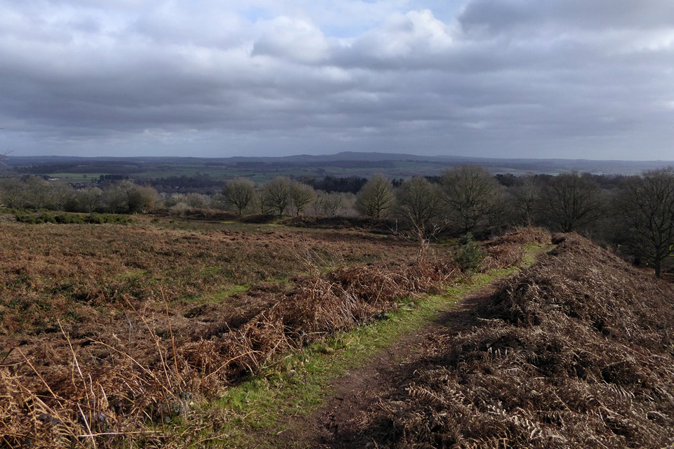
Looking east across the interior of the fort. The backdrop is the Clent Hills. Wychbury Hill fort where I was a couple of hours earlier is just left of centre skyline.

Very impressive bank and ditch on the southwestern side of the fort.
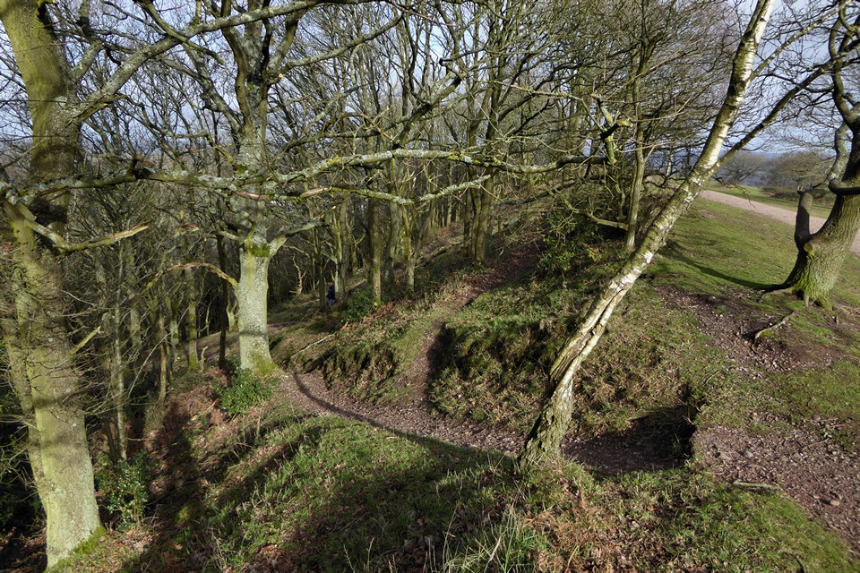
The steepness of the escarpment on the northwestern side of the fort renders ramparts unnecessary.

Looking northeast over Kinver village.

Looking west from the fort. The two hills rising on the skyline are Titterstone Clee and Brown Clee, both of which have hillforts.


Towards the western end of the southern ramparts.

The middle rampart on the south. The massive inner bank rises on the left, creating a big height difference between the two lines of earthworks.

The rather overgrown outer southern ramparts. Hagley Obelisk can be seen through the trees.


Looking down on the outer lines of the ramparts from the inner southern rampart.

Looking west along the inner southern rampart.

The northeastern defences rely mainly on the natural slope of the hill.

Inturned banks flank the eastern entrance (seen from inside the fort).


Silbury from the edge of Avebury village.


Aha! Oho! A track in the snow...


Get the feeling someone’s watching...?


The snow reveals the varied routes visitors take between the stones.


