
The long drop down to Cwm Bwch from the top of the escarpment. Cwm Bwch III can be seen at the top of the slope, left.
Image credit: A. Brookes (20.4.2019)

The long drop down to Cwm Bwch from the top of the escarpment. Cwm Bwch III can be seen at the top of the slope, left.

Looking out into Mid-Wales from Cwm Bwch III.

The profile of Cwm Bwch III from the north.

Cwm Bwch III. The flat summit of Great Rhos, the highest of the Radnor Forest peaks, rises in the background to the right.

Cwm Bwch III, the southern barrow of the group. I and II are at the end of the spur visible in the background to the right.
As well as the summit cairn, there is a further round barrow at the northwestern end of the Black Mixen summit ridge, Mynydd Ffoesidoes, at SO19096521.
Coflein description:
The monument comprises the remains of a substantial round barrow, a burial mound probably dating to the Bronze Age (c.2300 BC – 800 BC) and situated in enclosed rough moorland on the NW end of the Black Mixen ridge on Radnor Forest. The heather-covered barrow is circular on plan and measures about 24m in diameter and up to 1.3m in height. Although the W side of the monument has been disturbed and is generally lower, the base of the round barrow appears to be undisturbed. Traces of a surrounding ring ditch are visible, in places measuring up to 2m in width. The barrow is situated within boggy moorland – a Site of Special Scientific Interest – and has great archaeological and paleoenvironmental potential. The barrow possibly represents the remains of a platform cairn – the barrow displays no evidence of original ‘bulk’ indicating a rounded profile and is unlikely to have been extensively robbed.
Three round barrows located on the top of the curving escarpment edge either side of Cwm Bwch, on the northwestern slopes of Great Rhos.
Coflein descriptions, north-south:
Cwm Bwch I at SO17586497
One of two barrows, 11m in diameter and 0.9m high.
Cwm Bwch II at SO17576494
14m in diameter and 1.1m high, mutilated to the E.
Cwm Bwch III at SO17566414
Remains of a round barrow, situated in enclosed moorland on the edge of a prominent west-facing terrace on the summit of a ridge within Radnor Forest. The grass and heather covered barrow is circular on plan and measures about 12.5m in diameter and up to 1.2m in height.

Llandegley Rocks from the northeast.


This is a nice slab of sandstone. It would fit nicely in a stone circle.


Mature trees grow on the northern rampart.


Looking down on the modern southern entrance.


Looking down from the northwestern rampart.


Polished bone necklace from Skara Brae, National Museum of Scotland.

The landward side is protected by a sheer crag of dolerite.

The defensive position is impressive, even without the medieval walls.

Looking over the dunes on the northern flank.

The dunes separating the castle from the sea have a pleasing bank and ditch quality to them.

The site rises above its surroundings. Seen from Harkess Rocks to the northwest.

Bamburgh Castle rises prominent above Holy Island Sands, seen from the Lindisfarne causeway.
An archaeological excavation at Trethevy Quoit near Darite has made an exciting discovery which means that our understanding of the prehistoric site will have to be reassessed.
Between 9th and 13th July, more than thirty volunteers took part in the dig, which was supervised by Andy Jones and Ryan Smith of the Cornwall Archaeological Unit.
A geophysical survey had been undertaken in the field around the monument earlier this year and recorded a number of below-ground anomalies, which were targeted through excavation.
The largest below-ground feature was positioned close to the Quoit itself and, on investigation, this was found to be a significant platform of greenstone. The material had been quarried locally and brought to the site. It was clearly an integral part of the monument.
cornwallheritagetrust.org/exciting-discovery-at-trethevy-quoit-archaeological-dig/
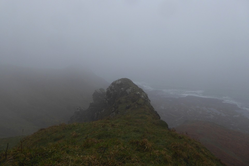
The ground falls away vertiginously from the rocky ridge on the west. The occupation site is below on the right but I didn’t get any closer than this.

The landward side is protected by a ridge of rock, which is now run close by the Edinburgh-Berwick railway line.

Conditions were less than ideal, but as far as I can tell, the site is below on the right.

Lamberton Shiels from the northwest.

Looking across Sand Bay from the bowl barrow, towards Worlebury (in the trees on the nearer headland) and Brean Down.


The top of the much-reduced bowl barrow.

Approaching the barrows from the east. The disc barrow is theoretically in the foreground, but there’s nothing to be seen.

Bank on the perimeter of the hill next to the footpath. I couldn’t tell if this was manmade, enhanced or natural.

Looking up over the scarping on the east side of the fort.

Overgrown holloway running up into the fort from the northeast.


Steep slopes on the northwestern side of the hill.


