Showing the proximity of the cairn to the cliff edge.


The eastern (seaward) side of the mound.

Exposed side slab at the northern end of the mound/cairn.

The remains of the cairn. There’s stonework beneath the bush, which may be growing out of one the cists.

Third cup and ring marked slab on display at Alnwick Castle.

Second cup and ring marked slab on display at Alnwick Castle.

Cup and ring marked slab on display at Alnwick Castle.
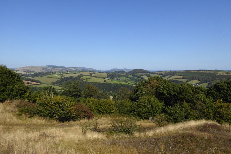
Looking NNW across the entrance towards the Long Mynd and the prominent Caer Caradoc hillfort. The wooded hill to the right of that is Wart Hill Camp, where I was before coming here.

The settlement area on the summit of the hill. The low remains of the single rampart are far left of shot, curving round the contour.

The steep slopes on the northwestern side.


Looking southeast from the settlement. The wooded hill is Norton Camp just the other side of Craven Arms.

The hilltop settlement from the southwest.
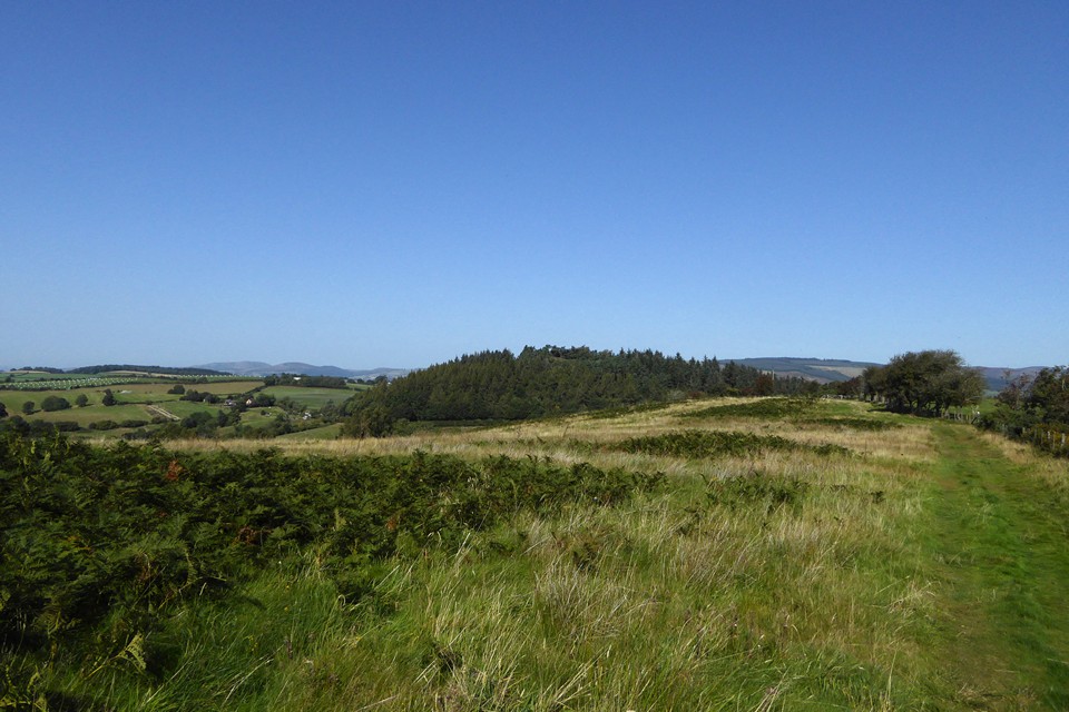
Wooded Wart Hill (centre) from Hopesay Hill to the south. Over to distant left are Corndon Hill and Heath Mynd, straddling the border between England and Wales.

The site of the summit barrow, looking towards Caer Caradoc.

The cairn marking the site of the summit barrow. The Ordnance Survey bolt (see Misc post) is bottom right. Looking towards Pole Bank, the Long Mynd’s summit.


Looking southeast off the northern barrow. The Clee hills (Brown Clee left; Titterstone Clee right) form the skyline backdrop.


Looking over south Shropshire towards Herefordshire across the southern barrow.


The approach to Grindle from Little Stretton, up Small Batch. Grindle is centre skyline, the barrows are just to the left.

Caer Caradoc rises far left over Church Stretton with The Lawley behind. Seen from Small Batch above Little Stretton to the southwest.

Pre-dawn Kemerton Camp through the train window.

Pre-dawn Nottingham Hill rises above the mist from the valley. From the train window.
There are two surviving round barrows on the southern shoulder of Grindle. A further barrow formerly crowned the summit of the hill, but has been destroyed.
Descriptions from the Shropshire HER:
Southern barrow (SO 4286 9241)
The monument includes a bowl barrow situated overlooking a steep east-facing scarp slope. The barrow is visible as a well defined, slightly oval, mound with dimensions of 10m north-east to south-west by 9m transversely and standing up to 0.6m high. The summit of the mound has been disturbed and hollowed to a depth of 0.2m by exploration at some time in the past. Although not visible at surface level, a ditch, from which material was quarried during the construction of the monument, surrounds the mound. This has become infilled over the years but survives as a buried feature some 2m wide.
Visited during a condition survey by the English Heritage Field Monument Warden, in 2000. Condition recorded as fair – covered by thick old heather.
Northern barrow (SO 4290 9244)
The monument includes a bowl barrow situated on the lip of a steep east facing scarp slope. The barrow is visible as a well defined, slightly oval mound of earth and stone construction, with dimensions of 11.7m north east to south west by 10m transversely and standing up to 0.8m high. The summit of the mound is flattened and slightly hollowed as a result of exploration at some time in the past forming a shallow central crater 3m in diameter and 0.2m deep. The centre of this crater shows the inner fabric of the mound to comprise angular limestone blocks of a fairly uniform size between 10cm and 20cm. Although not visible at surface level, a ditch, from which material was quarried during the construction of the monument, surrounds the mound. This has become infilled through the passage of time but survives as a buried feature some 2m wide.
Visited during a condition survey by the English Heritage Field Monument Warden, in 2000. Condition recorded as fair – covered by thick old heather.
Summit barrow (destroyed – SO 4300 9265)
The most northerly of the three barrows on Grindle Nills, circular in plan, 40ft in diameter by 18ins high.
The barrow has been destroyed. Its site is marked at SO4302 9265 by a roughly circular bed of stones, within an area of heather, 7.5m in diameter, upon which, on the N side, stands a modern cairn of stones. Embedded into the S side is an OS triangulation bolt.

Whether or not there are any traces of Iron Age predecessors, in their location the medieval earthworks are classic promontory defences.


Looking towards the river Tyne and South Shields.

The promontory across Short Sands from the north.
From Historic England:
The earliest evidence for occupation on the headland was uncovered by excavation in 1963. There survived the part remains of a large pre-Roman round house measuring 11.5m in diameter within a wall of upright posts set within a narrowly dug foundation trench. There was a doorway through the south wall. An outer concentric line of post holes which held the eave posts was situated 0.6m beyond the inner wall giving an overall diameter of 14m. Roman pottery found above the foundation trench indicated that the house had gone out of use by the late second century AD. It is thought that the house may belong to a much more extensive Iron Age settlement, possibly a promontory fort where the neck of land which joins the headland to the mainland would be defended by a palisade or a series of ditched defences.
The 1963 excavations at Tynemouth also uncovered the remains of a second circular house, 4.5m in diameter and of different form to the first. This house was not considered to be contemporary with the first, instead it was dated to the later Romano-British period. There was a concentration of Romano-British pottery in this area as well as a scatter across the rest of the excavated area and one of the pieces of pottery was dated to the late second century AD.

Cupmark on top of the bluestone at the front of the pub. If this is indeed a replica, it’s nice that they did the cupmark.


The bluestone in front of the pub.


The stone has found itself integrated into some planting since Hob’s visit.

The peat layer is at the base of the dunes. The Bronze Age cairn was located above, before its rescue and relocation to the visitor’s centre.
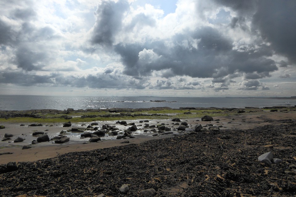
Looking across Druridge Bay towards Lynemouth from Low Hauxley. This scene would have been filled with woodland in the Mesolithic,