
Very scant remains of the northernmost section of rampart.
Image credit: A. Brookes (23.8.2020)

Very scant remains of the northernmost section of rampart.

Looking southeast, Pen Hill with its summit stand of trees is right of centre across the Churn valley.

Looking west, the Churn valley dropping away below.

Beeches line the western rampart.

Exposed stonework on the southern rampart, showing the construction.

Southern end of the western rampart.

The bank at the southern corner of the fort.

Landscape context from Pen Hill to the south. The Churn Valley lies between the two hills.

The northeastern edge of the barrow, where the mound is at its best preserved.

The higher northern end of the barrow.

Looking southeast. Difficult to see in the photo, but the edge of Marlborough Downs can be seen on the distant horizon, far left.
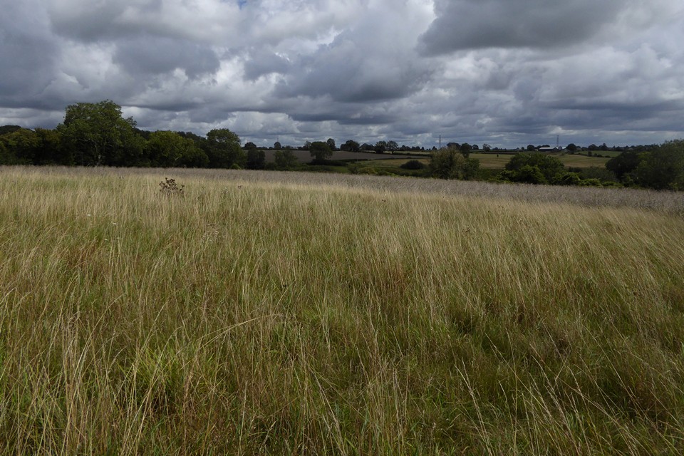
Looking east, the curve of the barrow is quite well-defined.

Looking north along the length of the barrow.

From the edge of the field to the east.
After leaving Woodmancote round barrow I head to the little village of the same name, from where a bridleway heads westwards. The landscape ahead is open and I can see the next site of the day as a lighter patch in a field across the dry valley dropping away on my left.
The path enters a little wood and turns right, and here a field gate allows access into the fields adjacent to the long barrow. Skirting around the top of the valley, the barrow’s field is margined with bright blue cornflowers, but the barrow itself is crowned only with long grasses.
It’s clearly been ploughed over the centuries, as it’s quite reduced in height. It’s nevertheless a good length and has enough left of its mound to be obvious. Now unploughed, it’s a nice place to sit for a while, as banks of cloud rush over. The crest of the hill blocks views to the west, hedges to the north, but to the southeast I can just make out the distant edge of the Marlborough Downs in Wiltshire.
From here I rejoin the bridleway to Cotswold Park and then up onto prominent Pen Hill to the north. Making my way up to the clump of trees on the top, the clouds that have been building all morning finally decide to drop their load on me, a temporary blip on an otherwise hot and sunny day. After a lunch stop by the trig, I drop down to Colesbourne and munch on a ice-cream before deciding on an impromptu revisit to Norbury hillfort and a long walk back to Cheltenham.
An easy stroll up from the bus stop at Rendcomb on a warm August day, the sun playing hide and seek behind billows of Cotswolds clouds.
The tree-covered barrow is prominent in a field next to the minor road east of Woodmancote. It’s at the top of steeper slopes dropping down to the picturesque River Churn, hidden by woodland from the barrow itself. There are neither crops nor livestock on my visit.
The trees make the barrow an obvious landmark and appear to have saved it from the plough, although the mound extends outwards into the field from the wooden fence surrounding the trees. The drawback with my summer visit is that the trees conceal the barrow beneath a deep covering of nettles, which also guard the site with a knee-high barrier. Clad in shorts, I make a half-hearted foray but am quickly stung in multiple places and retreat from closer inspection.
Vegetation aside, it’s heartening to find a Cotswold round barrow that hasn’t been ploughed down to nothing. The situation is pleasant, but the lack of longer views and the proximity of houses on the edge of the village stops it from really being a place to spend very much time. Worth the visit though, especially as I haven’t been here before.
I head off to Woodmancote itself, then on to Cotswold Park long barrow. A good start to the day.


Looking northeast. The Churn Valley drops away out of sight, between here and the wooded hills on the skyline.

The mound of the barrow extends beyond the fence and trees. It’s a decent barrow under the vegetation and doesn’t appear to be under threat of the plough at present.

With hindsight an August visit in shorts was maybe not the ideal time to come. The barrow shelters under the trees, through the knee-high nettle barrier.

As well as the long barrow, there is a round barrow across the road in the field to the north, apparently known as Royal Oak Field.
Summary of Pastscape details:
A round barrow situated at SP 06701239 upon the gentle north-facing slope of a ridge. The barrow measures in diameter 29.0m north-south by 26.0m transversely, with a maximum height of 1.0m. There are no visible remains of a ditch; under plough.
Two upright slabs seen in 1936 after ploughing are no longer visible.
The Bronze Age barrow is not clearly visible on the available aerial photographs, although a lighter coloured area, which is probably caused by a spread of the stone material that formed the mound, is visible in 1946.

Looking south towards the long barrow (behind the row of trees) across the top of the round barrow.

The low round barrow in the field to the north of the long barrow, difficult to see under long grasses.


The northern end of the barrow, seen from the road.

Looking SE. The distant hills on the far right skyline are the Marlborough Downs across the border in Wiltshire.

Looking ENE across the low mound of the barrow, thankfully no longer being ploughed but instead left to grasses, wild flowers and insects.

More of the circular features to the northeast of the long barrow.

I came across several circular crop/parch marks just to the northeast of the long barrow. The low profile of the barrow’s northern side in the background is clear from this angle.


The long barrow from the west. Sadly the farmer has dumped a load of earth/manure and cut-down tree branches on top of the mound and set fire to them.

Looking SE over the arc of the conspicuously circular churchyard perimeter, the intervening ground only allows the top of what I took to be Worcestershire Beacon to peak over the skyline.

The 1,200 year old yew mentioned in Carl’s fieldnotes.


The stone is a good slab of local sandstone.

Nice and easy to find, right next to the gate.


Golden light of a midsummer’s evening.


On a warm midsummer evening the barrow is alive with the hum of insect life, butterflies, caterpillars, grasshoppers and ladybirds abound.

Just past midsummer, in newly mown surroundings.

The hillfort rises over the ghosts of medieval ridge and furrow in fields to the north.

