
Hazleton South from the southeast.
Image credit: A. Brookes (26.4.2021)

Hazleton South from the southeast.

The low mound of Hazleton South from the west.

The lighter patch of limestone scatter running left to right across the centre of the image is all that remains of the excavated Hazleton North long barrow. Seen from the road to the west.
After a very enjoyable visit to Salperton Park round barrow (26.4.2021), I head south along a surprisingly busy road to Hazleton long barrows.
I’ve been aware of these long barrows for years, but knowing that they were in a pretty bad state I’ve never made the effort to come. However, as I’m now walking the Gloucestershire Way less than a mile away, it seems rude not to finally come and have a look. Older StreetView images suggest that the southern barrow lies open to the road, but sadly someone with a penchant for barbed wire has put an end to that.
The site of the nothern barrow reveals nothing much, other than what appears to be a lighter scattering of limestone on the planted surface of the field. The southern barrow is better, a reasonable mound right next to the road. The barbed wire doesn’t invite a closer look, but it’s not really a monument you need to get up close and personal with, sadly.
Still, it’s an easy visit and I’m glad I’ve finally made the effort. Of course, post-visit the barrows have taken on a much wider fame, courtesy of careful DNA research. All this is still to come though.
From here I rejoin the Gloucestershire Way route, which will take me past Salperton Park, through Notgrove (Notgrove long barrow is sadly too much of a detour today), then onto Cold Aston, heading across the Cotswold plateau via a few minor ascents and descents. The final barrow of the day will be the best though...

From the east as the sun came out.


From the northeast, showing the well-preserved mound from its less overgrown aspect.

The barrow from the southwest. The western end is covered in impenetrable shrubs and brambles.
The first of three new-to-me sites visited while walking the Gloucestershire Way from Shipton Oliffe to Stow-on-the-Wold (26.4.2021).
A grey morning start and a cold wind blowing across the Cotswolds plateau is slowly giving way to brighter skies as I head north-east from Shipton. There’s a good retrospective view towards the ridge surmounted by St Paul’s Epistle round barrow, prominent on the skyline to the west.
Salperton Park round barrow is in a narrow band of pleasant woodland immediately north of Penhill Road. The trees are a mix of deciduous species which provides a nice open canopy at this time of year, but unfortunately also allows plenty of light to support tangled vegetation at ground level. The barrow is quite overgrown, but also large enough to still be easily seen. In contrast to many ploughed down Cotswolds barrows, this is a large mound. It appears oval on plan, and I wouldn’t be entirely surprised to find that it was the remains of a truncated long barrow rather than a round barrow. As I poke about in the brambles and branches the sun breaks through the cloud, filtering a lovely Spring light through the canopy.
Well worth the detour from my route. Buoyed by decent barrow and improving weather I head off to Hazleton long barrows.

Northeastern ramparts of the inner enclosure.

The ground drops sharply down to Selworthy Combe on the eastern side of the fort.


The inner enclosure ramparts. Dunkery Beacon rises on the skyline, right.

Looking towards the inner enclosure from the outer ramparts. There’s a big open area between the two sets of the earthworks. The distant Quantocks are framed between Bratton Ball on the left and Periton Hill on the right.

The northern end of the outer ramparts with Selworthy Beacon rises beyond.

Looking south towards the high Exmoor ridge along the ditch between the outer banks.

Outer earthworks in the foreground, looking towards the inner enclosure.

The outer (western) earthworks from the southwest.
Abridged description from the Exmoor HER:
The main enclosure is bounded by a rampart and outer ditch, but because it is situated on a west to east slope the ditch disappears and the rampart degenerates into little more than an outer scarp on the downhill (eastern) side. No continuation of the southern end of the western outwork can be traced, but the northern end turns and is linked by a scarp to the main enclosure.
There are traces of stone building foundations in the northeast part of the inner enclosure where a track enters. Whybrow mentions that a good deal of stone is evident in the structure at and near the northeast entrance, as well as at one or two other points, and it is possible the rampart was originally stone revetted.
The site lies at 240 metres above Ordnance Datum on a spur running roughly northwest to southeast immediately northwest of Selworthy village. Situated on the tip of a spur, with a steep drop on two sides, but a gentler approach to the southwest. The enclosure is subrectangular in plan with slightly curving sides and rounded corners, having an internal area of 0.21 hectares enclosed by univallate earthworks. The defences are greatest on the upper sides, with a bank up to 2 metres high and outer ditch up to 2 metres deep, forming an external face 1.7 metres high. On the lower sides use is made of the natural slope which has been scarped to form a bank 0.2 metres high above a drop of 1.8 metres, with a slight outer terrace. The earthworks have a steep, well preserved profile. The most likely original entrance is in the centre of the northeastern side where there is a disturbed area consisting of a gap in the rampart and a mound of stone extending out from the interior of the enclosure, truncating the ditch which turns out along it. This may represent a tumbled outturned entrance or collapsed gatehouse. Uphill from this there is a counterscarp bank outside the ditch. The present entrance on the southwest appears to have been created by a modern trackway over the ramparts. Uphill, 32 metres above the enclosure, is a crossridge work with two arms meeting at a shallow point on the crest of the ridge. The northeast arm, 45 metres long, runs parallel to the top side of the enclosure, and the second arm runs south from this for 45 metres. It is formed of a bank approximately 2 metres high and an external ditch approximately 2 metres deep, of similar proportions to the upper side of the enclosure, forming an external face 2.5 metres high. On the north-east this work runs to the edge of the spur and turns briefly towards the enclosure as a scarp and terrace. A length of natural scarp completes the gap between the two. On the south, however, the work ends well short of the edge of the hill, suggesting that approach was intended from this direction. There is a gap through the crosswork immediately south of the apex, consisting of a shallowing of the ditch and lowering of the bank, but this appears to be modern. The crosswork may have defined an outer enclosure, but a more likely purpose was to provide better visibility both from and of the site along the uphill approach. Such crossworks covering the otherwise blind approach to a defended site are a feature of several sites in the region. The outer edge of the cross-work ditch has been reused as the course of a later field enclosure bank, and it has been faced with drystone walling. Redundant field banks are present around the site and date from the post-medieval or early modern period.

After leaving the cairn and heading downhill, we came across what appears to be a small cairn on the grassy slopes.

Lots of stone but little in the way of obvious structure.

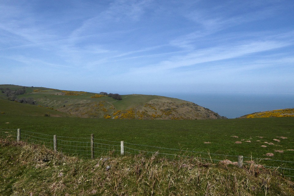
Looking northwest across the cairn. The South Walian coast is mostly lost in the haze over on the left.

The cairn is big but low, and is trying to hide behind the gorse.

Minehead Without 1, St George’s Day.

Minehead Without 1, the (possible) Bronze Age cairn on the summit of the hill, surmounted by a modern cairn.

The prominent Minehead Without 2, the western monument in the main group.

The very overgrown Minehead Without 3, looking across the Bristol Channel towards South Wales.

Minehead Without 6, one of the larger cairns in the group.

Minehead Without 7 in the foreground, one of the smaller cairns in the group. Looking west towards the summit of Selworthy Beacon.

Exposed stonework on the top of Minehead Without 9, near the eastern end of the group.Looking SSW towards Dunkery Beacon.
Landscape context on a very hazy St George’s Day. The fort (centre) is at the eastern end of a mile long spur on the seaward side of Selworthy Beacon. The grounds drops steeply away to Grexy Combe on the right.

Springtime, St Paul’s Epistle.

A quick and easy detour off the Gloucestershire Way for a revisit. The barrow gives great views over the Coln Valley, where I’m heading next.

Last time I came it was bitterly cold and the barrow was semi-clad in snow. It’s nice to return in beautiful Spring sunshine.

Landscape context, approaching the site from the southwest on the Gloucestershire Way, with Coldwell Bottom dropping away to the right. The barrow is in the centre of the image.

The southwestern barrow is in there, somewhere.


Wild garlic clothing the southwest barrow.

Lovely Spring weather and the excellent southwest barrow.
A revisit while walking the Gloucestershire Way (17.4.2021) after the usual dice with death crossing the road by the Air Balloon roundabout from Crickley Hill.
I last came here a year ago and was depressed by how overgrown everything was getting. It’s still knee-deep in vegetation this year, but there seem to be fewer nettles and the whole wood is beautifully pungent with wild garlic in the lovely Spring sunshine. It’s a cheering, restorative place to visit after the road crossing, and I look forward to the re-routing of the road in a few years that is planned to incorporate wildlife and pedestrian bridges.
From here my route will take me to an old favourite, Coberley long barrow. I set off with a renewed spring in my step.

Looking along the eastern ramparts towards Barrow Wake and Birdlip Camp.


The overgrown limestone slab of the Devil’s Table, looking towards Cooper’s Hill with Gloucester and Robinswood Hill to the right.
Walked up from Shurdington at the start of my sixth section of the Gloucestershire Way (17.4.2021) on a beautiful Spring morning.
The walk has already had a set-back due to the farmer at Greenfield Farm blocking the path, which leads to an annoying detour west then south, followed by a steep climb up from the A417. I’m out of practice at hills after a couple of months of being largely inactive as the latest lockdown combined with rubbish weather has kept me at home. My Gloucestershire Way efforts resumed a couple of weeks back on the flatlands of the Severn, this is the first uphill section since leaving May Hill and the Forest of Dean.
I’ve not come up here on this route before, and I had never heard of a limestone block called the Devil’s Table until route-planning. Like the Devil’s Chimney at nearby Leckhampton Hill, this appears to be a remnant of quarrying rather than a natural feature. When I get up there, puffing and panting, I find it’s partially buried in brambles, but it offers an excellent place to stop for a while, cool down and take in the extensive views across the Severn vale. I idly wonder why the quarrymen were so keen on giving Devilish names to their workings.
From here it’s a short pull up to the fort itself and familiar territory. It’s great to be back here on such a beautiful morning and the fort is quiet.
After a wander around in the sunshine, my route heads off through the lovely beech woods to the Air Balloon and then to Emma’s Grove round barrows.


