

thesweetcheat


From the Welshpool & Llanfair Light Railway to the west.
Image credit: A. Brookes (10.8.2011)


Cefn-Cyfronydd, seen from train carriage on the Welshpool and Llanfair Railway.
Image credit: A. Brookes (10.8.2011)
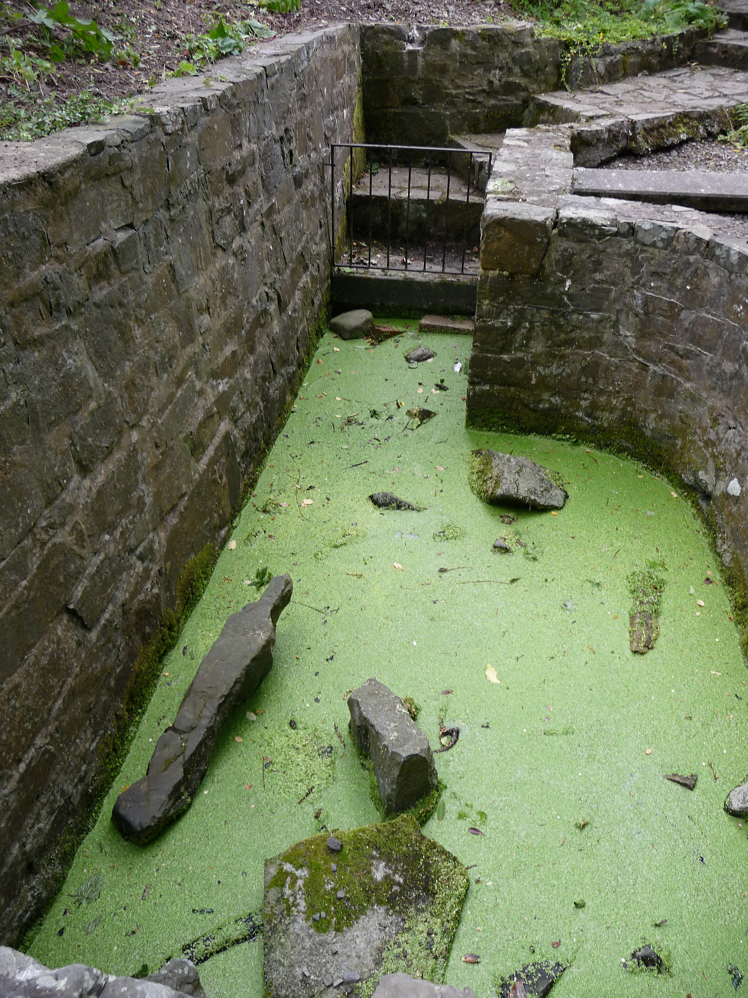
Can’t say I was desperately keen on trying out the “healing qualities”...
Image credit: A. Brookes (10.8.2011)


“Fragments of material loose in central part of a timber-laced rampart on the NW facing wall of Ffridd Faldwyn Iron Age Fort. These have been reduced to a vitrified state by fire built between the 1st and 3rd centuries BC”
On display in Montgomery Museum.
Image credit: A. Brookes (9.8.2011)

Long Mountain from Montgomery Castle. Beacon Ring hillfort is on the highest point, towards the left hand end. Offa’s Dyke crosses the flat lands below.
Image credit: A. Brookes (9.8.2011)

Looking NW across the ploughed-down mound. The Saxon earthwork of Offa’s Dyke is in the trees to the right.
Image credit: A. Brookes (9.8.2011)


The Rossett round barrow, seen from the north. The Kerry/Ceri Hills form the ridge beyond, topped with a (probably) prehistoric trackway.
Image credit: A. Brookes (9.8.2011)


The tree-covered ramparts on the northwest make use of the naturally steep slope.
Image credit: A. Brookes (9.8.2011)

The highest part of the hill, within the original Neolithic camp.
Image credit: A. Brookes (9.8.2011)

Looking across the interior of the fort towards the southwest. The hill over on the far left with obelisk is Montgomery Town Hill, the obelisk is a war memorial.
Image credit: A. Brookes (9.8.2011)

The fort interior, looking NNW. The Berwyns can just be seen directly ahead.
Image credit: A. Brookes (9.8.2011)


Approaching the SW “annexe” from the south.
Image credit: A. Brookes (9.8.2011)

Corndon Hill from Montgomery Castle. The hill dominates the surrounding countryside, making it an unsurprising location for the multiple cairns that top it.
Image credit: A. Brookes (9.8.2011)

The ridge of Long Mountain seen from Lymore Park to the SSW. The fort can be seen towards the lefthand (southwest) end of the ridge.
Image credit: A. Brookes (8.8.2011)

The fort presents a wooded aspect from the east. The ruins of Montgomery Castle can be seen on the left.
Image credit: A. Brookes (8.8.2011)

Corndon Hill seen from the west near Rownal, Montgomery.
Image credit: A. Brookes (8.8.2011)

Ffridd Falddwyn is the wooded hill on the right. Seen from low-lying farmland north of the Avon Camlad to the NE.
Image credit: A. Brookes (8.8.2011)

The brooding Corndon Hill, seen from Beacon Ring hillfort near Welshpool.
Image credit: A. Brookes (8.8.2011)

The fort from the south. The rampart can be seen beneath the trees.
Image credit: A. Brookes (8.8.2011)

Impressive earthworks near the southern entrance.
Image credit: A. Brookes (8.8.2011)

The southern entrance. Becairned Corndon Hill fills the skyline to the SE.
Image credit: A. Brookes (8.8.2011)


Extensive views from the western rampart, looking NW. Outskirts of Welshpool can be seen below on the far left.
Image credit: A. Brookes (8.8.2011)

Heavily overgrown rampart on the western side of the fort.
Image credit: A. Brookes (8.8.2011)

The northern-eastern rampart, near the northern entrance.
Image credit: A. Brookes (8.8.2011)

The rampart at the northern end of the fort.
Image credit: A. Brookes (8.8.2011)

The distinctive humpback silhouette of the Wrekin, seen from the Beacon Ring hillfort on Long Mountain, far to the southwest.
Image credit: A. Brookes (8.8.2011)

Approaching the tree-covered fort from the north.
Image credit: A. Brookes (8.8.2011)
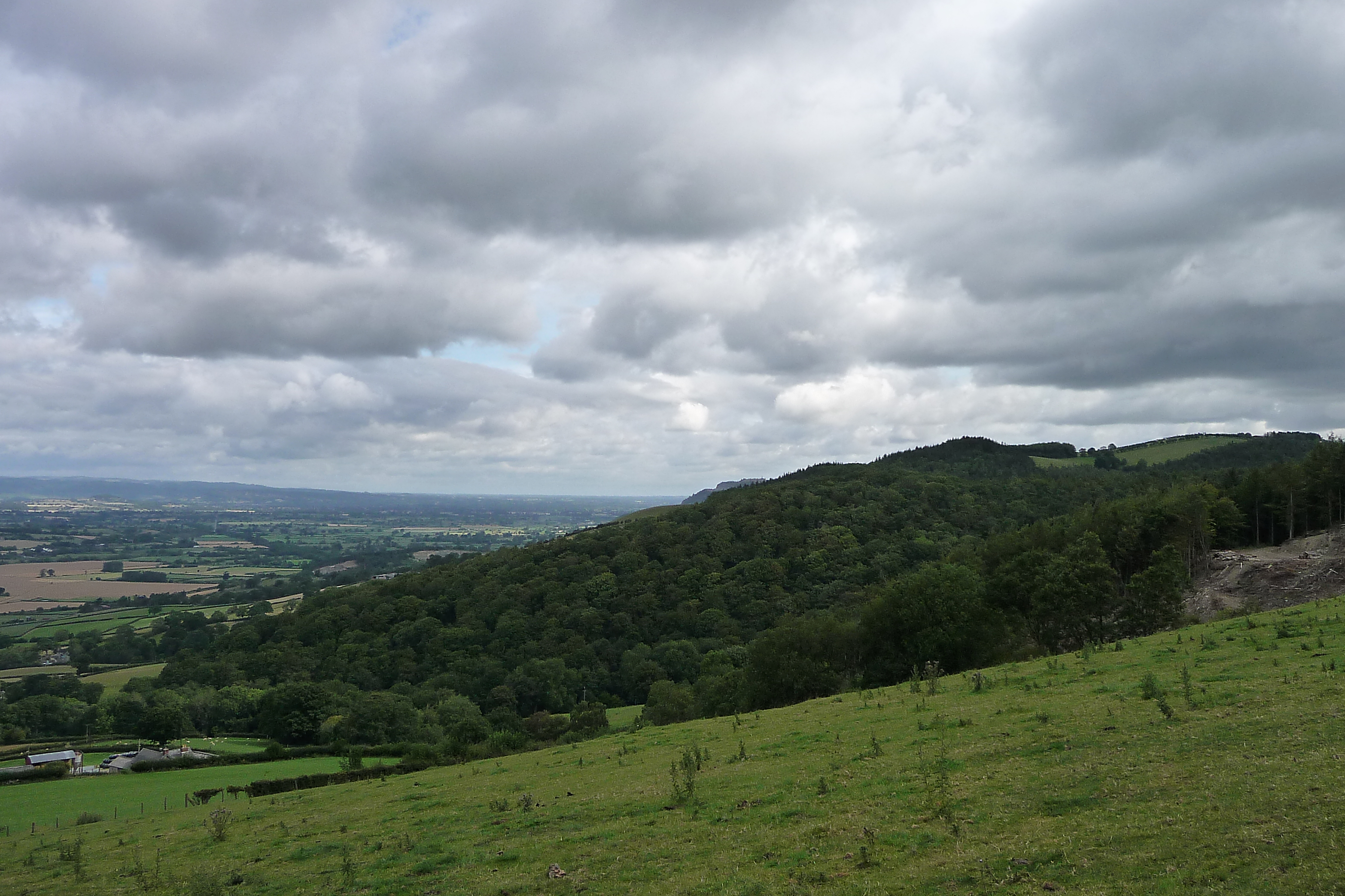
The fort on its wooded spur, seen from Offa’s Dyke Path near Salvagog Dingle to the south.
Image credit: A. Brookes (8.8.2011)

Seen from Offa’s Dyke Path near Stone House Farm to the west.
Image credit: A. Brookes (8.8.2011)


Long Mountain, with Beacon Ring surrounded by trees on the right skyline. The volcanic Breddins are over to the far left. From Powis Castle, near Welshpool.
Image credit: A. Brookes (7.8.2011)

Beacon Ring (centre skyline) seen from the gardens at Powis Castle.
Image credit: A. Brookes (7.8.2011)


What a brilliant stone this is.
Image credit: A. Brookes (6.8.2011)


The stone shining whitely with the saddle between Mynydd Llysiau and Pen Trumau the backdrop. The viewpoint is Pen Twyn Mawr to the SE.
Image credit: A. Brookes (6.8.2011)

Pen y Gadair Fawr on the right, seen from Pen Twyn Mawr. Below the skyline notch to the left, at the apex of the forest, is the Maen Llwyd standing stone.
Image credit: A. Brookes (6.8.2011)

The summit cairn, looking NE towards Rhos Dirion and Twmpa.
Image credit: A. Brookes (6.8.2011)

Approaching from Waun Fach. The summit cairn is prominent even from this distance.
Image credit: A. Brookes (6.8.2011)