

thesweetcheat


Plentiful visitors to the hill’s summit on a bright autumn evening.
Image credit: A. Brookes (7.10.2012)

The twin hillforted summits of Crow Hill (left) and Arthur’s Seat (right), seen across Dunsapie Loch.
Image credit: A. Brookes (7.10.2012)

Arhtur’s Seat from the north. Although there is little in the way of visible remains of defences, the hill is such an overpowering presence on the surroundings that it’s easy to understand why it would be chosen as the site for a fort, for status as much as practical application.
Image credit: A. Brookes (7.10.2012)

Large slab amongst the stones of the site.
Image credit: A. Brookes (6.10.2012)


Showing the jumble of stones that comprise the site. Hillforted Ord Hill on the Black Isle provides the backdrop.
Image credit: A. Brookes (6.10.2012)

Looking NW across the Moray Firth to the Black Isle.
Image credit: A. Brookes (6.10.2012)


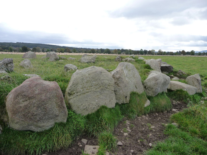
Well-perserved kerb on the northwestern side of the kerb.
Image credit: A. Brookes (6.10.2012)

Looking WNW. Hillforted Ord Hill on the Black Isle can be seen beyond.
Image credit: A. Brookes (6.10.2012)

Disturbed kerbing on the east side of the ring.
Image credit: A. Brookes (6.10.2012)

Looking NE. The ring cairn appears a bit of a jumble at first sight, but it’s actually pretty well-preserved.
Image credit: A. Brookes (6.10.2012)


An arc of five low stones remains of the site. Looking SE.
Image credit: A. Brookes (6.10.2012)

Looking NE across the low stones. The Nairn Viaduct provides the backdrop.
Image credit: A. Brookes (6.10.2012)

Mains of Clava SW from the northeast.
Image credit: A. Brookes (6.10.2012)

Stones in the SW arc of the SW circle.
Image credit: A. Brookes (6.10.2012)

Stone of the circle surrounding the SW cairn.
Image credit: A. Brookes (6.10.2012)

Cup-marked kerb stone on the SW cairn.
Image credit: A. Brookes (6.10.2012)


Shadow-dappled stone of the central circle, with the central ring cairn beyond.
Image credit: A. Brookes (6.10.2012)

Cupmarks in the passage of the NE cairn.
Image credit: A. Brookes (6.10.2012)

Lovely autumn day at Clava – the NE cairn.
Image credit: A. Brookes (6.10.2012)

Landscape context for the low-lying valley site. The cairn is on the edge of the trees, centre of image. From the B9001 to the NW.
Image credit: A. Brookes (6.10.2012)

Detail of the swirly-grained boulder adjacent to the cairn.
Image credit: A. Brookes (6.10.2012)

This enormous swirly-grained boulder sits at the NE edge of the site. It must surely have been here already and the cairn must have been built in relationship with it.
Image credit: A. Brookes (6.10.2012)

Scattered stones remain in what would have been the cairn itself. Looking SW.
Image credit: A. Brookes (6.10.2012)

The largest remaining kerbstone is a bit of a monster, approx 5 feet tall.
Image credit: A. Brookes (6.10.2012)


Large, overgrown clearance pile next to the cairn’s surviving stones. Of all the Clava cairns in the Nairn valley, this one is closest to the river itself.
Image credit: A. Brookes (6.10.2012)

Surviving kerbstones of the western arc.
Image credit: A. Brookes (6.10.2012)

Megalithic gatepost across the lane from the standing stone, there are other stones in the undergrowth here too. Could these be remnants of the possible lost circle?
Image credit: A. Brookes (6.10.2012)


Looking NE down the Nairn valley.
Image credit: A. Brookes (6.10.2012)


Seen from the lane to the SE. Sheep provide scale.
Image credit: A. Brookes (6.10.2012)

From the northeast. This site deserves to be better known.
Image credit: A. Brookes (6.10.2012)

