


In late spring the earthwork is clothed in bluebells and wild garlic.


The northern end of the dyke looks over the valley to the neighbouring hillfort of Haresfield Beacon/Ring Hill.
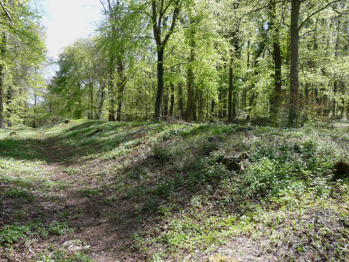
Standish Wood cross dyke, now much-cleared of vegetation.

Steep slopes guard the southern flanks of the hill.


Northern counterscarping seen from within the Ring Hill fort.

Counterscarping along the northern rampart of Ring Hill. The escarpment drops away steeply in the trees on the right.


The huge ramparts of Ring Hill, cutting off the promontory.


The southeastern rampart. The hill in the distance is Haresfield Beacon, another of the Cotswolds’ premier hillforts.


Extensive views northwest from the fort ramparts, from May Hill and Robinswood Hill, across Gloucester to the Malverns. Pen-y-Fan and the Black Mountains can be seen to the southwest on a clear day.

Multiple lines of ramparts on the west.

Looking along the northwestern rampart.

Another section of the southern rampart.


The westernmost part of the rampart. The scent of wild garlic was overpowering here.

The woodland setting of the dyke, running from the left side of the picture before disappearing into the trees right of centre.


Old Castle cliff fort from below.

Old Castle fort tops the cliff in the centre of the picture. Well, it is a cliff fort. Worm’s Head beyond.

The elusive burnt mound on the northern slopes of Rhossili Down, below Bessie’s Meadow.

Bessie’s Meadow cairn, looking SE towards the coast and Oxwich Point.

Showing the oval mound surrounding the chamber.

The configuration in which the slipped capstone was originally supported is not immediately obvious.


Detail of the pebbly conglomerate stones used in the chamber.

The chamber of the northern tomb.

The northern tomb, looking NE towards Llanmadoc Hill (cairns, hillfort) and Hardings Down (three forts).
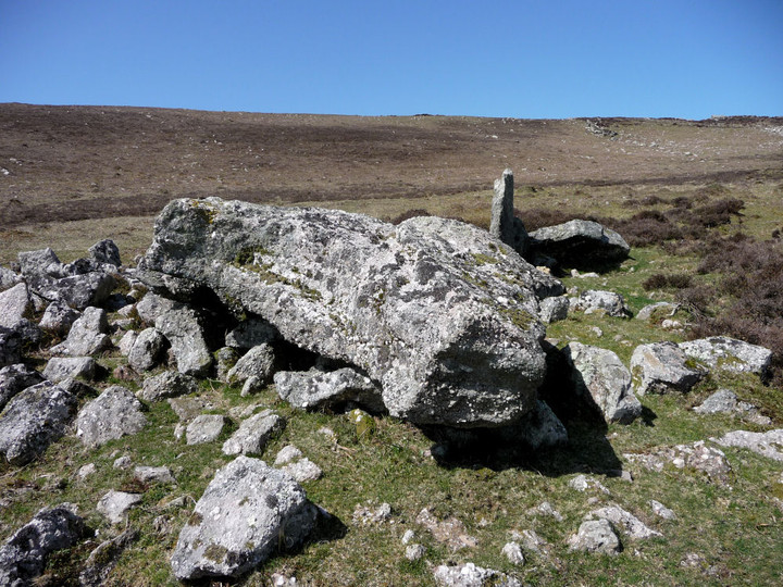
Presumably the capstone, but unusually shaped.

Looking south out towards the coast.

The wreck of the southern chambered tomb.

Sweyne’s Howes south, with the northern tomb directly behind. Llanmadoc Hill rises on the right.

Fine ring cairn, Rhossili Down. Hardings Down, with its three forts, can be seen beyond to the left.


Looking east from Cairn II across the Gower, towards Cefn Bryn.


The Beacon, showing huge footprint and boulder kerbstones.

The Beacon, Rhossili Down, looking NW towards Pembrokeshire.

Burry Holms from the east. The cairn is visible at the highest point of the promontory/island.

Looking south across the cairn to Worm’s Head.

The cairn, looking NE towards Whiteford Point.

The grassed-over cairn at the highest point of the promontory/island. Looking NW across Carmarthen Bay.

At its southern end, the rampart terminates at the cliff face.