
Approaching from the southeast. The cairn is prominent to the left of the track.
Image credit: A. Brookes (9.11.2016)

Approaching from the southeast. The cairn is prominent to the left of the track.

Looking east across the circle towards Harland Edge.

Looking north with the largest stone in the foreground. Hard to believe from the failing light that this was 2:30 in the afternoon.
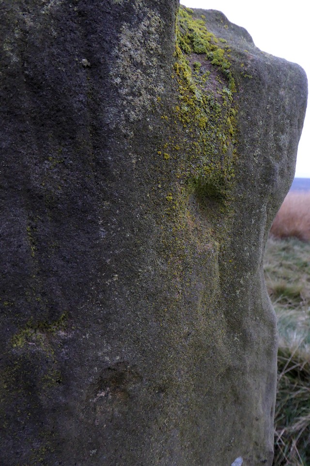
Two of the marks on the prominent stone. The lower one (bottom left) is jagged and shallow – this could easily be one of the bullet scars left by troops practicing their aim. The upper one is much smoother and looks like a genuine cupmark.

Looking towards Harland Edge.

Looking south. The small stone nearest the camera is typical of the size of most of the stones in the circle.

The most prominent stone in the circle, although not the biggest.

Minninglow seen from Hob Hurst’s House, away to the northeast. Ey up Stu.

Looking northwest to the snowy edges. G/F is standing on the opposite side of the tomb, giving some idea of how big it is.


One of the stones forming the edges of the chamber, bootprint for scale.

Looking southwest across the chamber. On the skyline, under the lighter patch of sky, is Minninglow.

18 years since we last came, this was probably the first chambered tomb I ever visited.

Illustration of the chamber from Bateman’s excavation.

At the western end of the rubble bank (see previous photo) are two upright stones, suggestive of the arrangements that form entrances to many of the ring cairns/embanked circles in the Peak District.

South of the cairnfield and near to the Chatsworth estate wall we came across this long rubble bank. The only NMR record for the vicinity (SK 27836 70362) suggests it is a ruined Bronze Age cairn turned into a series of Medieval sheepfolds.

What appears to be a kerb around one of the Gibbet Moor cairns.

Looking north across one of the small cairns on the high part of Gibbet Moor.

Small cairn on the high part of Gibbet Moor.

Looking northwest towards the snowy moors above Eyam and Grindleford.


Looking northeast towards Puddingpie Hill.

The grass has grown taller than the stones, it took us about 40 minutes of wandering around a small area and very wet feet to find. Well worth it though.


Sadly there’s not much left of Stone Low, after robbing. The remaining rim curves out from under the lone tree then back towards the other trees on the far right.


Craig Cnwch is the scarp-faced hill left of centre. The rising ground in the centre is (I think) Crugian Bach, awash with cairns and a stone circle. Seen across Caban-Coch reservoir on late spring day.


Low remains of the Iron Age cross dyke to the northwest of the long barrow.

Crickley Hill across Witcombe Reservoir. Birdlip Camp is on the far right.

Small standing stone at the grid ref. of The Cobstone, but presumably not “it”, from the misc. post.

Fairly well-defined earthworks usually hidden by tangled vegetation.

Facing the northwestern side of the enclosure from outside.


Small “standing stone” on the cairn.

The final site of a perfect Perth day.

Large upright slab on the cairn. It might be clearance, but it could be part of the cairn.


C’mon, just another 15 minutes?

Just out of reach.


The western circle in the foreground, fallen outlier immediately beyond, eastern circle beyond and eastern outlier standing on the left.

The fallen stones of the western arc of the western circle.

Looking north across the western circle.