
Watch Stone provides vertical element and Stones of Stenness henge the horizontal
Image credit: wideford
Watch Stone provides vertical element and Stones of Stenness henge the horizontal

view west across ring showing the four pseudo-cardinal cairns – Salt and South Knowes at back, Fresh Knowe and Plumcake Mound at front

Fresh Knowe and Plumcake Mound with Bookan Tomb on hill behind

Salt Knowe, South Knowe, Brodgar cairns, Ring of Brodgar, Comet Stone. In this view the backdrop is not the Black Hill of Warbuster but Linga Fiold (with the Lyking mounds facing us).

Watch Stone to Stones of Stenness viwed from Ireland Road

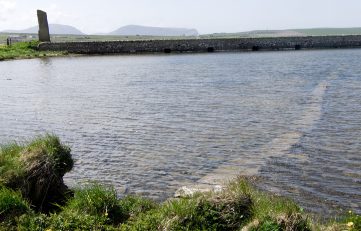
Ring and South Knowe viewed from Unstan Tomb – probably coincidence that two of the remaining stones appear to frame the latter

Maes Howe ‘in front’ of Ring of Brodgar and mounds (left), taken from Germiston road with 520mm equivalent [optical zoom on digital camera]

Maes Howe ‘in front’ of Ring of Brodgar and Fresh Knowe (bottom right), taken from Scuan on Germiston road with 520mm equivalent [optical zoom on digital camera]

Brodgar E end of parish boundary at left ad end of Seean at right with structural remains
? S end of stepping stones [Watch Stone top left] a rather wavy line and shoreside stones would appear to be a modern extension. As a causeway would most likely connect to holed sentinel and thence the Barnhouse Settlement

Fresh Knowe to Plumcake Mound from E end of parish boundary

looking over Fairy Well from top of bank with stones extending it back

Fairy Well coming down onto shore with old fence post roughly same height

overlooking Fairy Well from side

Fairy Well in bank face

Fairy Well main part – wellspring issues from base but are these stones in place or have they fallen into the well ?

brilliant light this week on underwater ‘stepping stones’ running from by NE end of Brodgar bridge diagonally – is this the alleged causeway, if so it looks more headed towards the Barnhouse settlement

Standing Stones of Stenness and Watch Stone, as seen from Grimeston road (Vola site is directly behind bushes left of foreground hut)

Ring of Brodgar & main Broidgar mounds seen from Grimeston road

the Stenness hills as backdrop with L-R in order of visibility ;Stones of Stenness, Ring of Brodgar, Salt Knowe.

slide of Watch Stone to Stones of Stenness from Stenness hills

slide of Watch Stone to Stones of Stenness

This sketch, made despite the wind at Deepdale standing stone where we sat, shows all the relative positions of the monuments and their proximity.
What a great vantage point!


nice pics again orkneyjar.com/archaeology/nessofbrodgar/index.html
A radically different picture of the prehistoric landscape around Orkney’s World Heritage Site is beginning to emerge – a landscape which perhaps didn’t feature the Stenness and Harray lochs.
Preliminary results from an archaeo-environmental project indicate that, prior to 1500BC, the Stenness loch was an area of wet marshland surrounding small pools or lochans.
Orkneyjar will be posting updates on this season’s dig that starts Monday :-
orkneyjar.com/archaeology/brodgar2007/index.html
An enclosure that may have originally been about a hundred metres across found at edge orkneyjar.com/archaeology/brodgarenclosure.htm
Finally found Fairy Well at HY2943212982. The Ring of Brodgar and knowes are in a large field with a quarry and such at the SW corner. From this corner a short fence forming a Y with it goes towards the loch and 5m from the base of the Y the well is well hidden by undergrowth at the edge of the steep bank here (about a fence post height). Scramble down onto the shore and look back at the ‘cliff’ face, watching your step as the ground is lumps and bumps and very squishy [so you don’t notice your feet sinking in]. All the way up are large stones of varying shapes though at the moment the spring comes from a gap at the base. A man came walking his dog which lapped up the fresh water momentarily revealed. Not a very regular construction and it appears to have collapsed back – a few feet to the east several yards of the bank have been roughly faced with very large slabs etc. to hold the bank up. Removed as much veg as I could, not sure how it would stand wholesale removal in its present state.
I don’t know how well accepted the idea that megalithic monuments are placed deliberatly at certain sites to relate to other features in the surrounding landscape is these days. If there’s any truth in it, then ones of the main focal points for this bunch of sites has to be the Isle of Hoy. It keeps popping up as you walk from the various monuments, from Maeshowe to Unstan, From the Barnhouse stones up to Bookan, it’s always there, as much a part of the setting as the Lochs.
If you have the chance to be here, and have the time, leave the car at the first site and walk to the others. Both on the way there and on the way back, each site seems to give out tantalising hints of it’s spatial relationship to the others, and to the area around them.
This place lives up to the hype.
There are several large mounds of this kind in the close vicinity of the Standing Stones of Stenness. In the latter part of the tenth century a party contest took place between two Jarls, Einar and Haarard, and their respective retainers, many of whom lie buried in these mounds. The spot on which they are situated used to be called Haarardshay, or the “field of Haarard.”
From Rambles in the Far North by R Menzies Fergusson (1884).
Many of the country do say, that in the larger round [of stones] the sun, and in the lesser the moon, was worshipped by the old pagan inhabitants of these isles.
From Brand’s ‘A Brief Description of Orkney, Zetland, Pightland-Firth and Caithness’ (from I think 1701 originally, but I found it in ‘A general collection of the best and most interesting voyages and travels in all parts of the world’, which was put together by John Pinkerton in 1809 – you can read it on Google Books.)
The quietly amusing Mr Thomas gives his insight on the stones’ folklore:
In vol. iii. of Arch. Scot. there is a rude woodcut from a drawing, and extracts from a description of the stones of Stenness, communicated by the Rev. Dr. Henry, in 1784. In the drawing we have an amatory couple exchanging vows at the shrine of Odin, but unfortunately the Odin stone is drawn standing upon the east instead of the west side of the Stenness Ring.
There are eight standing and two fallen stones in the Stenness Ring, which forms an exact semi-circle, and the cromlech is removed from the north side to what is intended to be the centre. Upon the cromlech is a kneeling damsel supplicating for the power to do all that is wanted from her by her future lord, while he is standing by, and seems to be rather intoxicated, but whether from love or wine is not to be determined from the drawing.
I quote the following account, which I believe to be extremely exaggerated.
“There was a custom among the lower class of people in this country, which has entirely subsided within these twenty or thirty years, when a party had agreed to marry, it was usual to repair to the Temple of the Moon, where the woman, in presence of the man, fell down on her knees and prayed the god Woden (for such was the name of the god whom they addressed on this occasion) that he would enable her to perform all the promises and obligations she had made and was to make to the young man present; after which they both went to the Temple of the Sun, where the man prayed in like manner before the woman. Then they repaired from this to the stone north-east of the semi-circular range; and, the man being on the one side and the woman on the other, they took hold of each other’s right hand through the hole in it, and there swore to be constant and faithful to each other. This ceremony was held so very sacred in those times, that the person who dared to break the engagement made here was counted infamous, and excluded from society.” – p. 119.In the description of the before-mentioned drawing, the Ring of Stenness is called “the semi-circular hof or temple of standing stones, dedicated to the moon, where the rights of Odin were also celebrated:” but my witty friend, Mr. Clouston, is of opinion that it was only the lunatics who worshipped here.
The Ring of Brogar is called “the Temple of the Sun:” unfortunately, the ring of Bukan, which was of course the Temple of the Stars, seems to have escaped notice, or we might have learned of some more ante-nuptial ceremonies performed therein.
Cheeky but no doubt true.
From ‘Account of some of the Celtic Antiquities of Orkney, including the Stones of Stenness, Tumuli, Picts-houses, &c., with Plans’ by F W L Thomas.
Chapter 13 in: Archaeologia, Or, Miscellaneous Tracts Relating to Antiquity By the Society of Antiquaries of London (1851).
This can be read online courtesy of Google Books.
Captain McKay, a ferrylouper, the destroyer of the Odin Stone, was finally stopped only after the destruction of of one stone and the toppling of another of the Standing Stones of Stenness.
The farmer who in 1814, removed the Stone of Odin because he was fed up of the many visitors to his land, clearly underestimated the attachment that locals had to this stone. The farmer (who also commited the crime of not being a native Orcadian) was almost killed after 2 attempted arson attacks on his property.
According to Reverend R. Henry (c.1784), every New Years Day local young folk gathered at the Kirk of Stenness with enough provisions for 4 or 5 days. Couples who wished to be married would leave the group alone and go to the Temple of the Moon (Stones of Stenness) where the woman would pray to Woden. Then they went to the Temple of the Sun (Ring of Brodgar), where the man would pray before the woman, when finally they went to the Stone of Odin where they clasped their right hands through the hole in the stone and exchanged vows.
Leslie Grinsell wrote in 1976 (Folklore of Prehistoric Sites in Britain) that babies who were passed through the hole in the Stone of Odin would live long and healthily. Grinsell also wrote that it was customary to leave offerings at the Stone of Odin and that sick people would go round the Stones of Stenness 3 times to become cured.
“The Stones of Stennis have a perfect setting of wild moorland and loch. There are two main groups- the Ring of Brogar, or Temple of the Sun, and the smaller Ring of Stennis (which is strictly a semi-circle or crescent), or Temple of the Moon.”
From “The Silver Bough Volume 1: Scottish Folklore and Folk-Belief” by F.Marian McNeill, 1957 page86.
Having noticed photographically that a line from the Barnhouse Stone through Maeshowe passes on to the Setter tumuli below Sordon (NMRS record no.HY31NW 14 at HY34581544 & 34631543, to whit two Bronze Age burial mounds) I wondered about the relative position of the Ke(i)thesgeo stone (HY31SW 41 at HY30351136). Pencilling in the position of the stake showing its former position onto a 1:25,000 map a line passes from it through Maeshowe to the Setter barrows, though missing out the Barnhouse Stone rather. Makes a useful backstop up on the Clouston hillside.
Pococke 1760
“[from the Ring of Brodgar] There is a single pillar about 50 yards to the North East, and a barrow to the North and South, one to the South West and another to the North East...
another circle of stones [Stones of Stenness] which are 15 feet high, 6 feet broad, the circle is about 30 yards in diameter, and the stones are about 8 yards apart. There are two standing to the South, one is wanting, and there are two stones standing, a third lying down, then three are wanting, there being a space of 27 yards so that there were eight in all : Eighteen yards South East from the circle is a single stone, and 124 yards to the East of that is another [Odin Stone] with a hole in one side towards the bottom, from which going to the circle is another [stone] 73 yards from the fossee [sic], the outer part of which fossee is 16 yards from the circle : there are several small barrows chiefly to the East [Clovy Knowes].” His map shows a large squat stone close to the shore E of the S end of the bridge – this and the possible causeway perhaps a reminder of when the main road went along the driveway to Stenness Kirk.
Low ~1774 unpublished ms “History of the Orkneys” quoted in 1879 edition published by William Peace [referring to a lost drawing, that published being one by William Aberdeen from the1760’s]
“[Stones of Stenness] The drawing shows the stones in their present state, which is four entire and one broken [??recumbent]. It is not ditched about like ... [Ring of Brodgar]..but surrounded with a raised mound partly raised on the live earth, as the other was cut from it... near the circle are several stones set on end without any regular order, or several of them so much broken, hinder us as to the design of them.”
William Aberdeen’s annotated map [donated to Royal Society of London 1784] is the source of observations attributed later to Hibbert
“When Oliver Cromwell’s men were in this county they dug tolerably deep in the top [of Maeshowe] , but found nothing but earth” also that site used for archery + “[E of Ring of Brodgar] a small mount... still retains the name of Watch Hill or Tower [Plumcake Mound rather than Fresh Knowe I think].”
The Dyke o’Sean, aka the Dyke of Seean ‘line’ [i.e. boundary dyke] RCAHMS NMRS record no. HY21SE 68 presently runs from HY28901367 to HY29431362 (across the parish boundary as it now is) but formerly ran from loch to loch with the Loch of Stenness end “built on each side” , with a cart once being with difficulty extracted therefrom. Close by the dyke’s north side is the Wasbister Disc Barrow and to its east a mound now not classified as burnt, then a whole settlement. The paucity of sites between it and the Ring of Brodgar complex would appear to indicate a prehistoric date, especially seeing how busy that landscape is N of the dyke. The nearest found by geophsics are two possible ring ditches HY21SE 93 somewhere in the field to the south’s southern half. At some remove, near the complex at HY29051322, by Stenness loch is an L-shaped cropmark some 55m long and ending at the shoreline. RCAHMS NMRS record no. HY21SE 89 is seen as a drain and/or enclosure but may be compared to a feature (HY465131) in the Carness Brecks below Blackhall.
In a talk today Euan MacKie mentioned that two of the Ring of Brodgar stones align almost exactly N/S, which is the same as the central hearth of the Standing Stones of Stenness. In neither case do these point to other archaeological sites.
The possible henge site I mentioned is named after the nearby cottage, where the legend for Staney Hill is shown i.e. the other side of the road from the standing stone field. I am informed that the ditch is clear to see, being water-filled, but my informant found on the first O.S. that the track previous to the present Grimeston road runs through where the possible entrance is shown.
In a talk tonight Colin Richards said (using insight from Andrew Appleby)that the Staney Hill area was probably another source of the stones for the Ring of Brodgar and that he will be investigating this summer
s.s themodernantiquarian.com/post/48685/images/staney_hill.html
?quarry below cairn themodernantiquarian.com/post/67427/images/staney_hill.html
A fantastic vicar’s sermon reported in “The Orcadian” 20/7/1801
ties the whole area together in fleshing out the alleged planetary correspondence :-
Maeshowe as the place where the Druids kept the symbols of sun, moon and serpent.
On the main festival of Beltane the sun sets on the Barnhouse Stone,
From there slightly north to the circle of the moon,
Then a little east to that of the serpent, the Odin Stone,
Now to the stone of mercury [? Watch Stone] at the Ring of Brogar,
Next to the height north that is the temple/house of the moon,
North again to the stones of Saturn & Jupiter [? Comet Stone]
Finally near the circle of the sun the stone of venus the King of Brogar.
At the last all go home to light the fires.
On the summer solstice the symbol of the serpent is taken to the mound [? Skae Frue] near the ring of Bhokin to be condemned to death. After which it goes to the King of Bhokin where it is pulled to pieces and eaten.
A newspaper report (“Orkney Herald” July 16th 1861) says that besides the Stones of Stenness (then used for the Ring of Brodgar) there were other stones still standing, both singletons and pairs, as well as the remains of a nearly destroyed circle (presumably the Comet Stone site). A week later Farrar reports that the two tumuli at the entrances to the Ring of Brodgar originally supported structures because of the amount of earthfast stone about their bases, though burial mounds encircled by stones are known from elsewhere. However only animal bones were found, and these from their upper parts.
In the very latest book on Stenness, a tome mainly concerned with the Barnhouse Settlement [price forty nicker], it is proposed that the Ring of Brodgar and the Standing Stones of Stenness and Maes Howe were specifically constructed so as to be encircled by moats. If it were not for the road Fresh Knowe would seem another possible candidate.
The map on the cover of the research agenda has the Ring of Brodgar legend but shows the present Standing Stones of Stenness as the Ring of Stenness. The slightly later 1st edition of the O.S. only has the latter as ‘Lesser Standing Stones’. More importantly it is the present Ring of Brodgar that has the legend Standing Stones of Stenness! Unless the whole area originally had this designation it would seem we do not know what Orcadians called these circles, so must be careful in attaching folklore and earlier reports to either one or the other when this latter is the referred name.
Details of the putative avenues between the Stones of Stenness and the Ring of Brodgar (from the resarch agenda) ; Watch Stone, Lochview, Stone of Odin, Comet Stone. Also suggested the pairs of stones (indicated at sockets alongside) at the Watch Stone and the Stone of Odin as symbolic doorways linking the circles.
Against the first of these the possibility that the Watch Stone and its companion socket are fragments of a circle now under the loch waters. Contra the second that they actually found three sockets from the Stone of Odin location, the third a few metres away.
About midway between the stone circles five cists were found HY302129. Four 3’x2’x1’ were aligned E/W and one at the end was 6"x6"x1’. Across the E ends of the middle two was a 2’6” triangular stone, incised with eight varying symbols, now at the national museum. Five foot below all of this was another cist.
P.S. April 2005, Nick Card is of the opinion that calling these cists is probably misleading as in the light of work at the Ness of Brodgar these could well be settlement features and the stone associated instead with the possible chambered tomb shown on the geophysics.
There were at least three wells of notes in the Stenness region. The sacred well stood in a marshy field with many springs below a farm (HY33721048 ?). This describes a different location from that ascribed to Bigswell which is on a slope across from the modern farm (Upper Bigswell). Both these are well SSE of Maes Howe however. But at the lochshore below the Ring of Brodgar is/was placed the “fairy well” (HY29541300).
Proceedings of the Society of Antiquaries of Scotland, vol 107 (1975/6)
A large document with many illustrations which surely must tell you almost everything there is to know about ‘The Stones of Stenness, Orkney’.

