The south-eastern front........
Image credit: Robert Gladstone
The south-eastern front........

Looking south-east from Dry Hill...

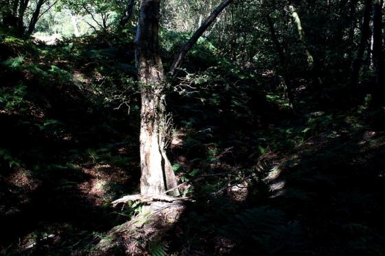
To north-west .

To north-west.

The best preserved section of powerful tri-vallate defences, to north-west near the reservoir.

Northern arc...


Approx east.

Souith-eastern arc, looking north-east.

South-eastern ramparts, looking south-west – middle rampart (I think).

Overgrown ramparts to south-east, looking north-east.
Dry Hill? Although I have to confess I don’t have the annual rainfall figures for Surrey to hand – one of my many faults, I’m afraid – it would appear to be somewhat over-optimistic to assign such a name to relatively high ground (hey, any ground, in fact) in England. Unless the title is a reference to an abstinence from alcohol by locals, or a very ironic ‘in joke’ by a droll bureaucrat approving the construction of the reservoir which occupies the north-western corner? No, I didn’t think so either.
There is more to this hilltop than an unusual name, however. Assuming you’ve got a thing for large, tri-vallate Iron Age hillforts, that is. The caveat, needless to say, is that this ancient home, fortress, status symbol, is now engulfed by the almost obligatory tree cover. In addition, just the one bank survives to the approx north out of the three, thanks to agriculture. But that still leaves a overwhelming amount in situ, even after some two millennia. For me, the most impressive section of the defences covers the arc to the north-west/west, the three banks and ditches nice and upstanding here, give or take a covering of fern or two. Or three. As mentioned, the northern circuit is somewhat reduced, numerically speaking, although the surviving inner bank remains pretty substantial. The remainder of the enclosure retains its three lines of defence to varying degrees, ensuring Dry Hill will no doubt satisfy the interested travelling antiquarian. Particularly those of the ‘modern’ variety, I’d have thought? OK, the interior of the enclosure does feature a reservoir, not to mention an OS trig point to mark the 550 ft summit, but so what? The vibe is great. And it doesn’t rain, either.
I approached the site from the south, via the ‘Vanguard Way’. To be honest an OS map would be of benefit to find the relevant starting point since, heading west upon a very minor road from Cowden, I found myself having to check-off the various farm names as I went along in order to locate the ‘V’ junction where it is possible to park a couple of cars upon the grass... within said ‘V’. Head north up the surfaced farm track – personally I wouldn’t drive – passing Woodlands Farm on your right. Then veer left, beyond Beeches Farm, to ascend the hill. The rest is up to you... As for myself, I’m off for a drink. Or two. Hey, make that three, come to think of it.