Skip to content
Julian Cope
presents
The Modern
Antiquarian
Latest
Posts
Sites
Map
Blog
Forum
search
Search
⚠️
Sign in
more_horiz
Eire
County Clare
The Burren
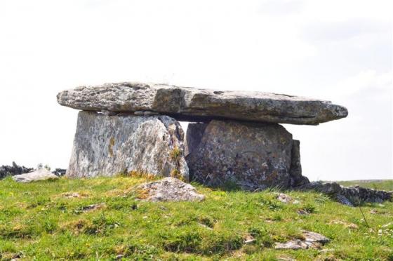
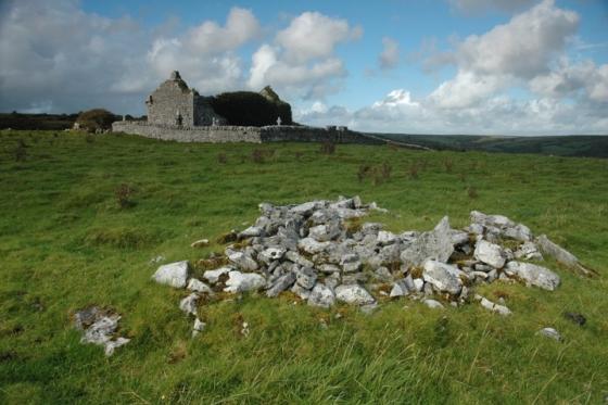
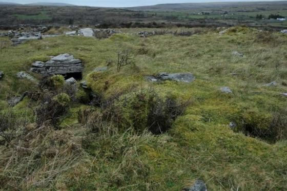
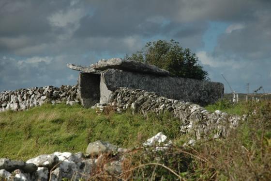
Meggagh
Wedge Tomb
R258988
expand_more
Nearest town:
Kilfenora (9km WSW)
OS reference:
R258988
OS sheet:
51
Latitude:
53° 2' 5.17 N
Longitude:
9° 6' 22.37 W
Added to TMA by
FourWinds
Images (3)
Fieldnotes (1)
Add
content
Images
Image credit: Charles Coughlan
bogman
May 31, 2010
Image credit: Charles Coughlan
bogman
May 31, 2010
Image credit: Charles Coughlan
bogman
May 31, 2010
Articles
Meggagh
Wedge Tomb
bogman
May 31, 2010
53.03511 N
09.10656 W
Sites within 20km of
Meggagh
Moheramoylan (Cl. 30)
Wedge Tomb
•
1.11km W
photo
1
Cahermackirilla
Stone Row / Alignment
•
1.73km SSW
photo
2
description
1
Eanty More
Wedge Tomb
•
1.73km NNE
photo
4
Fanyglavin
Wedge Tomb
•
1.73km SSW
photo
11
description
1
Carran
Cairn(s)
•
2.2km SW
photo
3
Caherconnell
Stone Fort / Dun
•
2.3km W
photo
7
description
1
Poulawack Souterrain
Souterrain
•
2.39km WSW
photo
6
Poulawack II
Chambered Cairn
•
2.4km WSW
photo
3
description
1
link
1
Poulawack
Cairn(s)
•
2.51km WSW
photo
11
description
2
Ballymihil
Wedge Tomb
•
2.53km NW
photo
5
description
1
link
1
Poulnabrone
Portal Tomb
•
2.79km W
photo
51
ondemand_video
1
forum
6
description
5
Poulaphuca
Wedge Tomb
•
2.96km N
photo
7
Rannagh West
Wedge Tomb
•
3.31km NNE
photo
2
Cahercommaun
Stone Fort / Dun
•
3.31km ESE
photo
19
forum
1
description
2
link
1
Iskancullin
Wedge Tomb
•
3.32km WSW
link
1
Castletown
Wedge Tomb
•
3.36km E
photo
4
Tullycommon (Cl. 54)
Wedge Tomb
•
3.37km E
Creevagh
Wedge Tomb
•
3.39km SE
photo
29
description
1
link
1
Tullycommon
Wedge Tomb
•
3.63km ESE
photo
4
Baur North
Wedge Tomb
•
3.88km W
Baur South
Wedge Tomb
•
3.88km W
photo
7
description
3
Baur South
Wedge Tomb
•
3.89km W
photo
3
Ballyganner North III
Wedge Tomb
•
3.9km SW
photo
6
description
1
Baur South
Cairn(s)
•
4.16km W
Boloona
Wedge Tomb
•
4.17km NNW
photo
4
Slievenaglasha
Wedge Tomb
•
4.19km E
description
4
Baur South (Cl. 26)
Wedge Tomb
•
4.29km W
photo
5
description
1
Commons North (Cl. 56)
Wedge Tomb
•
4.36km SE
photo
4
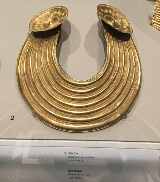
Gleninsheen
Wedge Tomb
•
4.47km WNW
photo
10
Ballyganner South II
Wedge Tomb
•
4.66km SW
Lissylisheen
Wedge Tomb
•
4.7km W
photo
2
Leana (Cl. 57)
Wedge Tomb
•
4.75km SE
photo
3
Gleninsheen
Wedge Tomb
•
4.83km NW
photo
16
description
2
link
1
Commons North (Cl. 65)
Wedge Tomb
•
4.84km SSE
Ballyganner South
Souterrain
•
4.86km SW
photo
2
description
1
Ballyganner North II
Wedge Tomb
•
4.87km SW
photo
5
description
1
Leana (Cl. 68)
Wedge Tomb
•
4.9km SSE
photo
15
description
1
Berneens
Wedge Tomb
•
4.93km WNW
photo
8
Cappaghkennedy
Wedge Tomb
•
4.98km E
link
1
Leana
Cairn(s)
•
5.01km SSE
photo
7
Ballyganner North
Court Tomb
•
5.03km SW
photo
6
Leana
Cist
•
5.11km SSE
photo
2
Parknabinnia (Cl. 66)
Wedge Tomb
•
5.13km SSE
photo
11
Clooneen
Wedge Tomb
•
5.19km SSW
photo
5
description
1
Parknabinnia (Cl. 153)
Court Tomb
•
5.32km SSE
photo
7
Parknabinnia (Cl. 67)
Wedge Tomb
•
5.34km SSE
photo
25
description
2
Parknabinnia (Cl. 59)
Wedge Tomb
•
5.39km SSE
Parknabinnia (Cl. 61)
Wedge Tomb
•
5.49km SSE
photo
4
Parknabinnia (Cl. 60)
Wedge Tomb
•
5.49km S
Parknabinnia (Cl. 62)
Wedge Tomb
•
5.59km SSE
Parknabinnia
Cairn(s)
•
5.59km SSE
photo
3
Parknabinnia (Cl. 69)
Wedge Tomb
•
5.6km SSE
photo
2
description
1
Ballyganner South
Wedge Tomb
•
5.8km SW
photo
6
Cahermacnaghten
Stone Fort / Dun
•
6.23km W
photo
5
Coolnatullagh
Ring Cairn
•
6.28km NE
photo
3
Coolnatullagh
Cairn(s)
•
6.4km NE
photo
2
Ballycasheen
Portal Tomb
•
6.48km S
photo
1
description
1
Ballyallaban
Bullaun Stone
•
6.57km NW
photo
2
Coolnatullagh
Wedge Tomb
•
6.65km NE
photo
2
Coolnatullagh
Wedge Tomb
•
6.67km NE
photo
2
description
1
Ballykinvarga
Stone Fort / Dun
•
6.94km SW
An Ráth
Rath
•
6.97km NW
photo
6
Cahermore
Stone Fort / Dun
•
7.64km WNW
photo
3
Faunarooska (Cl. 5)
Wedge Tomb
•
9.1km WNW
photo
4
Turlough Hill/
Knockycallanan
Cairn(s)
•
9.16km NNE
photo
7
Turlough Hill/
Knockycallanan
Ancient Village / Settlement / Misc. Earthwork
•
9.3km NNE
photo
11
Slievecarran
Cairn(s)
•
9.38km NE
Faunarooska (Cl. 4)
Wedge Tomb
•
9.42km WNW
photo
2
Faunarooska (Cl. 3)
Wedge Tomb
•
9.5km WNW
photo
2
Derrynavahagh
Wedge Tomb
•
10.25km WNW
photo
11
description
1
Lissateeaun
Rath
•
10.91km WSW
description
1
Ballytarsna
Artificial Mound
•
12.23km WSW
photo
1
description
1
Ballyelly Hut Site
Enclosure
•
12.72km W
photo
4
Ballyelly
Wedge Tomb
•
12.72km W
photo
5
description
1
Gleninagh North
Wedge Tomb
•
13.27km NW
photo
4
description
1
Moyree Commons
Portal Tomb
•
14.25km ESE
photo
10
Aughinish
Wedge Tomb
•
14.58km N
photo
6
description
1
Curraghadoo
Cairn(s)
•
14.84km WSW
photo
3
description
1
Doorus
Wedge Tomb
•
15.84km NE
photo
4
Caherdooneerish
Stone Fort / Dun
•
16.05km WNW
photo
3
description
1
Killian
Bullaun Stone
•
16.78km ESE
photo
1
description
1
Ballynastaig
Wedge Tomb
•
17.38km ENE
Ballynastaig
Wedge Tomb
•
17.43km ENE
Caherphuca
Wedge Tomb
•
17.48km ESE
photo
7
description
1
Crannagh
Portal Tomb
•
18.08km ENE
Crannagh
Portal Tomb
•
18.08km ENE
photo
10
Knockstoolery
Standing Stone / Menhir
•
18.14km WSW
photo
1
description
1
Ballynastaig Souterrain
Souterrain
•
18.57km ENE
Ballynastaig
Stone Fort / Dun
•
18.57km ENE
photo
8
description
2
Teergonean
Court Tomb
•
18.88km WSW
photo
9
description
2
Teergonean
Court Tomb
•
18.93km WSW
photo
4
description
1
Doolin
Round Barrow(s)
•
19.29km WSW
photo
1
Doolin
Round Barrow(s)
•
19.31km WSW
photo
2
description
1
Doolin
Round Barrow(s)
•
19.34km WSW
photo
2
Doolin Stone Axe Production Site
Ancient Mine / Quarry
•
19.47km WSW
photo
1
description
1
search
I’m looking for…
location_on
photo
ondemand_video
forum
description
link