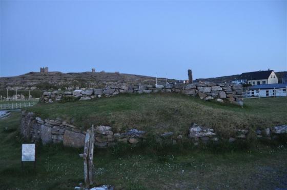
Viewed from the South East
Viewed from the South East

The North Eastern Walls

Terracing
I had first seen a photo of Caherdooneerish stone fort on Anthony Weirs wonderful web site, as I was visiting the Burren area recently and I decided to view it myself. Situated around 200 metres above Black Head the fort is not visible from the road, the owner of the B&B I stayed in was a keen walker and gave me good directions. If travelling from Ballyvaughan, shortly after Black Head Lighthouse you will come to two gates one on each side of the road, as you go through the gate you will see a rough path the farmer has made, this leads to a green path about a 100 metres up circling the cliff, turn left onto the path and follow it till you come to a wall follow the wall up on the left hand side and this will bring you to this beautifully situated fort. Your efforts will be well rewarded by the views alone.