Skip to content
Julian Cope
presents
The Modern
Antiquarian
Latest
Posts
Sites
Map
Blog
Forum
search
Search
⚠️
Sign in
more_horiz
United Kingdom
England
Southern England
Warwickshire
Harborough Banks
Hillfort
SP1838170850
expand_more
Nearest town:
Solihull (8km NW)
OS reference:
SP1838170850
OS sheet:
139
Latitude:
52° 20' 6.15 N
Longitude:
1° 43' 48.75 W
Added to TMA by
Baggles
Images (2)
Add
content
Images
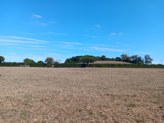
View of fort from North.
B
Baggles
Mar 31, 2026
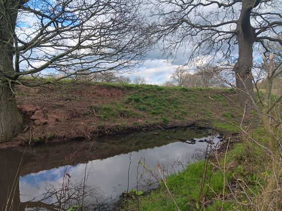
Rampart visible from track to the East.
B
Baggles
Mar 31, 2026
Sites within 20km of
Harborough Banks
Barnmoor Wood Camp
Hillfort
•
6.25km S
photo
1
description
1
Beausale Camp
Promontory Fort
•
6.29km E
photo
1
link
1
Berry Mound
Hillfort
•
11.24km WNW
photo
2
Barford Sheds Cursus
Cursus
•
13.45km ESE
description
2
Alcock’s Arbour
Sacred Hill
•
15.98km SSW
description
2
Burrow Hill
Hillfort
•
18.63km NE
photo
1
link
1
Wappenbury
Hillfort
•
19.34km E
photo
1
link
1
Coleshill Temple
Iron Age Shrine
•
19.66km N
description
1
search
I’m looking for…
location_on
photo
ondemand_video
forum
description
link