
Image credit: Robert Gladstone


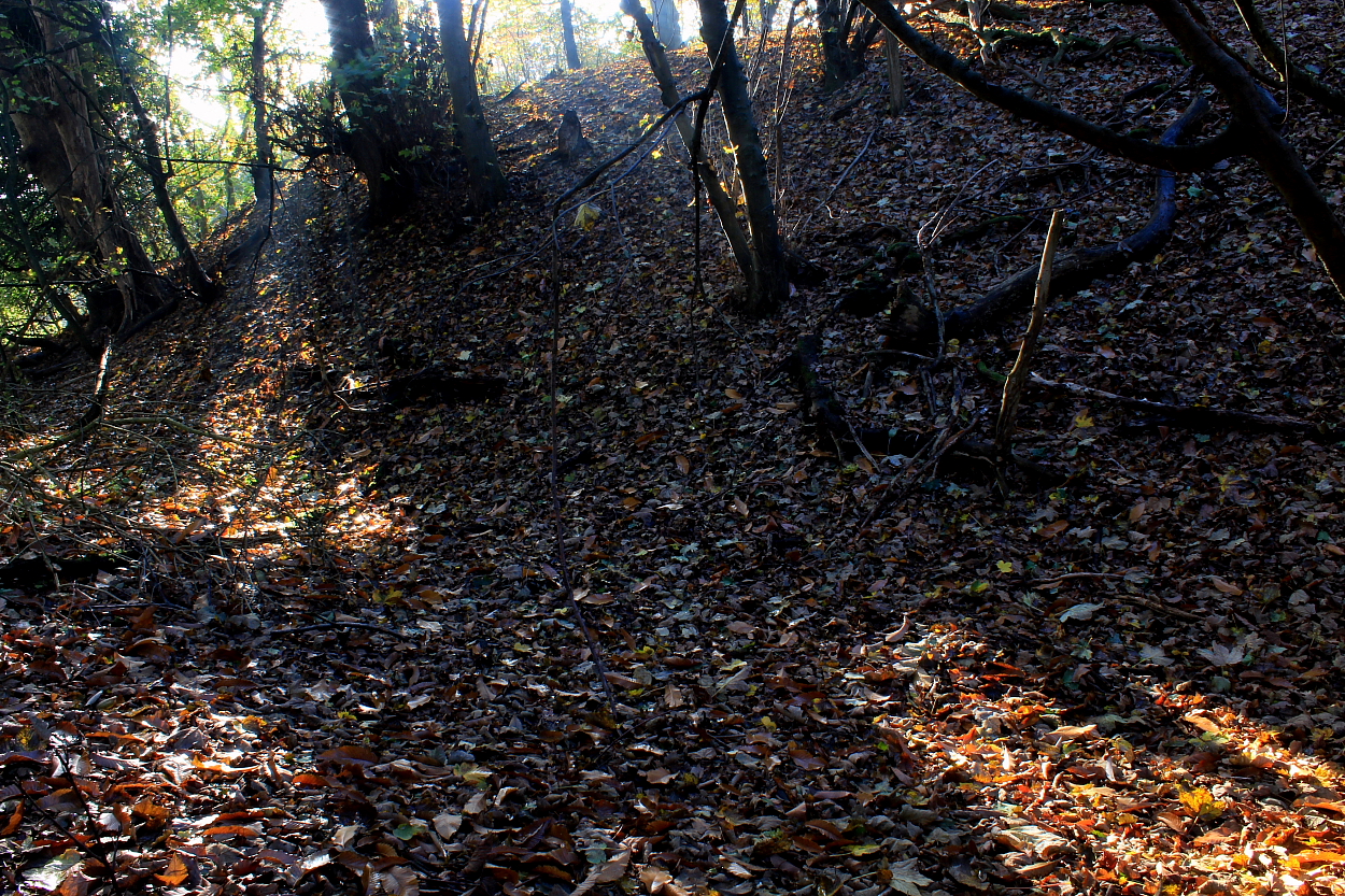


The very substantial cross bank. Sadly, this fine promontory fort is located within ‘private woodland’, the significance clearly wasted limited intellect. The usual story. However, a public footpath is located immediately to the east.


The massive cross bank .....
Sadly the landowner would appear not to believe Surrey’s heritage should be shared and celebrated. Whatever.
Located within ‘private woodland’ to the approx southeast of Godstone, near Leigh Place, this represents the substantial remains of an inland Iron Age promontory fort, the curving defensive cross bank still apparently in excess of 8ft high – to be honest, it looked taller.
Although there is no public access – arguably society should review the community obligations of any landowner in such a position? – a public footpath to the immediate east of the site does nonetheless allow a pretty good impression of what is clearly an impressive addition to Surrey’s prehistoric story. OK, the noisy A22 does run immediately below, but there you are. Combine a visit with a viewing of Godstone’s Bronze Age round barrows just over a mile distant and your time will surely be well spent.
The site is a scheduled ancient monument:
“The monument includes a promontory fort situated on a spur which projects to the west from a sandstone hill around 1.4km to the south east of Godstone. The promontory fort’s defences were constructed across the neck of the spur and survive as a NNE-SSW aligned, approximately 110m long, curving bank around 15m wide and 2.6m high, flanked to the east by an outer ditch up to 15m wide and 1.4m deep. The eastern edge of the ditch has been destroyed by the construction of the modern A22 Godstone bypass during the mid-1980s, and this area is therefore not included in the scheduling. Access to the interior of the fort was provided by a simple gap at the south western end of the ramparts. Contemporary buildings, storage pits and associated structures and features will have covered much of the steeply-sided spur top, and traces of these can be expected to survive in the form of below ground archaeological features. During World War II, the monument was used as an aircraft observation post, represented by a small trench dug into the southern sector of the monument.”
Refer: O’Connell, M, Poulton, R, ‘Surrey Archaeological Collections’ in An Excavation at Castle Hill, Godstone, , Vol. 74, (1983), 213-215


