The Modern Antiquarian
Log in
|
Register
Home
Latest Posts
Forums
Maps
Help
Browse Sites
News
Blog
Contributors
The Books
Select
-
Belgium
Denmark
Eire
France
Germany
Greece
Italy
The Netherlands
Norway
Portugal
Republic of Malta
Spain
Sweden
Switzerland
United Kingdom
Northern Ireland
County Fermanagh
Mullyknock or Topped Mountain
Standing Stone / Menhir
Mullyknock or Topped Mountain (Standing Stone / Menhir) on The Modern Antiquarian, the UK & Ireland's most popular megalithic community website. 4 images, 1 fieldnote, plus information on many more ancient sites nearby and across the UK & Ireland.
Image © ryaner
OS Ref (GB):
Latitude:
54° 21' 20.72" N
Longitude:
7° 31' 57.79" W
Added by
ryaner
Images (4)
Fieldnotes (1)
0 discussions
Start a topic
Show |
Hide
Web searches for Mullyknock or Topped Mountain
Flickr
Google
Google Images
Megalithomania
Bing
Stone Pages
Wikipedia
Show map
(inline Google Map)
- Sites within 20 km -
-
Cavancarragh (0.18km WSW) (3 posts)
Topped Mountain (0.94km ENE) (5 posts)
Coolbuck (1.48km SE) (0 posts)
Coolbuck (1.56km SE) (7 posts)
Coolbuck (1.58km SE) (4 posts)
Cloghtogle (1.82km ESE) (4 posts)
Mountdrum (2.01km SSE) (7 posts)
Mountdrum (2.24km SSE) (6 posts)
Ballyreagh (3.47km NNE) (6 posts)
Doon (3.89km ENE) (4 posts)
Cavantillycormick (4.52km NW) (9 posts)
Cloghcor (4.91km S) (0 posts)
Breagho (5.04km WNW) (0 posts)
Ballyreagh (5.17km N) (9 posts)
Gortaloughan (6.94km W) (2 posts)
Kilknock (11.14km NE) (6 posts)
Knockennis (11.79km NE) (7 posts)
Cornashee (12.23km SE) (7 posts)
Glengesh (12.46km NE) (5 posts)
Crocknafarbrague (12.48km NE) (2 posts)
Castlemervin (12.55km NNE) (1 post)
Killadeas (13.5km WNW) (8 posts)
Carryglass (13.79km NE) (4 posts)
Lisconrea (14.4km NE) (3 posts)
Screeby (16.58km ENE) (4 posts)
Carrickmacsparrow (17.2km WSW) (6 posts)
Reyfad (19.12km W) (14 posts)
Glenoo (19.16km E) (3 posts)
Glenoo (19.25km E) (3 posts)
Lislane (19.54km ENE) (5 posts)
- Add -
-
Add news
Add an image
Add fieldnotes
Add folklore
Add miscellaneous
Add a link
-
Add a site
Add a nearby facility
Add an alternative name/spelling
Images
(click to view fullsize)
Add an image
Fieldnotes
Add fieldnotes
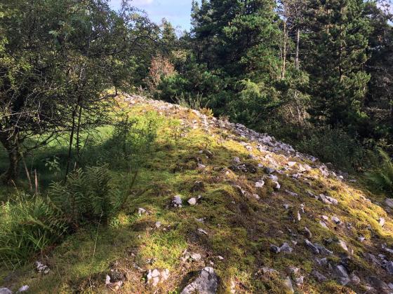
Unremarkable wedge-shaped standing stone, said to form an alignment onto Topped Mountain cairn with the stone in neighbouring townland of Cavancarragh 150 metres to the south-west.
Comments (0)
|
Add a comment
|
Permalink
Posted by
ryaner
21st July 2021ce