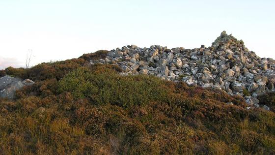
The cairn from the south east, the cairn material is to the south west.
Image credit: drew/A/B
The cairn from the south east, the cairn material is to the south west.

More kerbs on the east side.

The kerb mentioned in Canmore

West side.

The remains of a circular structure still exist.

Despite a fair battering, there is a decent footprint.

Kerbs in the north, famous friends to the south.

Scattered all over, the main part of the cairn is in the middle. Ben Auskaird to the east.
Canmore says that this site is well ruined, I can confirm that it is well ruined. It is also a complete nightnare to find.
I parked at Geisgeil farmstead and walked back south on the A894 looking for a place to get through the trees and bushes. Be careful clambering through here as I narrowly avoided jumping straight into bog. Once on the other side of the trees you’ll be confronted by a deer fence.
Basically I headed south west from the farmstead, climbing several small hills before I reached the site. Not much is left of the internal cairn, just a small pile of stones. The rest have long gone, however the kerb Canmore mentions is still there. I also believe several other kerbs also remain place.
Still, what makes it all worthwhile is the view Badcall Bay, Loch Obain, and the various mountains make it a stunning location for this prehistoric site.
What wasn’t stunning was my route back to the road. Looking due east I spied a gap in the trees. My route involved trudging across a decently dried bog, the south of a wee hill with many fallen rocks, jumping a stream to reach the deer fence. Climbing the deer fence I walked towards the road finding a piece of the bog that wasn’t so dry before heading north back to Geisgeil.
The site might not be much to look at, the scenery certainly is!
Visited 14/10/2020