
The fort from the northwest. The ground rises quite steeply up to the rampart from this direction.
Image credit: A. Brookes (27.6.2016)
The fort from the northwest. The ground rises quite steeply up to the rampart from this direction.

Stonework showing through in the construction of the rampart.

The northern flank of the fort, looking up the Helford River.

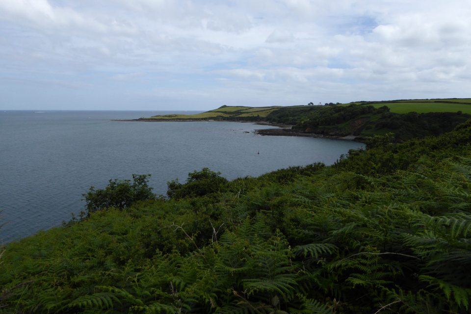
Looking from the fort across the mouth of the Helford River towards Falmouth and St Mawes, highlighting the potential strategic importance of the site.
Looking southeast to Nare Point, itself a military observation post.

The entrance through the rampart.

Seen from Flushing.

Little Dennis from Lestowder Cliff, across Gillan Creek. The fort commands views of two river mouths, Gillan Creek to the south and the major Helford River to the north.
The parish of St Antony in Kirrier occupies a mere neck of land, bounded on one side by the Helford River, and on the other by the Durra. The church, embosomed in trees, and almost close to the water’s edge, stands on the southern side of the narrowest part of the promontory, the extreme eastern point of which is cut off by an ancient earthwork, Castle Dinas, which was occupied during the Great Rebellion, and surrendered to Sir Thomas Fairfax in 1646. It was the last place in Cornwall held for the King, except St. Michael’s Mount and Pendennis Castle, and was defended by Sir Richard Vyvyan.
The situation of the church is very peculiar, and has a legend attached similar to that of Gunwalloe. It is said that soon after the Conquest, as some Normans of rank were crossing from Normandy into England, a tempest drove them on the Cornish coast where they were in momentary danger of destruction; but in their distress they called on St Antony, and vowed if he would save them from shipwreck they would build a church in his honour on the spot where they should first land. The ship was wafted into the Durra creek, and there the pious Normans as soon as possible fulfilled their vow.
From J T Blight’s Churches of West Cornwall (1885).


