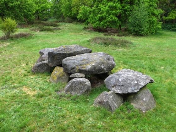
This is how the site of the former Hunebed D33 looks today: a field of neglected pasture livened by dandelions in bloom. Hunebed D34 is situated on the edge of the woodland, 150 metres ahead.
Image credit: Les Hamilton
This is how the site of the former Hunebed D33 looks today: a field of neglected pasture livened by dandelions in bloom. Hunebed D34 is situated on the edge of the woodland, 150 metres ahead.

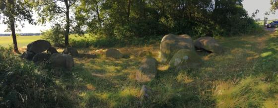
The remains of the now destroyed Hunebed D33 Valtherveld, photographed by A E van Giffen in 1918.
Destroyed Hunebed
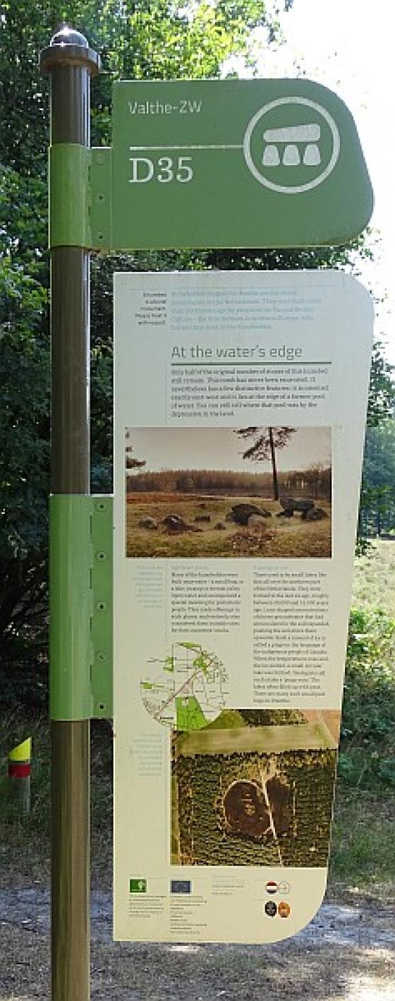
Hunebed D33 (formerly a member of a hunebed pair with D34) stood, as little more than a dilapidated cairn, some 150 metres to the north of its near neighbour, D34 Valthe, until the 1950s. But nothing of it remains today.
When Hunebed D33 Valtherveld was surveyed by A E van Giffen in 1918, it was already in a state of almost total disrepair, with only nine large boulders remaining on the site and barely recognisable as a hunebed. Later detailed excavation of the site in 1954 found that even the internal stone pavement had been completely destroyed.
It was around this time that moves were underway to restore some of the hunebedden, and Van Giffen, who was in charge of this project, realised that there was little at D33 that could meaningfully be improved upon. He determined that the stones could best be used in the restoration of other hunebedden, and they were removed for safe keeping in 1955.
On March 23, 1956, the large boulders were transported to the site of Hunebed D49 Schoonoord—popularly known as the Papeloze Kerk—and used in its reconstruction in 1958.