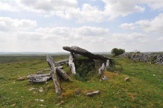
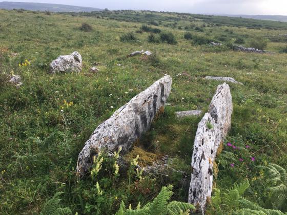
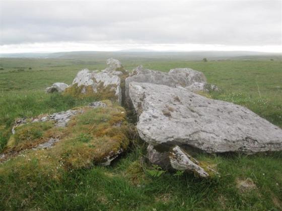
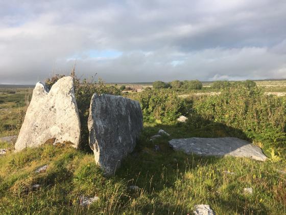
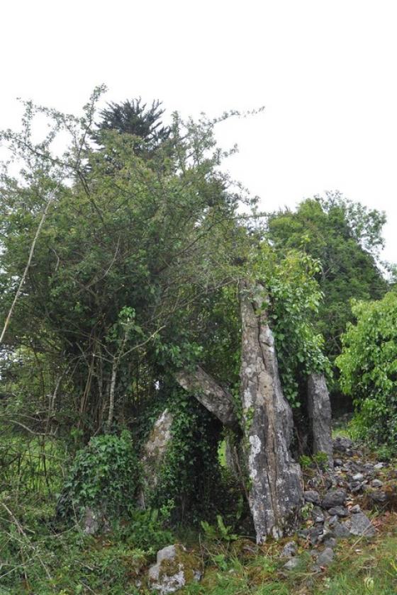
The Modern Antiquarian
Log in
|
Register
Home
Latest Posts
Forums
Maps
Help
Browse Sites
News
Blog
Contributors
The Books
Select
-
Belgium
Denmark
Eire
France
Germany
Greece
Italy
The Netherlands
Norway
Portugal
Republic of Malta
Spain
Sweden
Switzerland
United Kingdom
County Clare
The Burren
Cahermackirilla
Stone Row / Alignment
Cahermackirilla (Stone Row / Alignment) on The Modern Antiquarian, the UK & Ireland's most popular megalithic community website. 2 images, 1 fieldnote, plus information on many more ancient sites nearby and across the UK & Ireland.
Image © Charles Coughlan
OS Ref (IE):
Latitude:
53° 1' 11.06" N
Longitude:
9° 6' 46.19" W
Added by
bogman
Images (2)
Fieldnotes (1)
0 discussions
Start a topic
Show |
Hide
Web searches for Cahermackirilla
Flickr
Google
Google Images
Bing
Stone Pages
Wikipedia
Show map
(inline Google Map)
- Sites within 20 km -
-
Fanyglavin (0.02km E) (12 posts)
Carran (1.25km W) (3 posts)
Meggagh (1.73km NNE) (4 posts)
Moheramoylan (Cl. 30) (2.23km NW) (1 post)
Iskancullin (2.33km WSW) (1 post)
Poulawack II (2.42km WNW) (5 posts)
Poulawack (2.44km W) (13 posts)
Creevagh (2.45km E) (31 posts)
Poulawack Souterrain (2.48km WNW) (6 posts)
Ballyganner North III (2.52km WSW) (7 posts)
Caherconnell (2.92km WNW) (8 posts)
Cahercommaun (2.93km E) (22 posts)
Commons North (Cl. 56) (3.03km ESE) (4 posts)
Ballyganner South II (3.2km SW) (0 posts)
Ballyganner South (3.3km SW) (3 posts)
Commons North (Cl. 65) (3.34km SE) (0 posts)
Leana (Cl. 57) (3.37km SE) (3 posts)
Tullycommon (3.4km E) (4 posts)
Leana (Cl. 68) (3.46km SE) (16 posts)
Eanty More (3.46km NNE) (4 posts)
Ballyganner North II (3.48km WSW) (6 posts)
Clooneen (3.54km SW) (6 posts)
Leana (3.59km SE) (7 posts)
Parknabinnia (Cl. 66) (3.59km SE) (11 posts)
Leana (3.68km SE) (2 posts)
Castletown (3.69km ENE) (4 posts)
Tullycommon (Cl. 54) (3.7km ENE) (0 posts)
Poulnabrone (3.74km NW) (66 posts)
Ballyganner North (3.74km WSW) (6 posts)
Parknabinnia (Cl. 153) (3.76km SE) (7 posts)
Parknabinnia (Cl. 59) (3.76km SSE) (0 posts)
Parknabinnia (Cl. 67) (3.81km SE) (27 posts)
Parknabinnia (Cl. 60) (3.85km SSE) (0 posts)
Parknabinnia (Cl. 61) (3.86km SSE) (4 posts)
Parknabinnia (Cl. 62) (3.96km SSE) (0 posts)
Parknabinnia (3.97km SSE) (3 posts)
Parknabinnia (Cl. 69) (4km SSE) (3 posts)
Ballymihil (4.07km NNW) (7 posts)
Slievenaglasha (4.17km E) (4 posts)
Ballyganner South (4.3km SW) (6 posts)
Baur South (4.44km WNW) (3 posts)
Baur North (4.52km WNW) (0 posts)
Baur South (4.52km WNW) (10 posts)
Baur South (4.53km WNW) (0 posts)
Baur South (Cl. 26) (4.67km WNW) (6 posts)
Poulaphuca (4.68km N) (7 posts)
Lissylisheen (4.69km W) (2 posts)
Ballycasheen (4.77km S) (2 posts)
Rannagh West (5km NNE) (2 posts)
Cappaghkennedy (5.39km ENE) (1 post)
Gleninsheen (5.66km NW) (10 posts)
Ballykinvarga (5.71km WSW) (0 posts)
Boloona (5.84km N) (4 posts)
Gleninsheen (6.16km NW) (20 posts)
Berneens (6.23km NW) (8 posts)
Cahermacnaghten (6.39km W) (5 posts)
Coolnatullagh (7.71km NE) (3 posts)
Coolnatullagh (7.85km NE) (2 posts)
Ballyallaban (7.88km NW) (2 posts)
Coolnatullagh (8.14km NE) (2 posts)
Coolnatullagh (8.15km NE) (3 posts)
An RĂ¡th (8.28km NW) (6 posts)
Cahermore (8.82km NW) (3 posts)
Faunarooska (Cl. 5) (10.09km WNW) (4 posts)
Faunarooska (Cl. 4) (10.24km WNW) (2 posts)
Faunarooska (Cl. 3) (10.31km WNW) (2 posts)
Lissateeaun (10.57km W) (1 post)
Turlough Hill/Knockycallanan (10.85km NNE) (7 posts)
Slievecarran (10.93km NE) (0 posts)
Turlough Hill/Knockycallanan (10.98km NNE) (11 posts)
Derrynavahagh (11.09km WNW) (12 posts)
Ballytarsna (11.23km WSW) (2 posts)
Ballyelly (13.36km WNW) (6 posts)
Ballyelly Hut Site (13.36km WNW) (4 posts)
Moyree Commons (13.56km ESE) (10 posts)
Curraghadoo (13.73km WSW) (4 posts)
Gleninagh North (14.54km NW) (5 posts)
Killian (15.84km ESE) (2 posts)
Aughinish (16.29km N) (7 posts)
Caherphuca (16.84km E) (8 posts)
Caherdooneerish (17.12km WNW) (4 posts)
Doorus (17.48km NE) (4 posts)
Knockstoolery (17.56km WSW) (2 posts)
Teergonean (18.46km W) (11 posts)
Ballynastaig (18.5km ENE) (0 posts)
Teergonean (18.51km W) (5 posts)
Ballynastaig (18.55km ENE) (0 posts)
Doolin (18.65km WSW) (1 post)
Doolin (18.69km WSW) (3 posts)
Doolin (18.7km WSW) (2 posts)
Doonmeave (18.74km WSW) (1 post)
Doolin Stone Axe Production Site (18.87km WSW) (2 posts)
Crannagh (19.21km ENE) (0 posts)
Crannagh (19.21km ENE) (10 posts)
Ballynastaig Souterrain (19.84km ENE) (0 posts)
Ballynastaig (19.84km ENE) (10 posts)
- Add -
-
Add news
Add an image
Add fieldnotes
Add folklore
Add miscellaneous
Add a link
-
Add a site
Add a nearby facility
Add an alternative name/spelling
Images
(click to view fullsize)
Add an image
Fieldnotes
Add fieldnotes
Located over a wall just behind Fanyglavin wedge tomb
Comments (0)
|
Add a comment
|
Permalink
Posted by
bogman
30th April 2011ce