Skip to content
Julian Cope
presents
The Modern
Antiquarian
Latest
Posts
Sites
Map
Blog
Forum
search
Search
⚠️
Sign in
more_horiz
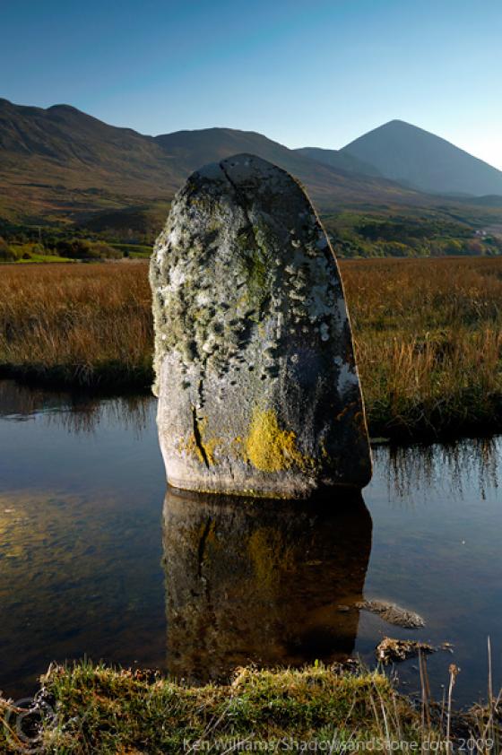
Eire
County Mayo
Moher Lough
Crannog
L976765
expand_more
Nearest town:
Westport (8km N)
OS reference:
L976765
OS sheet:
38
Latitude:
53° 43' 41.05 N
Longitude:
9° 33' 6 W
Added to TMA by
ryaner
Images (1)
Add
content
Images
22/8/10
Image credit: ryaner
ryaner
Aug 26, 2010
Sites within 20km of
Moher Lough
Boheh
Cup and Ring Marks / Rock Art
•
2km NNW
photo
17
forum
2
description
2
link
2
Oughavale
Bullaun Stone
•
6km NNW
photo
2
Killadangan
Stone Row / Alignment
•
6.78km NW
photo
33
description
1
Murrisk II
Standing Stone / Menhir
•
8.32km WNW
photo
5
Murrisk
Standing Stones
•
8.46km WNW
photo
9
Derryheeagh
Standing Stone / Menhir
•
16.57km WSW
photo
2
Srahwee
Wedge Tomb
•
18.33km WSW
photo
13
forum
2
description
1
Like all websites everywhere,
we use
cookies
.
OK
search
I’m looking for…
location_on
photo
ondemand_video
forum
description
link