From the fort looking towards Portknockie.
Image credit: drew/amj
From the fort looking towards Portknockie.

Northern tip western side.

Natural defences on the western side.

Beneath the fort there is a cve.


Natural harbour to the east.

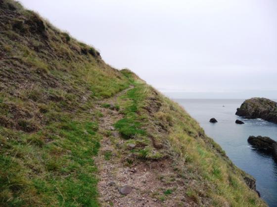
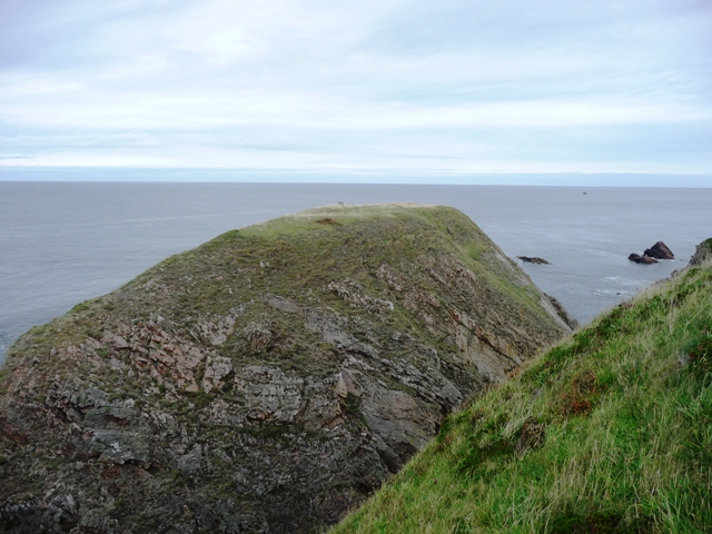
Tronach Point, another Iron Age fort beside Portknockie. Note the winding path, it can only reach the stack when the tide is out, unfortunately for me the tide was coming in.
From the Green Castle at Portknockie I walked the 11/2 miles westwards to Tronach Point along the well looked after coastal path. This is the same path that is a shambles further east at Cleaved Head, Macduff. I always find it strange that different reigons look after things in different ways, but that’s another matter!
Nothing much now remains of the Iron Age fort except that it’s defences where mostly natural sheer cliff face. Entrance from the coast depended on the tide being in or out, and even then landing would be some achievement considering the bay is full of dangerous rocks. Several dangerous paths track up and down steep grassy banks next to some severe drops. Not for the faint hearted.
Visited 21/9/09.
What the Canmore chaps and chapesses think.