Ye S.W entrance, and to me ye main entrance.
Image credit: Chris Bickerton
Ye S.W entrance, and to me ye main entrance.

The highest ditch, at the SE entrance

3 lines of defence

Ye S.E entrance

3 lines of defence

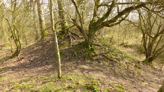
In ye overgrown ditch

In ye ditch

N.E entrance

3 lines of defence
Four years ago I went up Caer Caradoc not far to the west of here, and as I passed “The ditches” I thought, seeing as this one isnt very far from home add the site now and go see it soon.
Four years later we found a day with an opening, bunged the dogs in the car and headed for the other side of Shrewsbury. Inbetween the better known Wrekin and Caer Caradoc hillforts, is The ditches, a more unceromonious name admittedly, and hidden from everywhere amongst the mixed non and deciduous forest known as Mogg Forest.
But probably better preserved and better equipped than the other two
There is a footpath to it from the east in Brockton, but the easiest approach was up a farm track to the southeast, but we were approached by farmerboy in his tractor who felt we should know the footpath was the other side of the field, but he didnt mind us going to see the hillfort so on we pressed and down he reversed. The footpath actually passes straight through the middle of the fort, but there is no plaque, no information board, nothing to let the walker know they are passing through two thousand year old homes.
The main entrance is at the southeast corner and passes through two ditches, three banks, there are at least two more entry points, at the northwest and to the east (i’m probably wrong though) but theyre not as good as the main southeastern entrance, from which without trees we could see the nearby Wrekin.I couldnt tell if Caer Caradoc was in view from the other corner, because that is the route Mogg Forest follows.
The interior is far too overgrown to be able to discern any round houses or anything only the path through the fort is easily navigable.
Why this wonderful hillfort should be so completly buried in forest, lost and forgotten when it should be high on Ye Shropshire hillfort list is not known to this TMAer.