
Below the southeastern bank.
Image credit: A. Brookes (9.2.2019)
Below the southeastern bank.

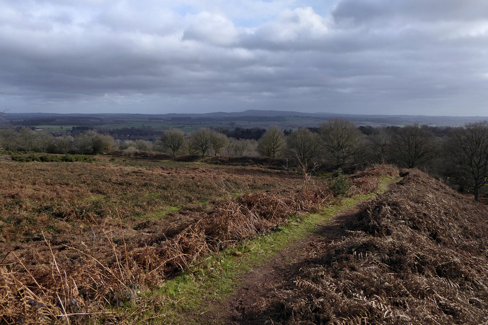
The southeastern rampart.

It’s a good time of the year to come, the sea of dead bracken covering the ramparts suggests a summer visit would be less rewarding.
Looking east across the interior of the fort. The backdrop is the Clent Hills. Wychbury Hill fort where I was a couple of hours earlier is just left of centre skyline.

Very impressive bank and ditch on the southwestern side of the fort.
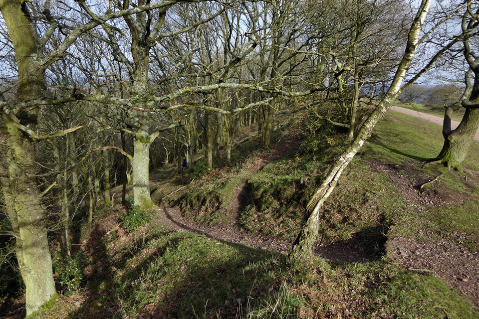
The steepness of the escarpment on the northwestern side of the fort renders ramparts unnecessary.

Looking northeast over Kinver village.

Looking west from the fort. The two hills rising on the skyline are Titterstone Clee and Brown Clee, both of which have hillforts.

Image Credit: Environment Agency copyright and/or database right 2015.
A little bit more on the boltstone:
In the midst of enclosures, and remote from public view, stands that curious vestige of antiquity, The Bolt, Baston, or Battle-stone, in the language of tradition, The Giant’s Thunderbolt; supposed to have been hurled from its native rock, the Edge, about a mile distant, by gigantic prowess..
..Dr. Plot* describes the pillar as “of a square figure, tapering a little towards the top, two yards and one inch high, and nearly four yards about,; having two clefts in the top, so that at a distance it appears like a triceps; its site in a leasow near to the Comptons.”
On personally surveying this relick, 1818, it appeared to be about five feet above the ground, a by-stander observed, that it was three times that depth in the ground, and that no effort had succeeded in attempting to loosen it.
p337 in Stourbridge and its vicinity, by William Scott (1832).
Three times. Let’s go for something believable, please.
The Rudston stone (and doubtless many others) has a similar subterranean rumour.
*From Plot’s 1686 ‘Natural History of Staffordshire’.
Kinver Camp is an Iron Age hillfort in a naturally defended spot – its univallate bank and ditch were only necessary on two sides because of the steep slopes elsewhere. Apparently (according to the EH record on Magic) univallate forts are unusual in this part of the country – they are mostly found in Wessex and other parts of southern England.
The landscape around here seems full of folklore. The excellent Sabine Baring-Gould recorded it as part of his novel ‘Bladys of the Stewponey’ (1897).
Kinver village occupies a basin in the side of the great rocky ridge that runs for many miles through the country and ends abruptly at the edge, a bluff of sandstone crowned by earthworks, where, as tradition says, King Wulfhere of Mercia had his camp. So far is sure, that the church of Kinver is dedicated to his murdered sons, Wulfhad and Ruffinus. The place of their martyrdom was at Stone, in Staffordshire; but it is possible that their bodies were removed to Kinver.
Kinver takes its name from the Great Ridge, Cefn vawr[..]
This isolated rock of red sandstone, on and about which Scotch firs have rooted themselves by the name of Holy Austin Rock[..] Although the local tradition is silent relative to a saintly denizen of the rock, it is vocal relative to a tenancy of a different kind. Once it was occupied by a giant and his wife, who with their nails had scooped for themselves caves in the sandstone. The giantess was comely. So thought another giant who lived at Enville.
Now in this sandstone district water is scarce, and the giant of Austin Rock was wont daily to cross a shoulder of hill to a spring some two hundred and fifty yards south of the Rock to fetch the water required for his kitchen. The water oozed forth in a dribble, and the amount required was considerable, for a giant’s sup is a drunkard’s draught. Consequently he was some time absent. The Enville giant took advantage of this absence to visit his wife. One, two, three. He strode across country, popped his head in, kissed the lady, and retired before her husband returned with the pitchers.
But one day he tarried a moment too long, and the Austin giant saw him. Filled with jealous rage, he set down the pitchers, rushed to the summit of the rock, and hurled a large block at the retreating neighbour. The stone missed its aim; it fell and planted itself upright, and for many generations bore the name of the Bolt Stone. In 1848 the farmer in whose field it stood blew it to pieces with gunpowder.
You can read it at the Online Books pages:
onlinebooks.library.upenn.edu/webbin/book/lookupid?key=olbp11522
The latter stone is mentioned in Britton et al’s “Beauties of England” (1801 -v13 pt2), which describes it. And I wonder, is it a bolt to do with lightning or arrows or what?
Just below the camp appears a tumulus or barrow, surrounded by a narrow ditch.. near it is also a large stone of a square figure, and tapering towards the top, about two yards in heigh, and four in circumference, having two notches on the summit. This stone is called Baston of Boltstone.
And in case you were wondering – (courtesy of SB-G again):
“[On the shoulder of the hill is] a strip of deep red in the sandstone, the colour of clotted blood. Here, according to tradition, a woman was murdered by the Danes, who had ascended the Stour and ravaged Shropshire. From the day of the crime the rock has been dyed blood-red.”
There are caves cut in the soft sandstone of the Edge, but I can’t find any mention that these date back to prehistory.

