Skip to content
Julian Cope
presents
The Modern
Antiquarian
Latest
Posts
Sites
Map
Blog
Forum
search
Search
⚠️
Sign in
more_horiz
Eire
County Offaly
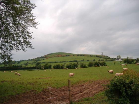
Croghan Demesne
Standing Stone / Menhir
N492325
expand_more
Nearest town:
Tullamore (17km WSW)
OS reference:
N492325
OS sheet:
48
Latitude:
53° 20' 25.66 N
Longitude:
7° 15' 40.58 W
Added to TMA by
FourWinds
Images (1)
Add
content
Images
Image credit: Bawn79
bawn79
May 26, 2006
Sites within 20km of
Croghan Demesne
Croghan Hill
Artificial Mound
•
1.2km W
photo
3
description
1
Croghan Hill
Sacred Hill
•
1.2km W
photo
2
description
1
Croghan Hill
Artificial Mound
•
1.25km W
St. Patrick’s Well
Sacred Well
•
1.34km WNW
photo
1
description
2
Oldcroghan
Round Barrow(s)
•
1.9km W
Clonin Hill
Round Barrow(s)
•
3.5km ENE
photo
3
description
1
Grovesend or Mooneysland
Standing Stone / Menhir
•
6.33km ENE
photo
2
description
1
Montrath
Round Barrow(s)
•
8.52km W
Derrygrogan Big
Bullaun Stone
•
9.23km WSW
Rathdrum
Bullaun Stone
•
9.32km WSW
photo
2
description
1
Cappanrush
Standing Stone / Menhir
•
9.42km W
Gibbonstown
Rath
•
12.07km NW
Calverstown
Standing Stone / Menhir
•
12.25km WNW
Pass of Kilbride
Round Barrow(s)
•
12.28km NNE
photo
4
description
1
Beggstown
Standing Stone / Menhir
•
12.69km NW
Dunboden Park
Round Barrow(s)
•
13.13km NW
Garryduff Barrow
Round Barrow(s)
•
13.46km W
Clonaglin
Round Barrow(s)
•
14.22km W
Clonkeen
Standing Stone / Menhir
•
14.43km ESE
photo
3
description
2
Cloncanon
Standing Stone / Menhir
•
14.63km E
Meelaghans
Bullaun Stone
•
15.25km SW
Kileenmore
Bullaun Stone
•
15.26km SW
photo
6
description
2
link
1
Corbally
Standing Stone / Menhir
•
15.94km NNW
Tullanisky
Round Barrow(s)
•
17.21km NW
Lilliput
Standing Stone / Menhir
•
17.8km WNW
School Boy
Crannog
•
18.45km NW
Loughaun
Artificial Mound
•
19.1km WSW
Carbury Hill
Round Barrow(s)
•
19.36km ENE
photo
22
description
5
search
I’m looking for…
location_on
photo
ondemand_video
forum
description
link