‘Four Burrows’ Barrow cemetery – 30th September 2003 – barrows 3 & 4 – looking north from the hedge at the side of the lane
Image credit: Martin Bull
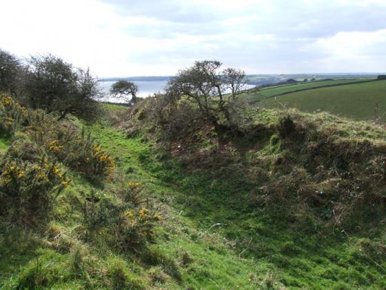
‘Four Burrows’ Barrow cemetery – 30th September 2003 – barrows 3 & 4 – looking north from the hedge at the side of the lane

‘Four Burrows’ Barrow cemetery – 30th September 2003 – barrows 3 & 4 – looking east towards the wind farm
‘Drive-By’ 17.4.12
We were heading back to the caravan park so didn’t have time to stop.
I asked Karen to drive as slow as possible along the very busy A30 and was able to spot two of the Barrows. Both were covered in gorse.
The O/S map has the site marked as Four Burrows.
‘Four Burrows’ Barrow cemetery – 30th September 2003
Located on either side of the A30, on the highest land in the area, these enormous barrows are impossible NOT to spot between the A30/A390/A3075 roundabout (locally called the ‘Chiverton’ Roundabout) and the junction of the A30 and B3284! You can either park in a small layby right next to the dead-end lane to ‘Fourburrow’ (not signposted), or just off the dead end lane itself.
As barrows 1 and 2 are located in the corner of fields it looks as though they are pretty much left to grow wild, whereas barrows 3 & 4 are more part of the cropped field and when I visited they were pretty neatly kept, and being famed up to the edge, making them stand out in the field (as if there size didn’t make them stand out anyway!)
Fowre Burrows, fowre litle hills raysed upon the vaste Downes nere the north sea; they stande together, and are the burialls of slayne men in the feylde. In those partes are manie like borrowes, as in manie partes ells of Englande, upon the spatious playnes wher, in the Saxon and Danish Broyles, battells have bene fowghte.
From John Norden’s “Speculi Britanniæ pars: a topographical and historical description of Cornwall”, written in the beginning of the 17th century. (I have transcribed this from the scan on Google Books.)
Mentioned by Craig Weatherhill, in “Cornovia: Ancient Sites of Cornwall & Scilly” (Cornwall Books – 1985, revised 1997 & 2000). “Like the Carland barrows these are sited beside the route of the main prehistoric trackway through Cornwall, which is closely followed by the A30. The prominent barrows lie in an arc on the highest ground in the neighbourhood. One, 3.0m high, is on the north of the road; the others, from 2.4m to 3.7m high, are on the south side. It is not known which of the mounds was ‘Burrow Belles’ which was opened during the reign of William III and found to contain a large burial chamber roofed by two capstones”.
Note – there is a typo in the grid ref in Cornovia – it should be the grid ref as given on this site (i.e. SW762483) or alternatively SW762482.