From the rear.......
Image credit: Robert Gladstone
From the rear.......


Looking ‘down’ the long cairn...

Facade..... or what’s left of it.

The Whangie, at the western end of Auchineden Hill, can be seen skyline. A relationship between natural rock and man made monument would appear likely?

The remains of the facade.....

Approx position looking from the rock formations of The Whangie.... mind you, this was on the way back... after the mist had lifted. Loch Lomond is upon the horizon.

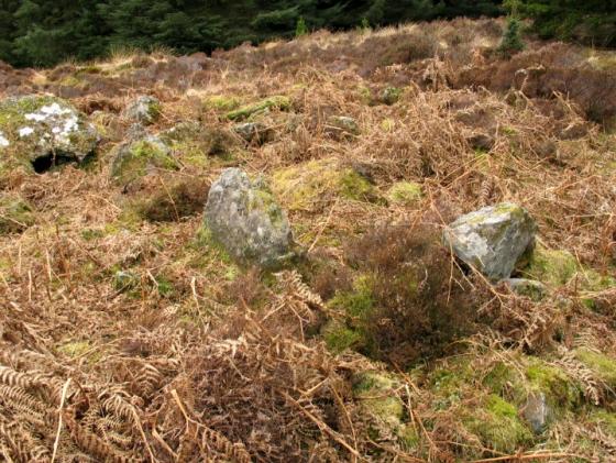
This is the view as you approach the cairn from The Whangie. The forestry behind it is quite a distance away.
It is a Clyde cairn facing E. Its most visible feature are the two portal stones of the axial chamber. No evidence of any other chambers has been found.
The E end is 11.5m wide. There is no sign of any facade stones although the cairn material suggests a shallow forecourt.

Looking N.
The cairn is 18m long.
In the distance is Loch Lomond and its surrounding hills.

Looking E from the rear of the cairn.
In the distance are the Kilpatrick Hills with the Whangie at the highest point on the ridge.

The two portal stones. The upright one is 1.3m high.
There is some evidence of a chamber behind these stones but it is now hidden by vegetation.

Another view of the portal stones.
Companion site to nearby Lang Cairn, albeit much smaller and not so well preserved, this is arguably even more remote and relatively difficult to reach. Both time and inclination resulted in me foregoing an approach from Lang Cairn yesterday, heavy, low cloud almost resulting in me deciding not to go for it today, upon awaking beside an ethereal Loch Lomond. Almost.......
Following Greywether’s advice, I arrive at The Queen’s View car park on the A809 and, after shaking my head at the so called ‘Queen’s View’ itself (is that it?), look in trepidation at the swathes of mist sweeping across Stockie Muir and wonder if I’m simply truly committed, or ready to be committed, if you know what I mean? So low is the cloud that I stick to the low-level path across the northern shoulder of Auchineden Hill, against all Gladman instincts, and head for The Whangie. OK, to southern ears it’s not the best of names, but there’s nothing second rate at all about these soaring, rocky pinnacles, reminiscent of Skye itself, mist swirling around and – to be honest – putting further doubts in the mind.
However the forest line is where it should be, so I follow it steeply downwards to the left of a prominent (glacial?) hill, to eventally meet an intersecting wire fence line barring progress. This is of the ‘barbed’ variety, but passable [note there are the rusting remnants of a parallel fence]. Once across, look for a small stream-bearing gulley, with a (sort of) green path to its right. Follow this, the gulley becoming more and more substantial, until a green bridge, metal water pipe markers and a small brick structure on the opposite bank announce you are almost there. The long cairn lies a little further on to the right, not far from the forestry line.
Overgrown and sporting a typically spunky little tree, two facade orthostats, one significantly leaning, form the major structural highlight of the cairn. It is more than enough... the cairn is pretty substantial and, so it would appear, more or less aligned upon The Whangie? If so, the latter is perhaps not so surprising, bearing in mind my recent experiences there. A protruding orthostat maybe hints at a former lateral chamber to the north, then again maybe not. To be honest that is that in terms of visual experience. But, hey, we’ve other senses too, right? And it’s the stimulation of these where Stockie Muir long cairn excels. Superb vibe.
The mist lifts, allowing a ‘high level’ return along the summit ridge of Auchineden Hill, with the tenament blocks of Glasgow to my right, Loch and Ben Lomond to my left. This is not your usual place, it has to be said.
The thought of a Chambered Cairn may not excite you compared with some of the other places mentioned on this web site but the StockieMuir Chambered Cairn was worth the walk. It sits high up on the side of a Glen that rolls down for miles in a gentle slope to the banks of Loch Lomond. A better view can be had from the unusual rock formation that sits higher up the hill from us called the ‘Whangie’ but by the time we’d battled across the boggy ground to get here our new view seemed more worthwhile. The rocks that form this Cairn undoubtably came from the Whangie but here there is a river nearby and is obviously a good place for settlement. We did debate whether people settled near their dead but wherever it was they didn’t want to travel to far to bury them hence this Cairn. The Chambers have collapsed to form distinct indentations along its length but for all that its is ‘ruined’ it still impressed the hell out of me. How could I have lived in this area all my life and walked the nearby Queens view many times and never known this was here? Its a lot larger than the pictures seem to suggest. Take your directions from Greyweathers postings and don’t do what we did which was to walk ‘as the crow flies’ straight at it. The going is heavy and the heather hides a few nasty surprises such as boggy holes in which to sink your legs knee deep.
This is a return visit to this cairn and I’m pleased to say it has not altered much in the interim.
It’s somewhat remote and probably gets few visitors which adds to its attraction. To add to the pleasure, although the weather over had been rather wild, once here the wind dropped and the sky turned blue. Perfect.
There are great views from here. To the N is Loch Lomond and Ben Lomond. To the E are the Kilpatricks. The line of the cairn points to the end of the Campsies but due to its low-lying position, they are out of sight.
There’s not a lot to see at the site. No chambers are visible but you can see the two portal stones of the axial chamber.
For more detail, see the photo captions.
You could get here from the nearby Lang Cairn but a more scenic way in is via The Whangie (an interesting rock formation) which can be reached by a path from the Queen’s View car park on the A809.
The ground is rough going and, rather than go in a straight line from the Whangie, go down to the forest to the W and follow the narrow path by the fence until it starts to run W. When you come to the junction with another fence, there is a wider path running NW to the site.
Visited 17 March 2004