Intermediate range view of Catto from the northeast, illustrating the central range of the barrow.

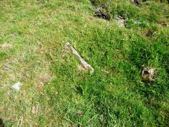
Closeup of one of the large cists within the Catto Cairn. The depth from the cairn top to the pit bottom is approximately 1.5 metres. The camera position is approximately three metres above the pit bottom.

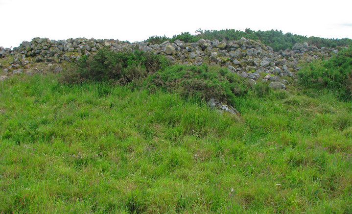
Standing atop the Catto long barrow with its gorse fringe and cows grazing in the background.

This view is from atop the cairn itself looking across one of the more pronounced stone pits. The lichens and mosses covering the stones form a colourful mosaic. The view is looking toward the west.

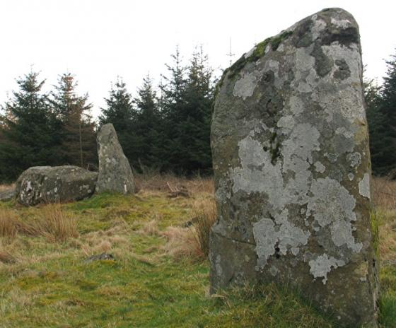
Large outlying stone near Catto Cairn with the monument itself in the background, looking west southwest.

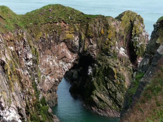
Looking south over the southeast rim of Cairn Catto.

Looking southwest at Cairn Catto across a grain field.
Pretty hard to beat Mr Hogans (to serious for me and at school I was told the battle was at nearby Cruden Bay) comments. The farmer has signposted the cairn-good, put a path to and all round the cairn -good and left it open at one end so that cows could get in and chase me back to the car-not so good. Otherwise everything that Mr Hogan describes is there except the mess on my boots!
Visited 31/06/09.
Catto Long Barrow is an extensive prehistoric stone structure with remnants of seven stone tombs. The site has yielded archaeological recovery of stone axes and its vicinity is replete with tumuli, hoards of worked flint and ancient battleground remains. Situated on locally high open ground, the site offers expansive views in all directions. The site has been suggested in the literature as a likely location of a major battle with invading Danes.
GEOMETRY. I measured the length of this ancient monument at 49 metres, one metre longer than published on the Aberdeen Council website. (Aberdeenshire, 2006) The stones are of considerable size ranging to characteristic length of greater than two metres, but more commonly having typical dimensions closer to 40 centimetres. There are seven sizable pit depressions within the stonework, others having suggested the pits are results of modern disturbance; however, based upon the considerable build-up of mosses on the surface of pit rocks, if the pits are of modern formation, I would judge the disturbance to be at least a century into the past. Ferguson (1875) witnessed the opening of some of the series of cists or stone tombs within the Catto Cairn. Subsequently archaeological publications (Society, 1904) noted that the Catto monument would have been of much greater original height, and states clearly that the pits are remnants of cist structures. The earliest literature reference I found of Catto Cairn is in Sinclair’s 1795 account indicating an elliptically shaped monument of circumference 120 metres. (Sinclair, 1795)
Aside from the pits noted above and the necessarily uneven texture necessitated by the stone sizes themselves, the top of the cairn is a remarkably large expanse of relatively level surface, contrasted with the more conical or mounded shapes of many other large cairns of this region. The orientation of the cairn axis is approximately west northwest to east southeast, very similar to the Longman Hill orientation (Hogan, 2008) somewhat farther to the northwest from Catto.
AREA ARCHAEOLOGY. There are numerous archaeological sites in the local area of the southern extremity of the historic parish of Longside, especially on the eastern side of Laeca Burn. Among the notable local sites are Silver Cairn and .Dun-na-chaich, a large oblong mound. Somewhat to the west are the Skelmuir Hill standing stones. The vicinity has been documented as historically rich in surface finds including sizeable nodules rich in flint tools.
Immediately to the east of Catto there were hundreds of mounds which survived to the mid 1800s; the diameters of these structures varied from about three to six and one half metres. Furthermore, there were over 17 of these to the southwest that were exceptionally well defined circular features.with very flat tops; each of these finely crafted mounds were approximately 2.5 metres in diameter.
BATTLEFIELD. This region is portrayed by several early writers as a site of significant battles with invading Danes. (Smith, 1875) Sinclair (1875) also notes that the immediate local area of Catto is rich with archaeological features including many tumuli with square inner chambers. !8th century legends link the Catto site with history of the Moray Firth and with some type of ancient foreign invasion. The military connection is underscored by the fact that the plain to the immediate west is called “Battle-fauld"on older maps..
J.B. Pratt is the first author I found who suggested Catto Cairn as a battlefield, noting that the cairn itself, by its high ground position, was a likely point for the point d’appui, where troops would have marshalled. To the west the steeply ravined Laeca Burn forms a natural impediment to attack, whereas an historic morass lies to the north. In the 19th century there were many more tumuli, Pictish house sites, graves and circular stone campfire sites throughout the vicinity of Catto; however, aggressive local farming has destroyed most of these features in the last two centuries.
NATURAL FEATURES. The surrounding grain fields suggest that this locale would have been an agriculturally attractive area to Neolithic farmers. In addition to the nearby Leuca Burn, there is recorded 18th century evidence of prolific springs (historically termed “Kemp-Wells” or “Morris Wells”), whose prominence has subsequently been masked by agricultural drains installed as early as the late 18th century; however, as late as the last quarter of the 19th century, the Morris Wells supply potable water to Peterhead. The name “Leuca” undoubtably derives from the granite boulder exceeding 60 tons, which lies in the Leuca Burn streambed west of Catto .Based upon the large tree trunks found in the Leuca ravine, it is likely that most of the early Holocene landscape (even indeed the Medieval landscape!) would have featured a majority of the land forested with large deciduous trees along with Scots Pine. Presently dense gorse patches envelope much of Catto’s perimeter, a common circumstance since gorse is a plant that thrives on stony soils, typical at the verge of ruined ancient stone monuments in Scotland.
North of Catto lay another dense historic forest, but due to deforestation by aggressive farming practises, by the 19th century the land was transformed to a barren wasteland known as the Moss of Savoch of Longside; this outcome provides an example of the failed attempt to cultivate an area not best suited for crops. This northern area yielded large numbers of spearheads and arrow points as reminders of the earlier great battle fought here.
To the southwest is the drainage of Leuca Burn with the Hill of Aldie beyond, where further prehistoric native forestation would have been found, now replaced by a monoculture coniferous plantation, virtually devoid of native understory or wildlife.
REFERENCES
* Aberdeenshire Council (2006) “Catto Long Barrow”
* William Ferguson (1881) ‘’The Great North of Scotland Railway: A Guide’’, Published by D. Douglas, 1881, 174 pages
* Society of Antiquaries of Scotland (1904) ‘’Proceedings of the Society of Antiquaries of Scotland’’, pp 256-262, published by Neill and Company, Edinburgh, Scotland
* C. Michael Hogan (2007) ‘’Longman Hill fieldnotes’’, The Modern Antiquarian
* Alexander Smith (1875) ‘’A new history of Aberdeenshire’’, published by Lewis Smith
* Sir John Sinclair and William Creech (1795) ‘’The Statistical Account of Scotland: Drawn Up from the Communications of the Ministers of the Different Parishes. By
Published by William Creech
* William Ferguson (1881) ‘’The Great North of Scotland Railway: A Guide’’, Published by D. Douglas, 1881, 174 pages
* Society of Antiquaries of Scotland (1904) ‘’Proceedings of the Society of Antiquaries of Scotland’’, pp 256-262, published by Neill and Company, Edinburgh, Scotland
Photo and some geometric parameters for the Catto monument.