
THEM’S THE BRECKS MARCH 10th & 16th 2010
The new digital camera zooms out to a 26mm equivalent so I set out to try and ‘capture’ the Wasbister Disc Barrow whilst it was still early enough in the year to use a low sun at a reasonable time of day. A short time ago the site was covered in a blanket of snow that brought out the curves wonderfully, enhanced enough to make an image [or so I hoped]. And then the old camera went kerplunk and [probably] it was too cold for the batteries to work, either of them. Unfortunately I finished work only in time for the half-ten bus. A slightly overcast day for the most part. Which allowed me to grab a smart shot of the lochward side of the Watch Stone. Wonder if there are better shots of Kokna-Cumming to take, especially now I don’t have to show a broch profile when it isn’t. If there was an avenue between the circles it would have had to go around this tomb, my betting would be the more sinuous side of the ness here, that on the west. More importantly where did this pass the the Great Wall and Lesser Wall of Brodgar ? The latter they excavated on the other side of the Lochview car track from the mound. Still seems strange to me that as yet no-one else has wondered what its relationship might be with the pair of Brodgar Farm standing stones there. At last I have pictures of these from the western side other than over the dig site. The southern one looks rather clunky in some views, made me think of all those squarish erect stones that even I normally reject as s.s. material. Are they truly co-eval. Perhaps they are simply posts for
an ‘Orkney gate’, simply much bigger than the ones elsewhere and not so well aligned. Or did the drive animals between them – might there have been a needfire hereabouts ? {On my next visit I did take other views of the mound. On the hill back of the excavation scar the field has no sign of the mound continuing, so either its a half-mound set well back into the hill or the site came first and then became buried under this artificial rise}.
My destination is a simple field to find – after the Ring of Brodgar go past the Dyke of Sean and its the first gate you come to. Now the difficult bit, because this is chained and once you climb over you also have to duck under the electric wire that goes diagonally from the roadside fence to that going across the hill. Looking up slightly right there’s the Bookan Tomb on the hill outline. I headed left for the Bookan Cairns, which are now believed to be the remains of a double Bronze Age house. Along the way I passed a bank running across the hill bottom, the western end perhaps marked by the curves of an old burn that shows [on an image] as a deeper green. There’s a few lengths where the composition is exposed as mostly earth with small stones and a few middling ones. Not totally unlike a more even topped Dyke of Sean against the hillside. Probably degraded natural, though the lower part of the east end terminates with tightly packed vertical stones on end. When I looked at my images later you could see a bright green patch above that end of the proposed bank, but I’m virtually certain it is nowt.
The Bookan Cairns run very roughly N/S and the two ‘cairns’ are connected by a stone-lined passage of modest length (no longer readily obvious). Its a rather unequal hourglass with the two halves presenting very differently. The northern half is more obviously circular with a concave top. Standing on this the impression is of a large depression occupying most of it with a few slabs set in a small grassy hump split in two. The southern half is more or less level on top and the slabs have an air of purpose. Some cut across the mound but it is uncertain whether these belong to this half and/or mark the division between the two. One slab aligns what looks like north-south and would appear to be matched by another in the northern half. Its possible another stone in between a few inches off this ?alignment. If a genuine axis it is even more off-centre [as the mound is left now of course]. A large piece of exposure on the western side of the northern half has a few small slabs but a lot of earth. In the area surrounding the obvious mound are visible some more stones, some flat in the surface and others buried erect. Unfortunately as I circled the mound weodorshins from the north the NiMH batteries went low then out as I went to take a few looking north, though the digital camera still worked a few times more. Darn fine I had another set charged up. Heck if I could find them where I put them though. Spent several minutes at several places, digging my hands into my bag and hoicking everything out. Must have been pisgies because after several more fruitless searches back home I found them eventually where I had put them, had ‘em wi’ me all along.
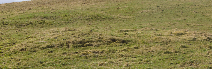
So had to content myself with using the SLR for the ‘disc barrow’. Going towards the bottom of the hill looking up I saw a bright green patch of grass in profile up the hill and dismissed it as natural. Shows even I can miss out on notes as this is on record or rather its neighbour as you will read further on]. Against the downhill side of the top end of the fence running up from the road NMRS record no. HY21SE 19 at HY28811397 is a small mound of earth and stones on the SE slope of the hill between the Ring of brodgar and Bookan farm. There was a stone setting around the base and its present dimensions of ~8mD by 0.6m high accords well with 27x1.5’ then, though I make the diameter of the Wasbister Cairn as varying between six point four and six point five metres. Once there I could see a few horizontal slabs dotted about its surface. Only a few yards away is a rough mound,very very ragged and disjointed but definitely of a piece. This is the green space I had seen on the skyline. It could have formed part of the course of a burn, however despite the fact that these two are not connected it is quite like the Bookan Cairns disparate pairing – from some views the ragged mound is so big that this and the cairn could even possibly be a single item subjected to different fates at E and W. But I only found a single flat stone on the whole of it’s surface. Though there are some loose stones around the base of the cairn of my measurements there are no signs that these have ever been embedded. On the other hand from the position of stones embedded in the cairn it does seem to be the remains of a circular structure. I know it is a lot to hang a theory on but there is one particular stone exposed on the top edge that looks for all the world to be the remains of walling and the face of it seems roughly curved.
After taking digital images of the Wasbister Disc Barrow six days later I walked east from the barrow to look for the Wasbister Burnt Mound, more in faint hope than any expectation. The way it’s described made me think it a vague report passed on. Either there wasn’t anything or it could be submerged. So I was delighted to find that as I came towards the large pool [I would term it a pow rather than a lochan or “small loch”] the site came into clear profile against the water. RCAHMS record no. HY21SE 20 at HY28961378 is a possible burnt mound 6mD by 0.3m high some 100 yards E of the ‘disc barrow’, though I myself was only certain of five metres of that and by using the lower land about the base I therefore came up with a height of point six metres. I saw a comparatively large piece of erosion at the highest point showing earth and a smallish stone and a small possible slab, both at one edge of this exposure. As to its being a burnt mound there are bodies of water either side of the Dyke of Sean and the one this side has a couple of very straight edges which made me think it artificial in contrast to the one the other side [where at some times there has been a small companion – since 1882 there have been between one and three pow/lochan of varying sizes]. But the maps make it very certain there are a whole rew of straight lines under and around these muckle pow. Not much like drainage. Perhaps there were once buildings, walls at the very least, either side of the dyke – as mentioned the water levels as elsewhere in Orkney show great fluctuations over time, and Caroline Wickham-Jones in a GMB Fellowship talk said that Wasbister is likely the next bit of land to disappear under the loch. My final act on the second visit was to make a beeline for the gate. In doing so I climbed over a rise of large area. It has no record and there are no distinguishing features. Nevertheless in passing over this plain grassy feature I had a feeling of settlement mound.
It had been my intent to visit those of The Brecks sites that stood by the quarry but a touch of diarrhœa put paid to that [these are as prominent from below as the Bookan Tomb, look to be an obvious triple grouping from the valley floor and have been split into two records with not enough reason to my mind]. Failing to hitch a lift, and there being no public toilets on the Ness of Brodgar [scandalous], I was fortunate to find Tormiston Mill still open at dinnertime (the ones by Stenness School are further I think). Despite my desperation still took more photos along the way. My super-duper camera easily made out the Standing Stones Hotel barrow [aka Little Barnhouse]. In one photo its profile made a good match for a hill in view behind it but you don’t know whether this was the same before the excavation [recorded by the local paper – there is apparently also an Irish society’s account somewhere, however that’s all Tommy wrote].
The 19thC mill is very well preserved, even better than the fractionally earlier Tankerness Mill – rather than running along the ground the dog-legged lade (stone-lined open topped water channel) is carried additionally on a high stone aqueduct, and there is an impressive dam upstream [though the bridge downstream is more functionally situated]. I walked along the other side of the burn and for the most part the lade was dry enough to walk in. It has a high-sided sluice at the uphill end.There has been a drystane wall set back either side of the burn (though starting where I began on the farmward side only) all the way up to the dam then continuing over the other side of the dam all the way up to the next farm road. This dam has had at least one set of alterations, likely from the mill being taken out of commission. It is almost entirely of drystone construction. The burn sides are further apart than the present small stream, being mostly on the southern side i.e. away from the road. The middle section above the present stream has very straight edges and the water passes through a channel composed of three small slabs. Behind this section is a dam-high stone sluice with two attached vertical timbers ?2” square in cross-section. This is set back from the other side of the dam – probably because this is hollow internally. I walked along the top of this dam and on the broadest section you step down for the space of a couple of yards. This is covered by roofing-type stone slabs (like rough thin paving slabs, used before the ones the size of large tiles and often seen in Orkney stacked vertically beside old buildings). At one end there has been a collapse and you can see inside the dam.

mound looking roughly E or NE with Wasbister Cairn behind


Wasbister Cairn looking S across small ‘lochs’ and monuments to Bigswell


Wasbister Cairn looking N with possible ‘ring’ surrounding it


S-N across Wasbister Cairn’s northern edge with possible wall-face stone R


Wasbister Cairn’s possible wall-face stone with tape out to 1‘

stones in W side of central portion of Wasbister Cairn with tape out to 1m

Wasbister Mound coming from ‘disc barrow’ with small lochan/pool behind


Wasbister Mound seen from the east with ‘disc barrow’ in background

the three Wadbister cairns, HY21SE 9 & 24, as seen from the valley floor
