Looking across The Migneint towards Arenig Fawr and Moel Llyfnant..
Image credit: Robert Gladstone
Looking across The Migneint towards Arenig Fawr and Moel Llyfnant..


Driven past more times than I can recall... and never sussed this was up here.
Y Garnedd means ‘The Cairn’ in Welsh... which is perhaps not that surprising since this c1,811ft peak, rising above Llyn Morwynion (Lake of The Maidens), is crowned by a massive Bronze Age monument of the ‘ring cairn’ variety.
Suffice to say, the mountain has ‘form’ since Llyn Morwynion, while not specifically namechecked, nevertheless appears to feature in The Mabinogion... since we learn Blodeuedd, upon hearing that the wizard Gwydion was hot in pursuit:
“...took her maidens with her and made for a court that was on the mountains, and over Cynfal river they made for a court that was on the mountain. But through fear they could not proceed save with their faces looking backwards. And then, never a thing knew they before they fell into the lake, and were all drowned save she alone..”
A visit to the ancient stone pile is recommended (a surfeit of quarry workings notwithstanding) since there are some fantastic views to be had from the summit. Hey, the archaeology’s pretty impressive, too, although I did wonder whether – having noted over the years how a number of Welsh summit cairns incorporate pre-existing crags within the structure – this was actually originally intended as a ring cairn? A crafty attempt to save effort, or symbolic incorporation of the living rock into the monument? Ermm. Let’s go with the latter, eh? Having said that, the professionals are pretty sure, Coflein reckoning:
A ring cairn located around the summit of Y Garnedd...It has a diameter of 12m, mainly consisting of turf-covered stonework 0.2 – 0.3m high, with a pronounced kerb in places. It is best preserved on the NE and NW sides, the S side partly formed from a natural outcrop. In the centre is a depression, but this appears to have been scooped out in modern times. There is an arc-shaped pile of stones on its E side, and slabs to the W which may be natural.....” [W B Horton, H & H, 10/01/2014].
Y Garnedd is most easily approached via a track above Llyn Dubach beside the B4407 from Ysbyty Ifan.
According to the “Mysterious Britain and Ireland” website Llyn Morwynion, overlooked by the fine ring cairn upon Y Garnedd:
“...is probably the lake where, according to the Mabinogion, Blodeuedd and her Maidens of Ardudwy drowned whilst fleeing from the wizard Gwydion and the men of Gwynedd.”
mysteriousbritain.co.uk/legends/llyn-morwynion-lake-of-the-maidens/
This place begs a couple of questions, the first of which is well rehearsed: Is it always important to remember that what we see at sites like Ballyrenan are the denuded, skeletal, interior remains of an earthen and stony mound? And does what remains at Ballyrenan cast doubt on that critical assumption in the first question? Because, like at Ballyvennaght in Antrim, there are two tombs here, separate but part of the same monument. At Ballyvennaght the entrance to the still standing western tomb is to the west, outwards from the cairn/mound – the collapsed eastern tomb is said to have a possible backstone at the west of the capstone so it must have opened to the east, again outwards from the cairn/mound.
At Ballyrenan, both chamber openings face east, meaning the western chamber would face into the mound/cairn. There is the possibility that there was come sort of central court in the intervening space between the front of the western tomb and the rear of the eastern. So was this a mongrel combination of a court and portal tomb? The fact that the western tomb has two chambers could lead you down that rabbit hole. But all of these musings are for later – today the sun is shining and this fantastic monument is right beside the country lane.
The large farm buildings to the west of the tomb do detract from the vibe a bit. The farmer’s there working away and gruffly gives us the go-ahead to park in the driveway. And then it’s just dive right in. It’s not massively spectacular in terms of size but this place has something else, something mysterious and deeply affecting. The thought taken to form the construction and the skill to complete it are impressive. And yet doubts remain – was the western tomb messed about with and re-constructed sometime after the supposed denudation of the cairn/mound? Because there’s a couple or three things amiss, or unique, or odd about the western tomb, aside from it facing into the mound, if there ever was one.
One: the skewed ‘lintel’ over the portal stones, propping up the capstone but also tilting it down to the north as it rests neatly on the southern, but precariously on the northern portal. Two: the stone that rests on the north-eastern sidestone of the eastern, front chamber that juts out by at least a metre and serves to counter the tilt caused by the portal ‘lintel’. The capstone of the rear chamber also rests on this stone. Three: The rear, sealed chamber itself. But sure what am I cribbing about? The easy, quiet backwoods atmosphere allowed us to engage with and immerse in the monument for as long as we wished. I couldn’t resist attacking the ivy that is beginning to colonise the northern portal of the western tomb, the physical action bringing the engagement to another level.
The ‘lesser’ eastern tomb has its own charms too. The stone that I thought to be a recessed, half-height doorstone, but actually a septal stone, is split longitudinally by a seam of quartz, discovered after another judicious bit of ivy clearing. The backstone is there, as are the two sidestones and both portals – all that’s missing is the capstone. The excavators discovered a small, cist-like second chamber at the back of the main chamber but we didn’t notice. If that was the case and it’s also double-chambered, then I would be leaning towards two separate monuments and two separate mounds. Either way it would have been an impressive, close to medium-sized dolmen when complete.
Ballyrenan is another must-see Tyrone site. I’d been in the vicinity a couple of times in the last few years and had neglected it for some reason, probably because of the multitude of other fantastic places in the county. Don’t make the same mistake!
I can’t remember the last time I visited North Wales outside of October, that wondrous Autumnal month when, with the barbecues finally extinguished and the tourists drifting away on the wind like the acrid smoke to warmer climes, the landscape exhales, unleashing a seemingly infinitesimally complex riot of reds, yellows and oranges to overwhelm the senses. Yeah, Nature’s last hurrah – if one didn’t know better, an outpouring of pent-up rage at her treatment by the ignorant masses? – before the battening-down of the hatches for winter. It’s therefore positively odd to see such otherwise familiar hillsides resplendent in a more-or-less uniform raiment of green. Not to mention the Easter hordes clogging up Snowdonia’s roads like fatty deposits within ageing arteries. However, following a couple of years of COVID – the resulting social upheaval further exasperated by the moronic activities of those sickening far left and far right plagues upon humanity – I figure opportunities to breathe deeply the benefits of freedom must be grasped with both hands. Albeit with a touch of arthritis in the fingers, perhaps?
Simply put, the traveller in search of more than ‘cheap thrills’ has to adapt. Rise with the dawn chorus and choose itineraries with care. Hence, upon scanning the map – admittedly rather wearily – I settle upon Pen y Castell as an ideal objective to soak up some more of that precious upland vibe in peace. Let’s face it, despite being one of Snowdonia’s most easily ascended 2,000ft summits, no thrill-seeking tourist is going to venture to the empty north-eastern sector of The Carneddau in a hurry. Wot, no zip wires? I set about negotiating the somewhat ‘minor’ roads above Tal-y-Bont to eventually arrive at Bwlch-y-Gaer, the magnificent hill fort Pen-y-Gaer looming to the east. Tempting as the easy option of reacquainting myself with the latter is, I maintain focus and set off along the green track heading west below the little pyramidical top of Pen-y-Gadair.
It’s a pleasant stomp, to be fair, the route initially delimited by tall, drystone walls prior to advancing across an open hillside, views of the looming high peaks of The Carneddau becoming progressively more intimate with every stride. In due course, beyond a plunging, traverse wall, a short yet steep pull finally sees me reach the craggy, ‘castellated’ summit, over 20 years since my last visit. In anticipation of the likely conditions at altitude, I’ve taken the precaution of wearing thermals; nevertheless, the severity of the wind is such that, rain or no rain, overtrousers are clearly an additional requirement today. As I struggle to put them on I lose my balance, feeling a sharp pain in my left hand as I steady myself against the summit rocks. Checking the damage, a stream of scarlet flowing from a gash in the webbing between my fingers is all too painfully obvious. Happy days. Jeez, clearly this ‘castle’ takes no prisoners.
A touch of improvised first aid later, I take stock and survey the scene from my none-too-welcoming perch. As expected, Pen y Castell is a truly wondrous viewpoint from which to take in the course of the sinuous Afon Conwy during the short journey from its rising upon the Migneint above Penmachno... to the sea beneath the drum towers of Edward’s superlative fortress-town, a tumultuous beginning morphing into confident, if serpentine procession. Closer to hand, the magnificently strategic siting of Pen y Gaer is all too apparent – hey, how often does an antiquarian-minded traveller get to enjoy an aerial view of a hill fort? – as is the sublime ‘place’ in the landscape occupied by Tal y Fan itself.
Looking the other way, however, the brutal uplands evoke quite different emotions, a juxtaposition of awe and perhaps a little nervousness when faced with such an uncompromising landscape, familiar summits viewed from unfamiliar angles: the witch’s slide; Pen Yr Helgi Du; a distant Moel Siabod; Craig Eigiau... and Carnedd Llewelyn, the sentinel peak itself. These are mountains I may perhaps never set foot upon again, yet such resignation is ultimately of little consequence if one accepts life is but a collection of memories; an individual the sum of what he/she has done. Ewan MacColl may have asserted that ‘No man has a right to own mountains’, but that does not invalidate the feeling I somehow possess a ‘connection’ to Y Carneddau. ‘Blood bonds’, courtesy of wind-rated incidents, notwithstanding. Yeah, it would appear the ‘high places’ have been messing with our minds since the beginning of time, enticing us to venture into the mist to learn more about ourselves.
Bracing against the wind, the far from steady gaze once again settles upon the most uniform skyline to the approx west: the high ridge of the Northern Carneddau rising from Carnedd y Delw to Carnedd Pen y Borth-Goch, Drum. The intervening landscape rising across Foel Lwyd to Drum appears ‘do-able’ but is of course greatly foreshortened. Very much aware of the effect of such ‘optical rose-tinted glasses’, the knowledge that the extension will demand everything I have precipitates a forlorn attempt to justify staying put. Needless to say, the siren call is too intense, the inner ‘Sergeant Wilson’ cautionary challenge noted for the record yet overridden.
In short order ‘Wilson’ appears right: substantial height loss followed by a steep ascent is perhaps my primary bummer when walking in the hills. However, an encounter with a pair of ubiquitous Carneddau ponies raises the spirits and renews my vigour. OK, lacking 4x hoof drive as I do, they soon leave me standing, but for a brief moment, I savour stumbling along with the wild horses. Hey, living the dream! The ascent of Foel Lwyd alongside the fence line is very steep indeed; consequently, it’s a marked relief when the angle eases for the final approach to the great cairn surmounting the near skyline. Naturally, there’s a price to pay, the landscape a veritable bog in places. But there you are. One last push and I’m finally there: Carnedd Pen y Borth-Goch.
Now in most other upland contexts Drum, rising to a very respectable 2,529ft, would represent a primary focus of any day spent in the Great Outdoors. Here, upon The Carneddau however, it is readily apparent that only Citizen Cairns can appreciate the true significance of the summit, for as I vacate the lee of the ridge and once again feel the sledgehammer force of the wind, facial muscles contorted as if auditioning for Peter Gabriel’s iconic 80’s MTV stalwart, the presence of 3,092ft Foel Fras rearing above to my left makes it abundantly clear that Drum, topographically speaking, is but a relatively minor player. That much is obvious. However, observe the massive circular footprint extending beneath the farcical ‘muppet shelter’ (preferably not headfirst and wind-assisted!) and it SHOULD also be obvious that relative height is but a part of the story, a simplistic view ignoring other important factors lost in the mists of time integral to who we once were. Yeah, so why doesn’t Foel Fras possess the remains of a once-massive cairn if it is so much higher? Do people just not think anymore?
It’s not just the route-marching SAS wannabees and ‘jolly hockey sticks’ trekkers who appear unable to interpret a map, or at the very least wonder why the word ‘cairn’ is annotated here in antiquarian typeface? To consider why the summit is covered by such an extensive circular feature serving no apparent modern purpose? Oh no. Check out most guide books and Drum is summarily dismissed as either a ‘staging post’, a ‘meeting of fencelines’, or featureless top lacking ‘inspiration’, whose one redeeming feature is apparently a ‘large shelter’ to take refuge within from those nasty mountain elements. I have two observations: 1) that this ‘shelter’ exists due to the wanton vandalism of a once fine Bronze Age funerary cairn by an ignorant – not to mention criminal – element of so-called hillwalkers seems to have escaped such authors; 2) shouldn’t those experienced enough to publish ‘guides’ to our high places exhort the need for visitors to dress appropriately and not rely upon huddling within ‘shelters’, like frightened sheep avoiding the views they presumably came to enjoy, in order to mitigate their dangerous lack of foresight? Just saying...
Surveying the scene I, unlike our expert writers, am immediately consumed within the melodrama of simply being right here, right now. Senses battered, optic nerves overwhelmed by the sheer volume, the intensity of light. As one might have expected, the vista to the east is an expanded version of that from Pen y Castell earlier in the day.. think of those ‘definitive versions’ of classic albums record companies flog to ageing punters (ahem) nowadays: extra tracks, copious sleeve notes.. stretching all the way beyond Tal y Fan and the former Axe Factory upon Penmaenmawr (not electric guitars, apparently) to the Great Orme, sweeping right to gaze out across the Conwy Valley to the distant Denbigh Moors etc. Continuing right, the heart of The Carneddau takes centre stage, insight brought to an abrupt hiatus by the bulk of the aforementioned Foel Fras. Unseen from here upon Drum, the ridge continues beyond Garnedd Uchaf to Foel Grach (both featuring Bronze Age summit cairns) to the highest of them all: Carnedd Llewelyn itself. Well, at least if you discount the burial cairn which presumably once graced Yr Wyddfa (aka Snowdon), that is.
Hahaha. So, in a manner of speaking, our myopic authors are correct in that evidence/context suggests the former great cairn upon Drum was – hey still remains – part of a much bigger picture. One might surmise an integral part of a major Bronze Age ritual procession approaching the sentinel peak from the sea? Suffice to say I pity the fool that views such a notion as ‘insignificant’. Incidentally, I also note with a degree of tragi-comic hilarity, mingling with disbelief, the substitution of Garnedd Uchaf upon the latest iterations of OS mapping with ‘Carnedd Gwenllian’. That (apparent) welsh nationalists should choose to attempt to score cheap political points in lieu of actively promoting – and more important still, PROTECTING – the remaining tangible remains of the prehistory of these uplands is, frankly, to court nothing but contempt from The Citizen Cairn. Shame on you! Surely the past needs to be acknowledged and, as far as possible, understood, warts and all – not warped for political ends like the mechanical deceptions of a myriad doomed Winston Smiths complicit in their own subjection? What about the ancient VIPs who were PHYSICALLY commemorated upon these high summits millennia before the Princes of Gwynedd drove a wedge between North and South Walians that exists to this very day? A division that not even Glyndwr could, even temporarily, fully overcome? I ask again: What about them? What about those who lived and died here before the concept of ‘Wales’ apparently even existed. Do they simply not matter?
To the west, Cwm Anafon carves a deep fissure between Drum and Llwytmor (2,785ft), the latter not only one of the most strenuous ascents of The Carneddau (the brutal south face of Pen Yr Ole Wen notwithstanding), but also cairn-less, this, to my mind, re-enforcing the idea of ‘procession’ inherent here? The mountain was the scene of a Heinkel III crash during WW2, the ghost of the decapitated ventral gunner said to still walk the environs. Suffice to say I haven’t seen him myself and would no doubt say “Serves you right”, if I did. That, or run away as fast as I could. Although, come to think of it, do ghosts retain a gender? Can ‘headless’ ghosts even hear? It is all very puzzling. Anyway, coming full circle, Anglesey and the coast take centre stage once more. Time to retreat from the summit to drink it all in away from the steady stream of Easter Bank Holiday arrivals. Along with some very welcome coffee.
Sure enough they all – without exception – huddle within the ‘shelter’, hurriedly consuming unseen lunches. We observe each other with shared bemusement: just who IS that crazy man sitting out in the wind taking in the glorious views while we enlightened ones huddle here clad in entirely inappropriate attire missing it all? One such occupier asks me if I’m waiting to enter and takes great offence when I inform him that I wouldn’t in a million years since this ‘shelter’- and all others like it – should not exist. Needless to say, he has no idea he is cowering within the rearranged material of the last resting place of a Bronze Age VIP. “But doesn’t every mountain have a cairn?” A-ha!!! By jingo, I do believe he’s beginning to think! I leave him to ponder the thought that, since this cairn was recorded as apparently intact as recently as 1956, where is the former occupant now? Cast aside to the four winds? To his credit, the realisation appears to hit home.
The more I regard the footprint of the former great cairn, the more substantial and well-defined it appears to these eyes. Consequently, it is a major drag to finally come to the inescapable conclusion that I must leave to begin the downward journey. To be fair, if this had been October such a point would have been reached hours ago. ‘Horses for courses’, as they say. One must trade such a benefit for the downside of mixing with the Easter hordes. Speaking of things equine, my gloriously unkempt friends wisely keep well clear of the stumbling biped this time around as I retrace my soggy steps to Pen y Castell, the ponies albeit visible – not to mention audible – from a distance.
Here I pause for a while to survey the wondrous scene amongst the crags, somehow managing to keep my balance and not fall over in a bloody heap. I have to say that this summit deserves a full day’s hang on its own merits. Duly noted. Looking down into Cwm Dulyn I think I pinpoint the ring cairn/four-poster/kerbed cairn/take-your-pick at Hafod-y-gors-wen (SH73366742)? Or maybe not. I certainly identify Moel Eilio across the way, but not the iconic tree adorning the Cae Du cairn at SH75206616.
Whatever, I reflect upon a day very well spent as I finally make the car and properly attend to my physical wounds. Hey, I conclude I’ll live as long as I keep the wound clean, I guess. As for my current state of mind, having experienced what remains of the great stone pile Carnedd Pen y Borth Goch upon ‘insignificant’ Drum? Well, suffice to say even our trekking friends may understand this one: to say it’s good is a ‘no-brainer’.

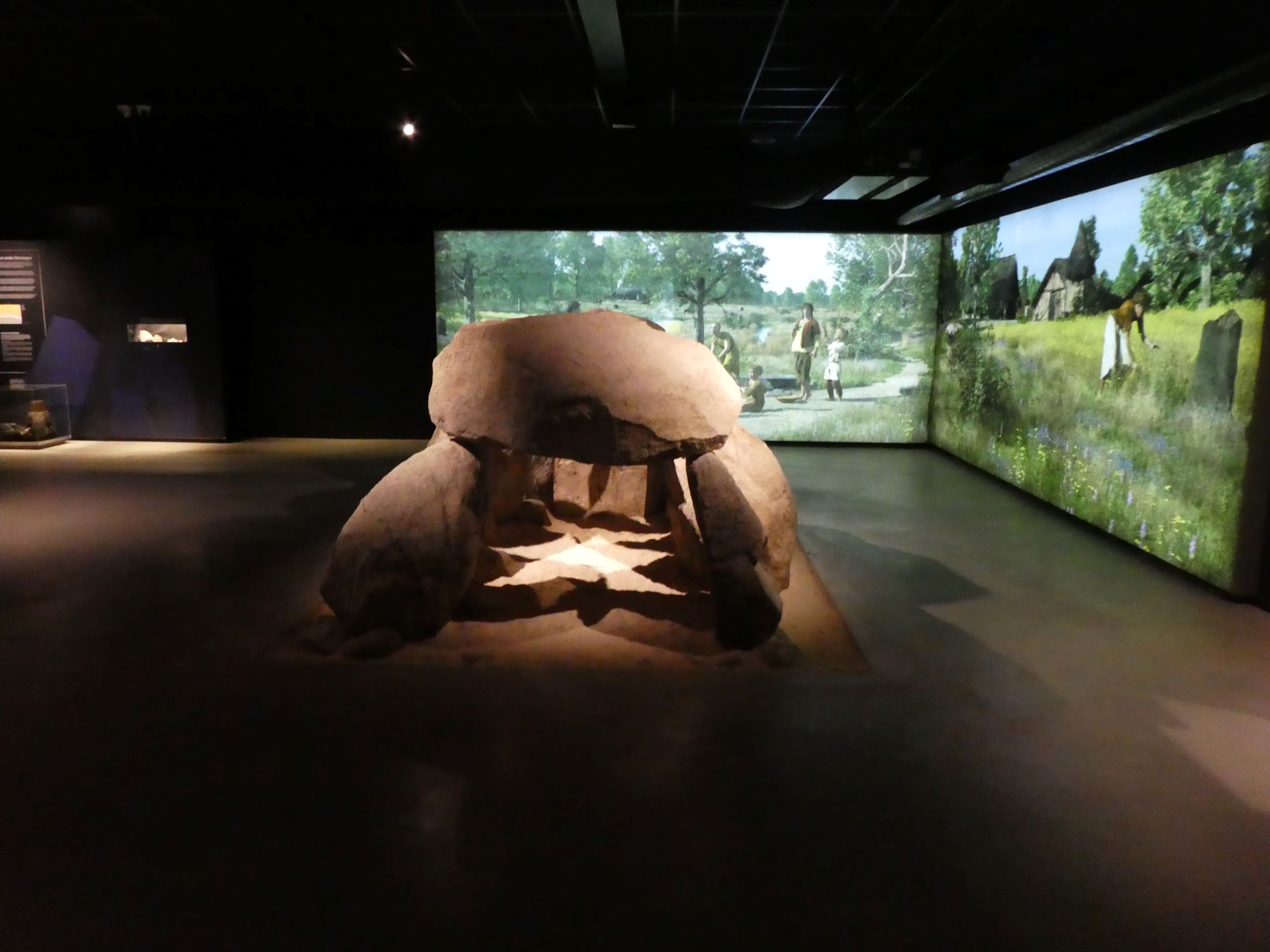
This large hunbedden was sparkling today with the sun finding its way through the trees and reflecting off the stones

The Migneint, an extensive area of peat blanket bog overlooked by the Arenig mountains of Gwynedd, is not the place for those seeking easy walking... or trendy ‘outdoor experiences’... to venture. ‘Hostile’ or ‘bleak’ might be appropriate adjectives, particularly when the cloud base is down and the rain just won’t relent.
However, don the boots when the weather is a touch more salubrious and the curious traveller may experience a touch of that special wilderness vibe without too much effort. Perfect for the short day, or when the body just won’t respond. It happens, right? Furthermore, there are a number of hidden highlights to discover here, far from the maddening crowds, so to speak: Llyn Conwy, source of the river high above Cwm Penmachno; the massive prehistoric ring cairn crowning Y Garnedd, keeping watch over Llyn Morwynion; equally massive cairns surmounting the sentinel peaks of Arenig Fach and Arenig Fawr; and arguably the most obscure of all – in my opinion – a lovely little Bronze Age cairn located above the Nant yr Olchfa, upon the flanks of Carnedd Iago at SH7919140367.
Although not that far from the B4391 – and within sight of the usual moronic petrol head bikers and wannabee rally clowns racing up and down during Easter Bank Holiday – the location is one to savour for such limited expenditure of effort. Hey, the monument even displays a hint of a former internal cist. Should you lack a GPS (hopefully you do and still engage in traditional fieldcraft rather than have some bloody satellite tell you where you are – or not as the case may be) the cairn is not easy to find. Indeed, I came away bemused the first time of asking. However, persevere since an audience is worth the effort.
Coflein has this to say:
“A small funerary cairn found emerging from the peat. The exposed circular stone structure measures 4.5m in diameter....There is no obvious external kerb and the exposed area is up to 0.4m high. There is one possible recumbent side slab for a cist surviving in the northern half of the cairn. The cairn is located on a flat spur of land raised above the confluence of two streams”. [P.J.Schofield, OANorth, 29th July 2008]

Police are investigating damage to one of Scotland’s most important prehistoric houses, which is more than 2,000 years old, after stones were reportedly removed from the remaining structure and used to build a cairn nearby.
More info :
Cunningham Standing Stone on Canmore

Cunningham Standing Stone viewed from N.

Cunningham Standing Stone viewed from S.

Cunningham Standing Stone viewed from W.
Visited 11.05.22
Cunningham Standing Stone lies prone on an E-W Axis within 10 yards of a gateway on Cunninghame Farm road. It is an oval boulder c. 40 inches in diameter and c. 50 inches long with a rounded point on the W. The ground round the stone has been eroded by cattle leaving the stone on a grassy island. Canmore ID 62845 (go to Links) observed that it bears a similarity to the stones in the Torhousekie Stone Circle which is c. 500 yards NNW from the stone.

This destroyed hunbed is also known as Pottiesbargien due to the large quantities of pottery discovered when the site was excavated