
Coming up on the road from south to Stem Howe with a low autumn sun delineating the various shapes made by the knowes and picking out features on them. The whole is so much sculpted that it is no longer a moraine, if ever it was. Seem to be various levels too. Thought this to be only the upper part but this is an ilusion of time passing sentence on the steeper bits. Partway up the southern edge where it nears the the road the harsh sunlight brings into relief a low ridge, only a couple of feet across a few inches high, forming an edge to the mound as if to stop visitors falling unawares. This looks to stop just where the most man-alters bit starts. I notice it begins at the top end of a twisted rectangular hollow or depression, which doesn’t look to be from antiquarian investigation, though possibly a long scoop.
Latest Fieldnotes
November 1, 2010
‘Visited’ 30.10.10
What a lovely place to come for a picnic / walk in the summer!
From the village of Pontneddfechan the forestry commission site is clearly sign posted. There is a large free car park and the first thing that strikes you is the huge, flat, near vertical rock face which had a couple of climbing ropes dangling down it. There is an information board and map of the walks available from the car park. The info board states Craig -Y –Ddinas means ‘Fortress of the Rock’ and seeing the afore mentioned rock face you can easily see how the place got its name! Strangely enough there is no mention of a Hillfort and it is not marked on the otherwise fairly detailed map. There are several paths to follow and I decided on the one which leads to the nearest waterfall and is an easy 400 metre walk along the river bank (wheelchair friendly). I passed a small cave entrance on the left, below the sheer cliff face and the gently flowing river was on my right. When the path ends you are close to a small waterfall. Very pretty. A group of ‘gorge walkers’ had just taken the plunge into the icy water!
As for access to the Hillfort itself, I couldn’t find any! (Unless I joined the climbing club who had just started scaling the cliff face!) There must be a way up to have a Hillfort here in the first place but there was no obvious route. The information board states that there were a lot of explosives used in the area in the past (one walk is called the gunpowder path) so perhaps the original access way has been destroyed?
Anyway, this is such a pretty place to visit that I shall return in the summer with Karen and the children and will have another look for a path to the Hillfort.

Discovered yesterday , 160 metres to the NW from themodernantiquarian.com/site/13479/kiltyrie.html .Despite the proximity the chambered cairn is unsighted . Kiltyrie is a bit of a rock art desert in the middle of the rich Ben lawers area ,possibly due to limestone being more prominent here .
Visited 23.10.10
From Gelli Nedd Hillfort I hiked across the open moor, heading north east towards the rocky outcrops. When climbing the outcrops, the cairn can be seen on the brow of a hill a short walk away. I couldn’t see any gate into the field where the cairn is so I had to climb over a barbed wire fence. The cairn is about 1 metre high and about 2 metres in diameter. The O/S map I had shows two cairns but I could only find one of them. In all honesty it was not worth the effort to visit the cairns although there is a decent view to be had. If you do choose to visit, keep an eye out for the old lime kilns near the rocky outcrops and don’t do what I did – get lost trying to find my way back!!
Visited 23.10.10
Really easy to access this one.
I parked in the large free car park in the village of Ystradfellte and walked north along the road through the village for a couple of hundred yards. After passing a couple of houses on your left you come to the cairn which is right next to the road (also on the left). The cairn is about 1 metre high and 10 metres in diameter. The central section has been dug into and the remaining bank has a ring of trees growing on it.
I visited several cairns in the area today and this was easily the best preserved, despite the damage done by the digging. You could easily have a look by just pulling up along side the cairn; it is so close to the road. There is a fence between the road and the cairn.
Well worth a look when in the area.
Visited 23.10.10
I parked in the large free car park in the village of Ystradfellte and headed up the road/track which runs directly from the car park, uphill towards Tyle farm. You will shortly come to a turning right towards the farm, but keeping walking straight up the hill. The track now becomes rougher and you go through two metal gates. After the second gate you come out onto open moor land. You pass the cairns when walking to Gelli-Nedd Hillfort.
As you approach the brow of the hill look over to your right and you will see the remains of two cairns. One is round in shape – about 0.5 metres high and 5 metres round. The other is oval in shape – about 0.5 metres high x 5 metres x 10 metres.
Well worth looking out for are the strange rocky outcrops you pass on the way to the cairns. Very odd looking – like the remains of stone walls (which they are not). I have never seen these types of formations before. In truth, more interesting than the cairns themselves!
It takes 15 minutes to walk from the car park to the cairns.
Visited 22.9.10
Whist visiting the Matfen Stone I took the opportunity to have a quick look at the nearby barrow marked on my O/S map. Taking the minor road north east out of Matfen towards Warwick, the road takes a sharp turn to the right. Just beyond the bend I parked near a field gate and was able to see the barrow on the far side of the field. The field had recently been ploughed and the barrow appeared as a small ‘grass island’.
I settled for a view from afar as I didn’t fancy getting caked in mud.
Visited 17.10.10.
As Karen is now only 7 weeks away from producing the newest member of the clan, I thought it would be best to stay fairly close to home for the next few weeks! With this in mind I decided to visit a site I became aware of last year but had forgotten about. (Isn’t it always the case that you often neglect the places closest to home?)
Anyway, I traversed the maze of lanes to the north of Cardiff and parked in the small, pretty village village of Draethen. I would recommend visitors not used to the area to get to Draethen via the A468 between Newport and Caerphilly.
The footpaths up to the Hillfort are well signposted and easy to follow. I picked up a very good (free) information booklet from the Hollybush Inn in Draethen. The booklet states the Hillfort was built in around 200BC and gives artists impressions of how it may have looked.
The walk from the village to the top of the Norman Motte (which sits proudly at the centre of the Hillfort) took 30 minutes. It was a beautiful autumn day, deep blue skies, not a breath of wind and early morning frost turning the grass white and crispy. Not a soul about, so quiet in fact that you could actually hear the leaves falling when walking up through the trees! The views from the top are excellent, overlooking Cardiff, Newport and the Bristol Channel with the islands of Flat and Steep Holm easy to see.
You can also look down upon the ruined Ruperra Castle at the foot of the hill.
As for the remains of the Hillfort, I am sorry to say there isn’t much to report. I took the path which runs right through the centre of the site. I could see no trace of defences on the eastern side of the Hillfort although I possible saw some on the western side. I say possibly as I am not 100% sure. There is a small path which runs around the side of the hill at this end of the site and it may follow a single bank ditch. It is hard to say as the ferns which cover this end of the hill are chest high, making clear observations impossible at this time of year. Perhaps things would be clearer in the winter?
Despite this, I really enjoyed my visit, no doubt helped by the fantastic weather. It has been a long time since I enjoyed a visit so much without actually finding anything! I would certainly recommend a visit if in the area. One word of caution though, the paths up to the Hillfort are very muddy, so make sure you wear your boots!
When visiting Twmbarlwm Hillfort (known locally as ‘the pimple’) it is worth having a look at the cairns which can be seen to the east of the Hillfort.
Access is easy enough – just follow the track north (which runs to the east of the Hillfort) and the cairns are on the right hand side of the track, behind a fence. The cairns are quite prominent, covered in grass. I visited the cairns about 2 years ago so can’t remember exactly how big they were but I do remember they were a fair size and easy enough to spot. I wouldn’t say it was worth the effort to visit the cairns specifically but they are certainly worth a look when visiting the Hillfort. Parking is easy.
Visited 10.10.10
Take the minor road south east out of Glandy Cross. (an O/S map would be helpful)
There is no public access to the stone but it is easily seen from the field gate. You can of course jump over the gate and a two minute muddy walk takes you up close and personal. One stone is approx 1 metre tall and the other, fallen stone, is about 2 metres long. There is a pool of water around the stones, no doubt caused by the cattle. Whilst I was there the sun came out and lit up the stones lovely. There are nice views to be had looking north towards the mountains.
Visited 10.10.10
Heading north out of Glandy Cross along the A478 you quickly come to a metal field gate on your left hand side just past a house (there is another metal field gate directly opposite). Park here as best you can but be careful, the A478 is surprising busy.
Climb over the gate on your right hand side and follow the field hedge to the right, heading back towards the house. There is a low field wall you can stand on which gives a good view of the site. The earthwork is semi circular in shape and consists of a low bank – approximately 0.5 metres high / 40 metres in diameter.
Please note – this site is not visible from the road due to the high hedgerow.
Visited 18.9.10
Driving west out of Shap on the way to see the Thunder Stone, you pass the remains of this small barrow on your right hand side. All that can be seen is a small, mainly ploughed out mound on the crest of the hill.
Fairly easy to spot if you know to keep an eye out for it.
I visited this site last summer and was pleasantly surprised how well preserved the banks/ditches were. I have visited several Promontory Forts along the South Wales coast and I would say this is the best preserved. Between Llantwit Major and St Athan along the B4265 you come to the village of Boverton. From here take the lane south towards Summerhouse Point Seawatch Centre. Follow the very bumpy lane as far south as you can (passing a farm on your right) and the lane ends with a small place to park.
Over the gate and follow the track south, through the trees. You will soon come across the Summerhouse ruins which were built in 1730 – worth a look around. You will then see the two small ditches / ramparts of the Promontory Fort. If memory serves me right the ditches are about 1 metre deep. There is not much of a view now due to the trees but I am sure things would have been different in earlier times.
This site is worth a visit when in the area.
October 31, 2010
The remains of this chambered cairn were only discovered in 2000 . It’s a Clyde -Carlingford type so quite a long way from from it’s usual area in the the SW of Scotland but there are others in Perthshire . Fwiw it’s oriented E-W and the equinox would be seen on the day on either horizon barring tree cover .
More big cups from this area .You can’t help but think it’s the same person rather than very localised style .They are all within 300m of each other .

Described in ‘Mourne Country’ by E.E.Evans as a court grave in a tangle of thorns and briars, consisting of three chambers. He first identified it (as a megalith) in 1947. Thankfully there were no briars when I visited (Oct 10). Knarly old hawthorn trees grow on the site, giving it a very peaceful air. The large boulders are still loosely arranged in the shape of 3 chambers, but I couldn’t make out a forecourt. There is a pile of smaller boulders just downhill (maybe 25m) of the site.
October 29, 2010
Visited 29.10.10 and Postman was right, its huge and on first sight (without any previous knowledge) you may not think it actually is a barrow. Its sits on land directly opposite a farmhouse of the same name.
It shows signs of abuse and is very pitted and eroded, but well worth a visit. I hopped over the gate and into the ‘paddock’ in which the barrow is sited. The ‘paddock’ is clearly a rectangular walled enclosure but probably only several hundred years old. It appears to be a walled field whose drystone walls have tumbled and are now covered in earth, moss, etc. The barrow is neatly framed in the centre of this field enclosure.
The views in all directions are that of distant hills and mountains and Rhiwiau appears to sit in the bottom of a bowl whose sides are those distant hills – no coincidence I guess?!
Visited 29.10.10
There is no longer any scrambling through trees or undergrowth as the approach to this site, and Bryn Beddau close by, have been made easy by a neat stone path through the trees without any loss of ambience (for me this was my first visit, alone and in a very quiet wood, except for the wind in the trees... with an occasional look over my shoulder!).
With clearance of the scrub and trees around Maen Llwyd there are now three other smaller stones visible. How these are associated, or not, with the main stone is not recorded but they add to the general vista. Maen Llwyd is vast but as far as I know its total mass is not known so I cannot guess how far into the earth it extends. It’s right-angled ‘corner’ rises from the ground and resembles a huge cheese wedge.
Could it possibly be a waymarker stone, perhaps one of a series, showing the route to Bryn Beddau or the site that is now Llyn Brenig beyond?
Other stones/cairns may have also been lost to forestry I suspect and may only be returned to us after felling, albeit damaged. As it appears to be the felling time for many FC plantations in this area now who knows? (a good example being the damaged cairn being more visible for the past few years on Nercwys Mtn OS:117-221581)
Visited both Bryn Beddau & Maen Llwyd 29.10.10.
My first visit to these sites which are less then 20 miles from home and I must admit that I was really surprised to find them more than just another set of stones.
The Forestry Commission have made a neat stone path to each site off their existing forestry road and whilst not waymarked (except for the info board at the Glan y Gors carpark) you cannot miss them. All trees, grasses, etc are cleared around the sites and makes for an atmospheric visit (well I was on my own which also helped). For the birders the forest was also full of crossbills.
Bryn Beddau is descibed elswhere and may not be a site high up on many ‘stones to see’ lists, but I recommend you go if you are anywhere near. It only takes an hour to see both sites once parked up.
Coflein lists two ‘cairns’, south and north with the south cairn being “lost to forestry”. I guess the one visible today is the north cairn. Judging by it’s position if you strip away the FC’s trees this site has great views of the distant Hiraethogs and as the crow flies not that far from the cairn sites at Llyn Brenig. A possible link? I’ll be returning for sure.
We visited the stones at Drumtroddan on the 24th Oct 2010 and there is now only one standing. The stone to the west which is seen standing in ‘the modern antiquarian’ (page 360) is now lying on the ground. It appears to have faillen recently because the soil on the base looks fresh. Interesting that such a small portion appears to have been in the ground!
October 28, 2010

Druid – Friday 15 October 2010
After a delicious (and rather IN-expensive) lunch in The Catacol Hotel, we drove down through Thundergay and Whitefarland. Beautiful calm seas and high leaden skies lent the journey a sense of impending.... something or other. I’d not had my fly rod out on the holiday, and although the trout season had finished the October runs of Sea Trout and Salmon were in full flow. A lucky angler walked up to the bridge at Dougarie Lodge as we drove past. He was carrying what must have been a twenty-five pound Salmon. “Wow Look at the fish he’s got!” I exclaimed. No answer. My OH was fast asleep in her car seat and the wee fella was snoring gently, slumped on his booster in the back. Hmm, I thought, free time for Druid!
I pulled over about half a mile further on and walked up to Auchencar Farm leaving the two dreamers to their dreams. The farmer was just setting his prize tups out amongst his ewes in the field with the stone and in the one next to it. he stopped on his quad and told me just to go into the field if I wanted. I’ve been up to the stone many times before and I politely declined, the view is so much better from a distance. You get a better idea of the scale of the stone. A bit of perspective.... Also, I hate to disturb a tup about his business, so I contented myself with brilliant views across the field toward the stone.
Druid is just such a brute of a thing. massive and phallic, a curving, bulging, priapus and yet at the same time it is one half of a very feminine shape (the other half lies broken beside it). There is a slight rise around the stones which could be a well robbed-out cairn but I’m not convinced. Some short cists were ploughed up between the stone and Auchencar Farm about a hundred years ago and a cremation urn was found about a hundred yards North West of the stone in the late 19th Century. The surviving stone faces towards the sea and it is highly visible. This stone was meant to be seen. We saw it from miles away, walking round from King’s Caves at the start of the holiday. For the sea-going (and sea-arriving) early visitors, the 70 feet above sea level stones would have been a superb landmark as they arrived by canoe from the South up the Kilbrannan Sound. The stones would have guided them into Machrie Bay and two of the best salmon runs (The Machrie Water and the Iiorsa) on the South Western Seaboard of Scotland. There is an ancient (and large) tidal fish trap by the mouth of the Machrie Water and those runs of Salmon would have been immense in the Neolithic.
I returned to the car and the two still-snoring dreamers and set off for King’s Cross Point, our wee holiday cottage and the promise of a game of the new Arran Monopoly set.
October 27, 2010
I visited the Hillfort on my way home after a long day in north Wales. Although I was tired and it was starting to get dark, I made my way to the car park and then through the kissing gate and up the steps to the Hillfort. The ramparts are very well preserved and large. The path around the site is easy to follow and there are several E.H. information boards to read.
I didn’t have time to go right around the Hillfort as it was so late but I managed to see about half of it. I am sure I will come back for a longer visit one day. Highly recommended.
October 26, 2010
Dreamtime in Stronach Wood – 14 October 2010
I grabbed a couple of hours during the afternoon while Junior and my OH played with the latest consumer purchase – Arran Monopoly. While they were racing around buying up the likes of Catacol and Lochranza and vying for control of Arran Aromatics, I parked up on the String Road just at the pull-in, up from the stalkers path and headed into Stronach Wood.
I could hear shooting going on up in the hills and on Monday we’d watched and heard stags at the rut in the corrie high above Corrie, from the North Goatfell Ridge and all the way back down the mountain. There were fresh quad tracks on the stalker’s path all the way to the carvings. The carvings are about half a mile along the path and actually are the path. This is a shameful state of affairs. For the want of a few felled trees, some fenceposts and a hundred yards of fencing wire, foot and quad traffic could be diverted off these beautiful panels. It wouldn’t stop the interested folks getting as close as they wished but it might stop the wear and tear of unintentional damage from the through traffic.
I photographed the panels and checked out some triangular pointy peaks on the panel slightly above the birds I’d noticed during the summer’s visits. They appeared to mirror the view to the pyramidical peaks of North Arran (Goatfell, Cir Mhor and Beinn Tarsuinn).
themodernantiquarian.com/img_fullsize/91813.jpg
With the forestry plantation still surrounding the panels, photographing them with the back drop of the peaks wasn’t possible – but it will be one day! The illustrations from Coles (1901) nearly show the orientation (it would be slightly more turned to the right).
themodernantiquarian.com/img_fullsize/88438.jpg
The panels in the Kilmartin Valley haven’t suffered by being displayed well. This site could easily be cleaned back and should be properly examined. Without a doubt, there is much more art to be found around the three exposed panels. I was looking for some more…
You see, I’d had a wee plan to seek out the lost panel (panel K) reported to be 80 yards to the West back in 1901. It hasn’t been seen since and was thought to be buried by bulldozer action in the dense forestry plantation. I paced and measured. I measured and paced. I retraced my steps and thanked my lucky stars it was October and the midges were all dead. After a while and right on the eighty yard mark I came across the edge of an eight foot slab buried in soil, pine needles and peat. It was right where it should be and had a plantation tree growing on top of it. I had no spade, trowel, GPS or axe. I photographed it.
themodernantiquarian.com/img_fullsize/91712.jpg
From my memory the exposed edge looked rather like the top edge of the slab shown in the very poor 1901 photograph here
newimages.fotopic.net/?iid=yr16tt&outx=0&quality=100&original=1&noresize=1&
I was kicking myself for not bringing at least a wee trowel, so I promised myself yet another trip over to Arran later this year – this time properly equipped to shift some of the soil off this likely slab. It didn’t look like anything worse (or more) than the peaty spoil from the drainage ditch between the planting lines for the trees had been heaped up on top of the slab. Then the trees had been planted and had been patiently dropping sixty years of pine needles on top of that. So maybe I’d found panel K? A winter trip was definitely on!
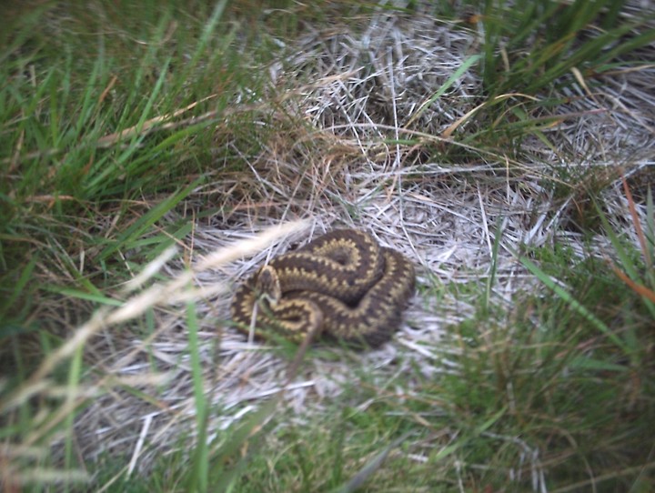
With myself exhausted and the camera battery dying, I headed out of the forestry, onto the top of the Stronach Ridge and wound my way along a rocky crag-edge on the lower slopes of Muileann Gaoithe heading towards the Parking Area and cairn at Allt Mor at the bend halfway up the String Road. At one point below me, a large slab of rock at the side of the ridge-crag formed a great-looking rock shelter enclosing a squarish area the size of my living room. I checked my map (I aint got no GPS) and it was at NR 995 360. I climbed down carefully to have a look and nearly put my foot down on a BIG Adder.
themodernantiquarian.com/img_fullsize/91814.jpg
It hadn’t sensed or seen me. It lay dozing, coiled in a considerable heap in the last warmth of the afternoon in the rock shelter. I leaned down as close as I dared and snapped a picture. It woke and slid very quickly into the long grass. It was between three and a half and four feet long. A BIG Adder! I legged it out of the shelter pronto. I’ll have to go back in winter for a photo of the rock shelter too.
I got back to the road and decided to forgo the cairn at Allt Mor and head down the hill to my car. I’d had enough excitement for one day. Stronach Wood... it’s the gift that just keeps giving. Go get some I say.
This site is much degenerated. A few large stones mark the tomb in the centre of a roughly circular area of stones/boulders about 30 metres diameter. The area is overgrown with trees. It is described in an article “The Horned Cairns of Ulster” by O.Davies and E.E.Evans in Ulster Journal of Archaeology, Third Series, Volume 6 1943. The site is described as a later monument, having two chambers. Even in 1943 they described it as having been badly disturbed to the extent that few human bones were found. The bodies were not fully cremated, but ‘toasted’ and dismembered and laid in the chambers (perhaps one body in each).
October 25, 2010


Situated in next field south and over the shoulder of Dilly Hill. Even better views on Bennachie, with stone seemingly aligned to the Mither Tap. Sadly the other stones in the picture formerly stood their positions being used as rubbing stones again.
However a chance meeting with an elderly gentleman, who had worked at Conglas farm, ended with the information that Dilly Hill had stones circling it. This is even more interesting that considering that a cairn and settlement existed on the hill. Even more interesting is that a henge, settlement and/or enclosure stood at Middleton. Further investigation needed.
Visited 23/10/2010.