

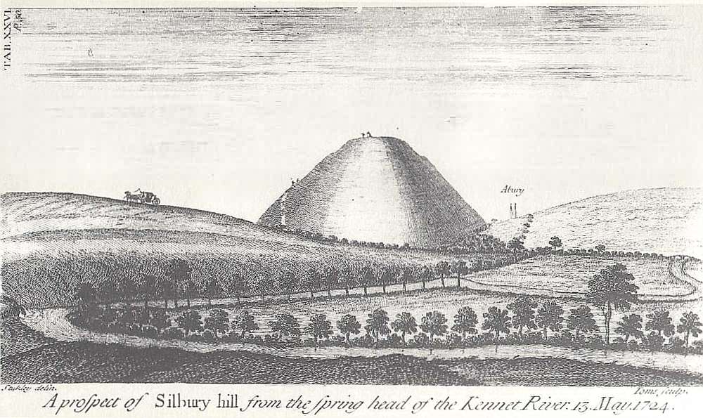
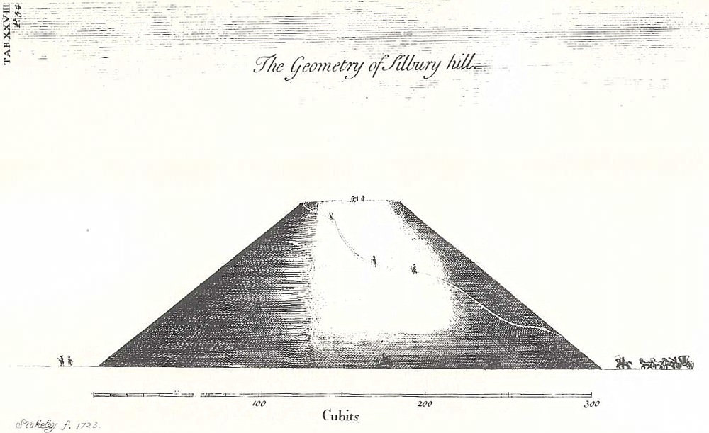
Sukeley's illustration of 1724, <b>A prospect of Silbury hill from the spring head of the Kennet River</b>* is interesting; firstly his illustration shows the stream (what stream is that again?) flowing under Pan Bridge and joining the Swallowhead Spring to become the Kennet. The stream to and from the Swallowhead is shown flowing much stronger than it does today and I wonder if that's just artistic licence on Stukeley's part or if the streams ever were that full? Stukeley's rendering of Silbury in his <b>A prospect of Silbury</B> is shown, yet again, with the sides roughly at 60 degrees (why does he keep doing that when his illustration, <b>The Geometry of Silbury hill</b> of 1723 shows the angle pretty accurately?).**
Perhaps most interesting of all is that in his <b>A prospect of Silbury hill<b> he shows the tower of St James Church in Avebury popping up over Waden Hill; again, is this just artistic licence or was the church tower still visible from West Kennet in the 18th century?
* http://www.avebury-web.co.uk/plates/24.jpg
** http://www.avebury-web.co.uk/plates/26.jpg