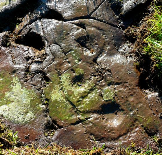
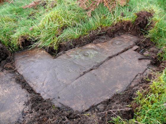
Log in
|
Register
Home
Latest Posts
Forums
Maps
Help
Browse Sites
News
Blog
Contributors
The Books
Select
-
Belgium
Denmark
Eire
France
Greece
Italy
The Netherlands
Norway
Portugal
Republic of Malta
Spain
Sweden
Switzerland
United Kingdom
Scotland
Dumfries and Galloway
Brighouse Standing Stone
Standing Stone / Menhir
Brighouse Standing Stone (Standing Stone / Menhir) on The Modern Antiquarian, the UK & Ireland's most popular megalithic community website. 3 images, plus information on many more ancient sites nearby and across the UK & Ireland.
Image © pebblewolf
Nearest Town:
Kirkcudbright (7km NNE)
OS Ref (GB):
NX640456 /
Sheet: 83
Latitude:
54° 47' 11.85" N
Longitude:
4° 6' 54.73" W
Added by
rockartwolf
Images (3)
0 discussions
Start a topic
Show |
Hide
Web searches for Brighouse Standing Stone
Flash Earth
Flickr
Google
Google Images
MAGIC
The Megalithic Portal
Multimap 1:25000
Stone Pages
Streetmap.co.uk
Wikipedia
Show map
(inline Google Map)
- Sites within 20 km -
-
Senwick 4 (0.5km NE) (8 posts)
Clash (0.78km NE) (10 posts)
Senwick 1 (1.3km NE) (5 posts)
Clauchendolly (1.63km N) (53 posts)
Borgue (2.73km NNW) (6 posts)
Torrs 10 (3.73km E) (2 posts)
Torrs 3 (3.91km E) (11 posts)
Torrs 3b (4km E) (1 post)
Torrs 7 (4.1km E) (2 posts)
Torrs 1 & 2 (4.1km ENE) (12 posts)
Torrs 4 (4.1km E) (7 posts)
Torrs (4.13km E) (7 posts)
Knockshinnie 2 (4.3km E) (8 posts)
Knockshinnie (4.38km ENE) (10 posts)
Balmae 35 (4.62km E) (2 posts)
Tongue Croft (4.63km W) (18 posts)
Drummore Castle (4.77km ENE) (0 posts)
Drummore (4.79km ENE) (3 posts)
Grange 2 (4.87km ENE) (3 posts)
Grange 1 (5.01km ENE) (3 posts)
Grange 3 (5.14km ENE) (11 posts)
Castle Haven (5.35km W) (5 posts)
Blackhill Cottage (5.37km ENE) (4 posts)
Dunrod (5.69km ENE) (2 posts)
Auchenhay (5.71km NNW) (2 posts)
Townhead (5.87km ENE) (45 posts)
High Grange 2 (6.15km ENE) (0 posts)
High Grange 1 (6.27km ENE) (13 posts)
Milton (6.53km ENE) (88 posts)
Galtway 18 (7.2km ENE) (6 posts)
Galtway (7.36km ENE) (2 posts)
Galtway 7 (7.59km ENE) (2 posts)
High Banks (7.62km ENE) (39 posts)
Galtway 5 (7.85km ENE) (6 posts)
Castlecreavie (9.11km ENE) (1 post)
Castlecreavie (9.22km ENE) (15 posts)
Castlecreavie Dun (9.22km ENE) (5 posts)
Bombie 5 (9.27km ENE) (0 posts)
Bombie 1 (9.32km ENE) (5 posts)
Bombie 2 (9.36km ENE) (18 posts)
Bombie (9.41km ENE) (2 posts)
Bombie 3 (9.45km ENE) (9 posts)
Bombie 4 (9.5km ENE) (3 posts)
Culdoach (9.66km NE) (21 posts)
Newlaw Hill 2 (9.83km ENE) (3 posts)
Newlaw Hill 1 (9.83km ENE) (15 posts)
Newlaw Hill 3 (9.93km ENE) (18 posts)
Mossyard (11.09km W) (17 posts)
Newton Farm (11.11km W) (3 posts)
Newton Farm Burial Chamber (11.23km WNW) (8 posts)
Newton Farm (11.37km WNW) (1 post)
Trusty's Hill (11.57km NW) (11 posts)
Laggan Farm (11.93km WNW) (3 posts)
Park of Tongland (11.93km NNE) (7 posts)
Lagganmullan 9 (12km WNW) (6 posts)
Lagganmullan 8 (12km WNW) (5 posts)
Lagganmullan 10 (12km WNW) (3 posts)
Rutherford's Witnesses (12.06km WNW) (1 post)
Lagganmullan 1 (12.15km WNW) (0 posts)
Lagganmullan House (12.23km WNW) (2 posts)
Lagganmullan 2 (12.28km WNW) (6 posts)
Kirkclaugh (12.3km W) (2 posts)
Lagganmullan 7a (12.31km WNW) (5 posts)
Lagganmullan 7b (12.31km WNW) (3 posts)
Lagganmullan 7d (12.31km WNW) (5 posts)
Lagganmullan 6 (12.31km WNW) (0 posts)
Lagganmullan 7 (12.31km WNW) (2 posts)
Lagganmullan 7c (12.31km WNW) (2 posts)
Lagganmullan 4 (12.4km WNW) (7 posts)
Harper's Hill (12.44km NW) (10 posts)
Lagganmullan 5 (12.45km WNW) (2 posts)
Lagganmullan 3 (12.48km WNW) (4 posts)
Kirkclaugh (12.81km W) (1 post)
Upper Newton 3 (12.87km WNW) (4 posts)
Park of Tongland (12.92km NNE) (1 post)
Upper Newton 2 (12.95km WNW) (5 posts)
Upper Newton 1 (13.28km WNW) (3 posts)
Upper Newton 4 (13.34km WNW) (0 posts)
Bardristane 3 (13.5km W) (3 posts)
Bardristane 4 (13.58km W) (6 posts)
Glengap House (13.63km N) (1 post)
Whiteside (13.65km WNW) (3 posts)
Bardristane 1 (13.69km W) (5 posts)
Barholm 2 (13.97km W) (1 post)
Barholm 3 (14.18km W) (2 posts)
Nether Linkens (14.25km NE) (9 posts)
Barholm 1 (14.63km W) (1 post)
Kirkdale House (14.63km W) (2 posts)
Cairnholy (14.71km W) (77 posts)
Cairnholy 01 & 02 (14.71km W) (7 posts)
Cairnholy 03 (14.78km W) (0 posts)
Cairnharrow (14.95km WNW) (2 posts)
Cairnharrow (14.98km WNW) (12 posts)
Kirkmuir 1a & 1b (15.1km W) (1 post)
Kirkmuir 2 (15.1km W) (1 post)
Kirkmuir 3 (15.15km W) (1 post)
Kirkdale Mains Stone (15.15km W) (1 post)
Cairnholy 09 (15.22km W) (4 posts)
Cairnholy 10 (15.26km WNW) (0 posts)
Kirkmuir (15.26km W) (2 posts)
Cairnholy 04 (15.27km W) (1 post)
Cairnholy 06 (15.28km WNW) (1 post)
Kirkmuir 4 (15.29km W) (1 post)
Cairnholy 08 (15.33km W) (1 post)
Cairnholy 05 (15.39km W) (1 post)
Cairnholy 07 (15.45km W) (0 posts)
Cauldside Burn (15.94km WNW) (11 posts)
Cauldside Burn Cairn (15.94km WNW) (8 posts)
Cauldside Burn Stone Setting (16.01km WNW) (2 posts)
Claughreid (16.06km WNW) (11 posts)
Cambret Moor (16.23km WNW) (11 posts)
Penkiln (16.25km W) (31 posts)
Doon of Carsluith (16.68km W) (8 posts)
Slagnaw (16.94km NE) (3 posts)
Culscadden (17.08km W) (7 posts)
Blackmyre Moor (17.3km WNW) (5 posts)
Bagbie Stone (17.67km W) (8 posts)
Big Airds Hill (17.67km ENE) (0 posts)
Bagbie Cairn (17.79km W) (7 posts)
Bagbie Four Poster (17.79km W) (7 posts)
Broughton Mains (18.13km WSW) (20 posts)
Little Balsmith (18.18km WSW) (4 posts)
Glenquicken (18.19km WNW) (31 posts)
Glenquicken Cist (18.2km WNW) (6 posts)
Blackmyre Farm (18.23km WNW) (2 posts)
Little Airds Hill (18.27km ENE) (0 posts)
Lodge Of Kelton Farm (18.54km NE) (9 posts)
Kirkmabreck (18.8km W) (14 posts)
Boyach (19.18km WSW) (2 posts)
Gallows Outon 2 (19.29km WSW) (3 posts)
Gallows Outon 1 (19.44km WSW) (3 posts)
- Facilities within 20 km -
-
Newton Farm (Camping Site: 11.4 km WNW)
Cairnholy Old Farmhouse (Bed & Breakfast: 15 km WNW)
- Add -
-
Add news
Add an image
Add fieldnotes
Add folklore
Add miscellaneous
Add a link
-
Add a site
Add a nearby facility
Add an alternative name/spelling
Images
(click to view fullsize)
Add an image