|
|

|
|
Painswick HillHillfort
|
||||||||||||||||||||||||
|
|
|
News |
|
Repair Project Nears CompletionA year-long project to restore and preserve an Iron Age hill fort on the Painswick Beacon is nearing completion. The £80,000 initiative involved repairs to the ancient ramparts at Kimsbury Camp and new measures to reduce erosion caused by walkers and history-lovers... continues... |
 Posted by Rhiannon
26th May 2005ce Edited 27th May 2005ce |
Hill Fort Repairs to StartFrom 'This is Gloucestershire': A public meeting will explain repairs planned to a nationally important Iron Age hill fort at Painswick... continues... |
Posted by Rhiannon 1st February 2005ce Edited 1st February 2005ce |
Images (click to view fullsize) |
|
Photographs: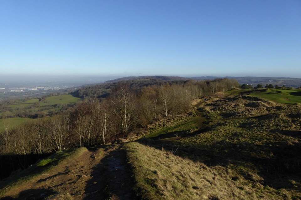
 Maps / Plans / Diagrams:
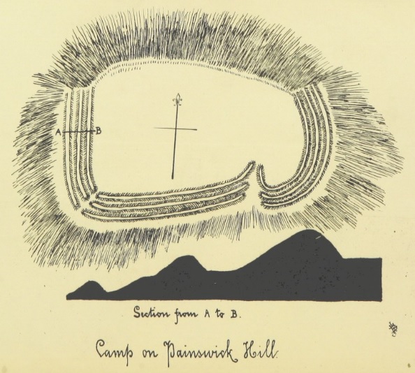 Artistic / Interpretive:
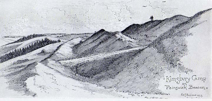
|
Fieldnotes |
|
|
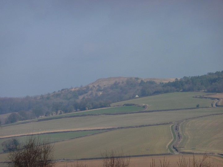
We've all been to an ancient site and left with a sinking heart because of litter or the vandalism of past excavations. Today I almost wept - had to go to Stroud in Gloucestershire, the sun came out so thought to make a day of it and walk up to Painswick Beacon. A place I've visited once before three years and, although then the whole of Painswick Hill seems to be a golf course, it seemed peaceful and the views across the Severn Valley are pretty amazing. Today I discovered part of the hillside is missing - a great yawning chunk of hillside gone. The noise from the diggers moving great lumps of Cotswold stone around destroyed any peace. Cotswold stone has always been quarried but I've never seen it done on such a destructive and industrial scale. http://i296.photobucket.com/albums/mm200/TJJackson66/012-19.jpg Painswick hillfort and beacon are still intact, the views still terrific, a kestrel still hovered but what a travesty. |
 Posted by tjj
13th July 2012ce Edited 13th July 2012ce |
|
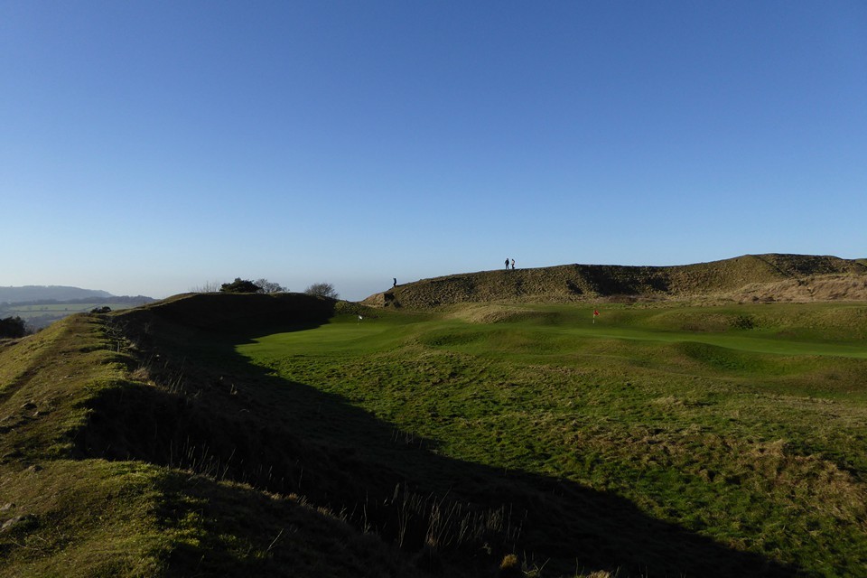
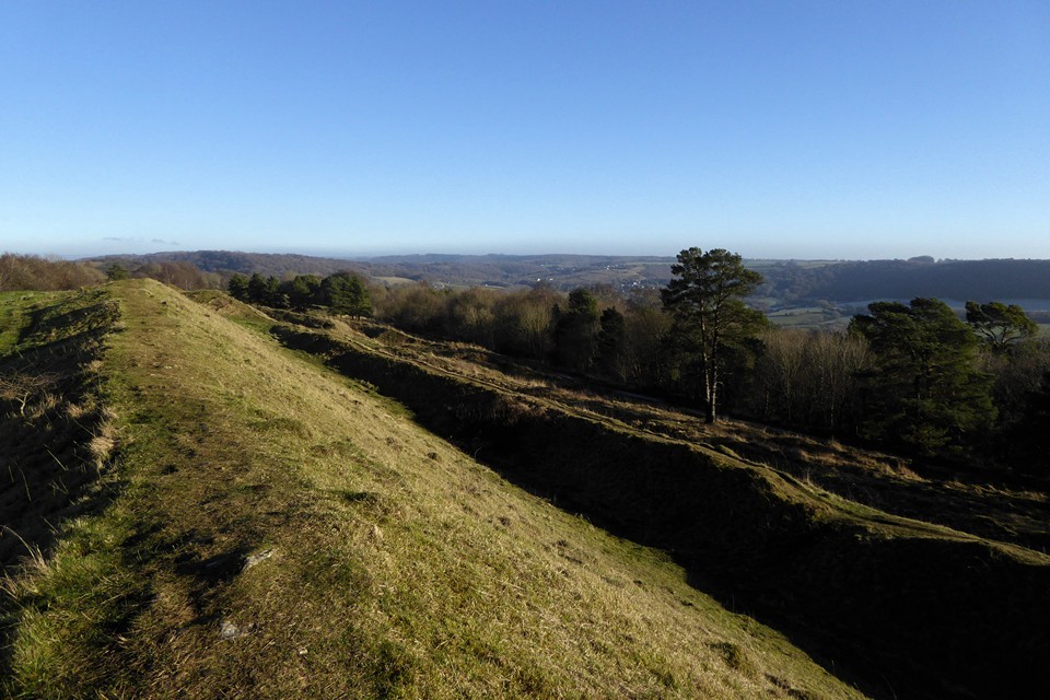
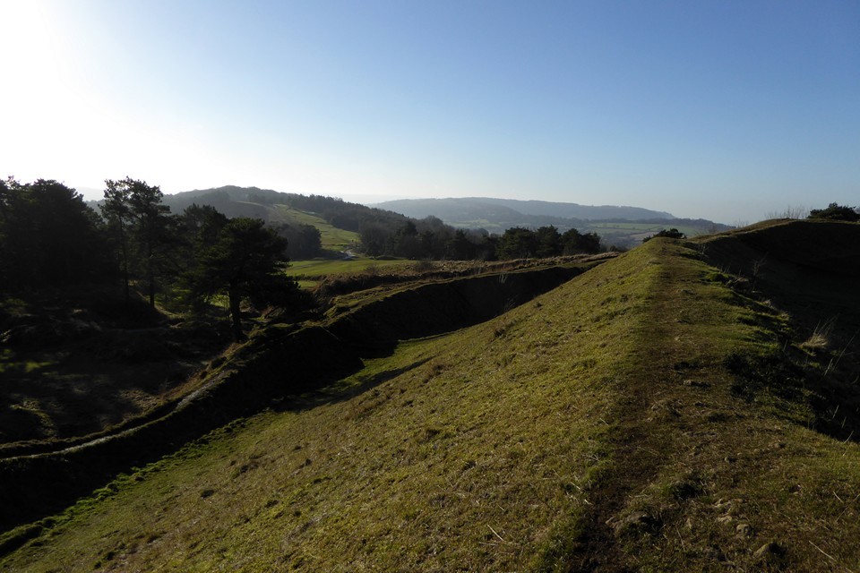
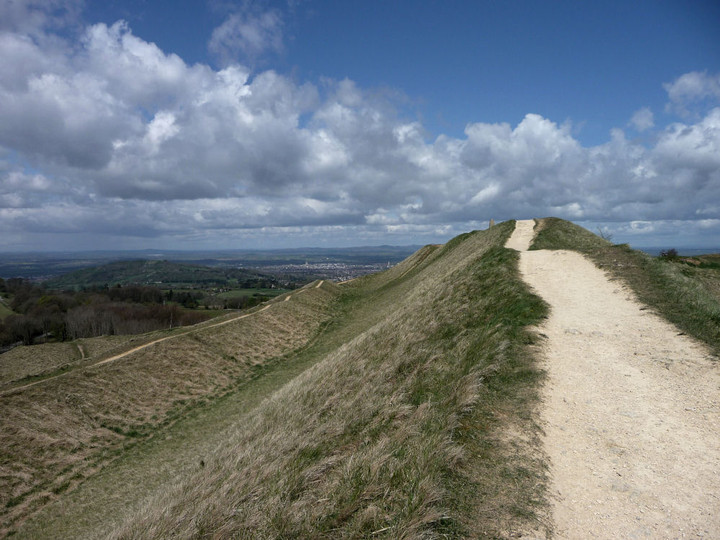
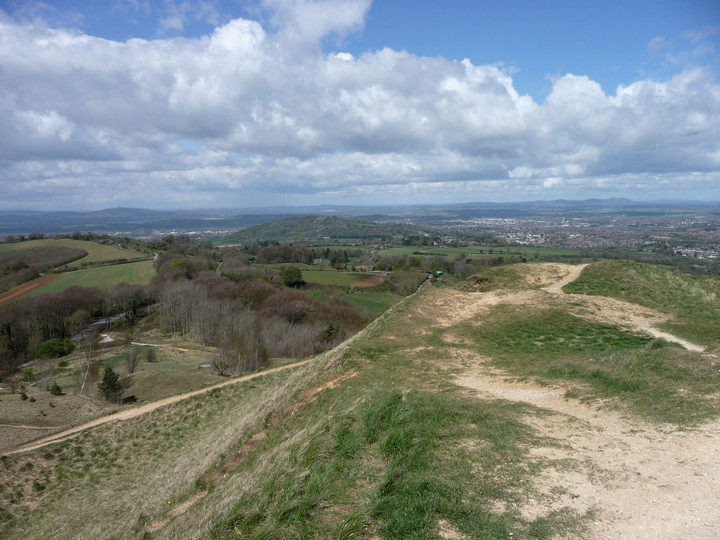
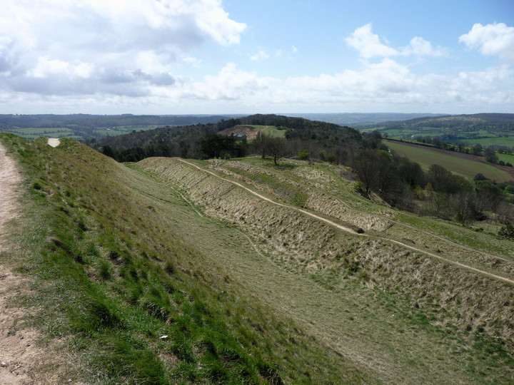
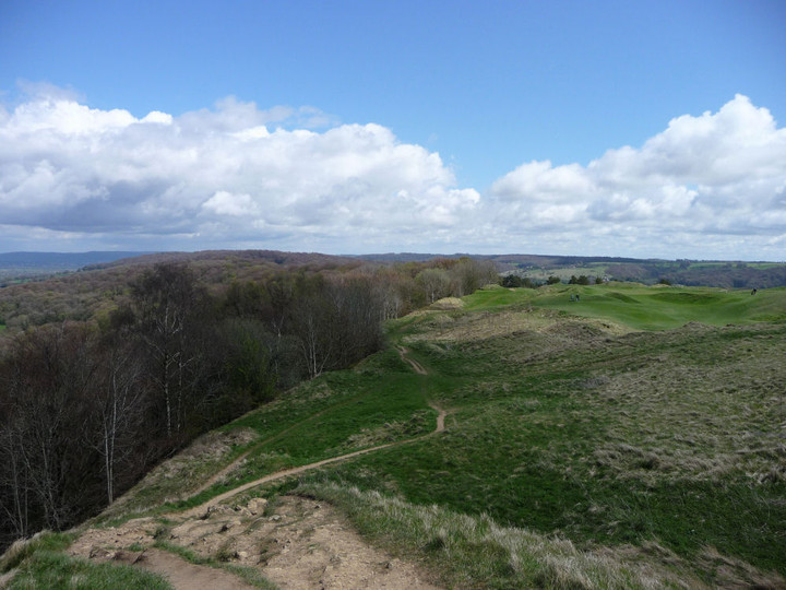
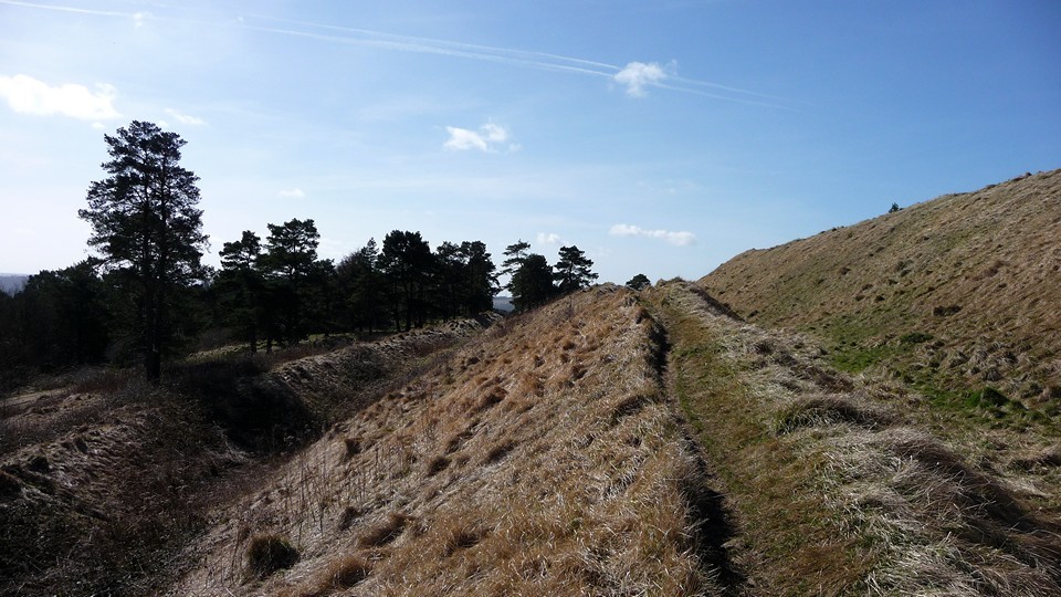
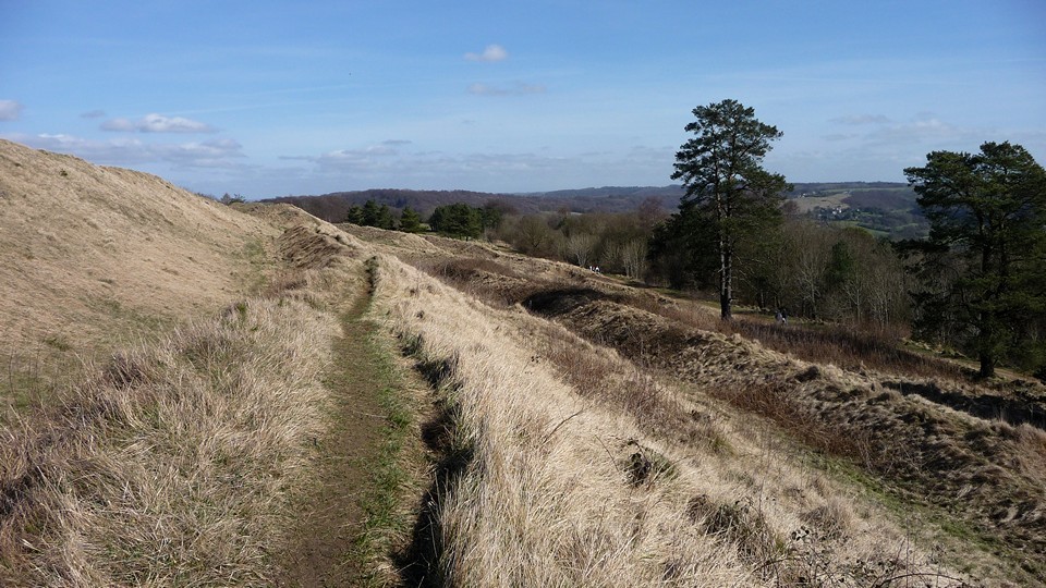
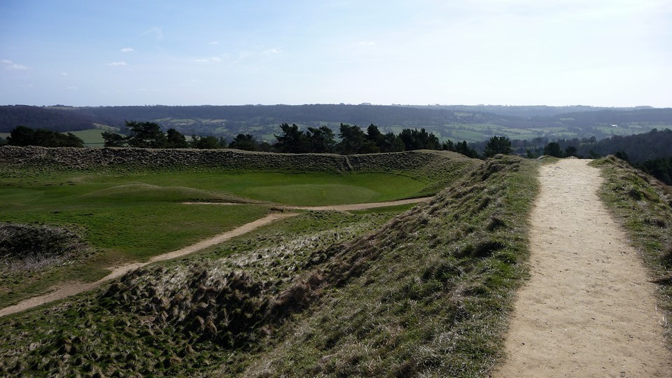
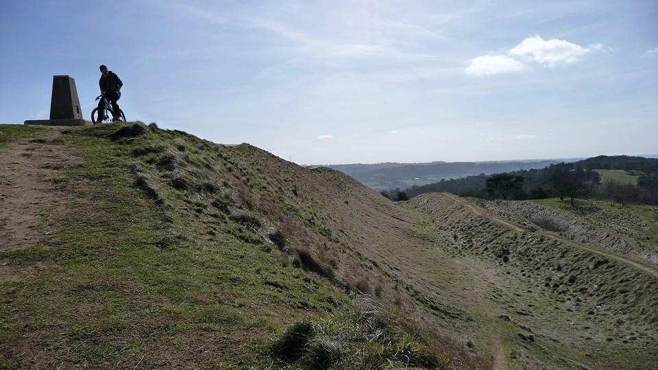
Visited 5.2.11 Painswick Beacon is signposted from both the B4073 and the A46 heading north out of Painswick. Take the relevant turning and you will soon come to a large parking area at the top of the hill. Park here and take one of the many paths which lead up to the Hillfort. I was surprised to find that a golf course has covered most of the site (I hadn't read the previous fieldnotes) but don't let that put you off visiting. The ramparts of the Hillfort are easily seen and well preserved. I found this a complicated site to work out as there are between 2 and 4 ditches / ramparts on various sides of the Hillfort. The ramparts are high – easily above head height when standing in the ditch. It is a 10 minute walk to circumnavigate the interior of the site and only a 5 minute walk from the car park. There is a Trig point on the highest rampart, with one of those signs on top showing you what you can see in the distance. Unfortunately the weather was closing in so viewing was limited although you would be able to see for miles on a clear day. Speaking of the weather, it was near gale force winds on top and (believe it or not) I had to hold on to the trig point to stop myself getting blown off my feet! In fact, I was blown off the ramparts into the ditch on the way back to the car! (Karen has the sense to stay in the car with the children) Well worth a visit when in the area – particularly if the weather is nice! |
Posted by CARL 7th February 2011ce |
|
On Saturday I walked up to Painswick Beacon and hillfort from the village of Painswick. I was surprised to find that much of the walk up towards the beacon is a golf course. Even more surprised when reaching the top, to find the golf course is also inside the ramparts of the hillfort. I understand the hillfort to be a scheduled ancient monument, is a golf course on one unusual I wonder? Terrific views, now inspired to explore some of the long barrows in Gloucestershire. |
Posted by tjj 17th August 2009ce Edited 17th August 2009ce |
|
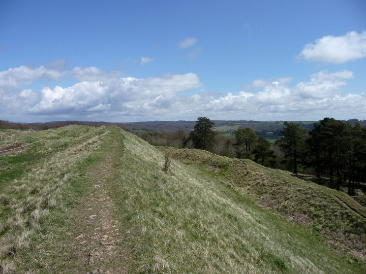
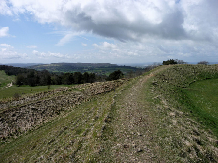
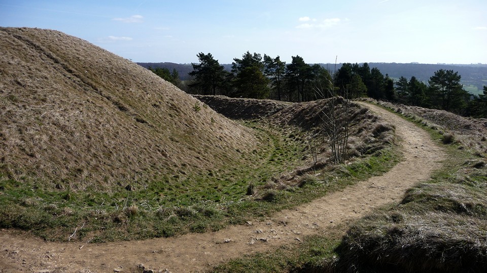
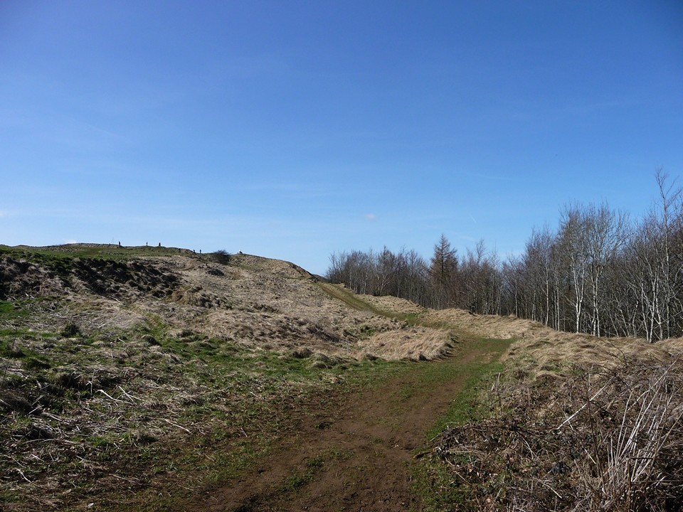
Visited on a glorious warm Spring day (15.3.2009). Approached from the NE along the Cotswold Way from Cranham Corner. This is a great hillfort, although it has a golf-course right in the middle of it. The setting is terrific, as the ground slopes away in every direction from the hillfort, especially sharply to the north and west. It was very busy there today, with golfers, walkers, cyclists and family parties enjoying the weather. Views are terrific, right across the whole of West Gloucestershire, to the south Haresfield Camp, the Severn Estuary to the SW, May Hill and Hay Bluff, to the NE the Malverns, then over the Vale of Gloucester with the cathedral and Churchdown Hill, around to the north and NE the hillfort topped Bredon Hill, Nottingham Hill and Cleeve Hill. The fort is very accessible, with nearby parking. The fort is approximately 8 acres in area, and is trully, and impressively, multi-vallate. On the north side the rampart is low as the natural scarp provides its own defence. On the south is a series of three banks enclosing deep ditches, the highest and most imposing bank being the top one - you really wouldn't want to be the attacker here! From here it's a pleasant stroll along the Cotswold Way (easy walking) down into the lovely village of Painswick, where there are several nice pubs and a few shops. The photos of the banks and ditches are dedicated to Rhiannon (yes, it's another ditch). |
 Posted by thesweetcheat
15th March 2009ce Edited 15th March 2009ce |