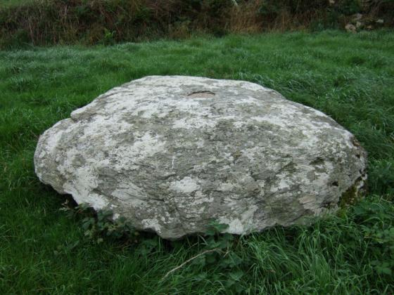
The Modern Antiquarian
Log in
|
Register
Home
Latest Posts
Forums
Maps
Help
Browse Sites
News
Blog
Contributors
The Books
Select
-
Belgium
Denmark
Eire
France
Germany
Greece
Italy
The Netherlands
Norway
Portugal
Republic of Malta
Spain
Sweden
Switzerland
United Kingdom
County Cork
Burrane
Standing Stone / Menhir
Burrane (Standing Stone / Menhir) on The Modern Antiquarian, the UK & Ireland's most popular megalithic community website. 4 images, plus information on many more ancient sites nearby and across the UK & Ireland.
Image © Michael Mitchell
Nearest Town:
Timoleague (3km SSE)
OS Ref (IE):
W467466 /
Sheets: 86, 89
Latitude:
51° 40' 10.2" N
Longitude:
8° 46' 13.82" W
Added by
Meic
Images (4)
0 discussions
Start a topic
Show |
Hide
Web searches for Burrane
Flickr
Google
Google Images
The Megalithic Portal
Bing
Stone Pages
Wikipedia
Show map
(inline Google Map)
- Sites within 20 km -
-
Barryshall (3.82km S) (7 posts)
Darrary (6.85km SW) (4 posts)
Lisnagun (6.85km SW) (7 posts)
Corravreeda (7.59km NNE) (6 posts)
Templebryan (8.29km WSW) (23 posts)
Templebryan (8.41km WSW) (0 posts)
Parkaghadallaun (9.05km NE) (3 posts)
Letter (site E) (11.52km WSW) (11 posts)
Cashelisky (11.57km WSW) (9 posts)
Knocks (East) (11.59km W) (7 posts)
Ballyvackey (12.89km WSW) (30 posts)
Ahaghilla (13.58km WSW) (13 posts)
Killaneer (13.95km WNW) (3 posts)
Coorleigh South (14.08km SW) (9 posts)
Castlelanaght (14.31km N) (31 posts)
Kilnagnady 2 (14.42km N) (1 post)
Castlelanaght (14.61km N) (6 posts)
Knockatlowig (14.7km WSW) (10 posts)
Laravoolta 1 (14.8km WNW) (2 posts)
Laravoolta 2 (14.94km WNW) (3 posts)
Kilnagnady standing stone (14.97km N) (2 posts)
Caherkirky (15.51km W) (11 posts)
Ahidelake (15.73km SSW) (3 posts)
Knockavilla (Clashanimud) (15.74km NNE) (10 posts)
Bengour West (16.07km NW) (6 posts)
Coolnaconarty (16.1km WSW) (9 posts)
Knocks (16.35km WSW) (13 posts)
Knocks S (16.6km WSW) (18 posts)
Laughtneill (16.7km NW) (9 posts)
Knocks N (16.73km WSW) (20 posts)
Knocks (16.79km WSW) (2 posts)
Derryduff (17.03km WSW) (4 posts)
Bengour East (17.43km NW) (6 posts)
Inchinattin (17.52km WSW) (2 posts)
Bellmount Upper SW (17.98km NNW) (9 posts)
Bellmount Upper NE (18km NNW) (9 posts)
Kinneigh (18.17km W) (5 posts)
Hornhill (18.2km WNW) (5 posts)
Currabeha (South) (18.22km NW) (7 posts)
Currabeha (North) (18.36km NW) (7 posts)
Sarue (18.5km WSW) (7 posts)
Bohonagh (18.62km WSW) (45 posts)
Knocknaneirk SW (18.71km NW) (17 posts)
Garranereagh (18.71km WNW) (4 posts)
Hornhill (18.76km WNW) (8 posts)
Milleennagun (18.85km W) (3 posts)
Kinneigh (18.92km WNW) (4 posts)
Milleennagun (18.94km W) (12 posts)
Ahaglaslin (18.97km WSW) (3 posts)
Knockawaddra (Muskerry East By.) (19.03km N) (9 posts)
Tinneel (19.17km WSW) (8 posts)
Knocknaneirk NE (19.18km NW) (13 posts)
Freahanes (19.2km WSW) (7 posts)
Lackanashinagh (19.33km WNW) (0 posts)
Burgatia (19.35km WSW) (5 posts)
Knockawaddra E (19.42km WSW) (15 posts)
Glanbrack (19.54km WSW) (15 posts)
Knockawaddra W (19.6km WSW) (17 posts)
Galley Head (19.89km SW) (3 posts)
Lettergorman (North) (19.94km W) (25 posts)
- Add -
-
Add news
Add an image
Add fieldnotes
Add folklore
Add miscellaneous
Add a link
-
Add a site
Add a nearby facility
Add an alternative name/spelling
Images
(click to view fullsize)
Add an image