


Fieldnotes – Visited Late July 2012
Another classic drive-by TMA site. Although these barrows lie within the parish boundary of Pewsey, they are only a field away from the Everleigh Barrow Group and should be considered as a sub-set of that group.
I really wanted to have a good look around this barrow group as it is said to have contained virtually every kind of round barrow from a Bell, Bowl, Disc, Pond, Saucer and even an elusive “Cone” barrow. As it turned out there was no direct access and I couldn’t be bothered to arrange it with the land owner. The last time I visited the area, the farm was a dairy but this time the field was full of very fat and sunburnt pigs. All their mud pools had dried up and the ones that were not in their huts were wondering around looking angrily at anything that came near them. I decided to leave my visit for another day and carried on towards Everleigh and the Plain.
Details of Barrow Group on Pastscape
A cemetery of eight round barrows which occupies a prominent position, below the crest of a south west facing spur, on the northern edge of Salisbury Plain, 320 metres south east of Down Farm. Three of the barrows survive as substantial earthworks. Of these the most northerly example is a bell barrow with a mound 16 metres in diameter and a sloping bern 5 metres wide. In the centre of the mound, which reaches a height of 3 metres, are traces of disturbance, most probably resulting from an excavation by Sir Richard Colt Hoare in the early 19th century which uncovered two burials of cremated bone. South of the bell barrow is a bowl barrow which has a mound 20 metres in diameter and reaches a height of 2.25 metres. The most southerly barrow of the group is also a bowl barrow. It has a mound 30 metres in diameter and 2.5 metres high. In a line between this barrow and the bell barrow to the north east are a further two bowl barrows. These have been greatly reduced by cultivation but are still visible as low mounds 20 metres in diameter. They were partially excavated in 1958 by Faith de Mallet Vatcher who found the remains of a wooden coffin and a disarticulated burial in the northenmost barrow and an empty grave in the other. The monument also includes the site of a further three barrows. These are no longer visible of the surface but were also examined by Vatcher who identified them as saucer barrows. The site of a further possible barrow is thought to lie in the north east corner of the group. Scheduled.
(Centred SU 18735662) Tumuli (LB). (1)
A barrow cemetery with bowl, bell, disc and pond barrows. The first known archaeological excavations were carried out by Colt Hoare. One barrow (either Pewsey 4, 6 or 7) was found to have contained a primary cremation with a bronze awl, two shale beads and part of a cup. Another barrow, listed by Colt Hoare as `Cone Barrow’ (Pewsey 3 or 5) contained a primary cremation within a cist and a secondary cremation with a small dagger (2). The pond barrow was identified by Grinsell and is visible on APs. (3-4)
Excavations took place on five of the barrows in 1958 and as a result three bowl barrows were re-identified as disc barrows, one of which contained Neolithic pottery indicating Neolithic occupation within the vicinity. (5)
--------------------------------------------------------------------------------
SOURCE TEXT
--------------------------------------------------------------------------------
( 1) Ordnance Survey Map (Scale / Date) OS 6” Prov
( 2) by Sir Richard Colt Hoare; introduction by Jack Simmons and D D A Simpson 1975 The ancient history of Wiltshire 1 Page(s)191
( 3) edited by R B Pugh and Elizabeth Crittall 1957 A history of Wiltshire: volume 1, part 1 The Victoria history of the counties of England Page(s)187, 210, 225
( 4) Aerial photograph AP OS 71/476 109, 110, 07-SEP-1971
( 5) The Wiltshire archaeological and natural history magazine F de Mallet 57, 1958-60 Page(s)339-51
( 6) Scheduled Monument Notification 14-JUL-1999
Details of Barrow Group on Pastscape
A barrow cemetery comprising of six bowl barrows, of which three remain, the others visible as cropmarks. Excavations located a cremation within one of the barrows.
(Centred SU 17655490: 4 shown) Tumuli (NR). (1)
A barrow group comprising of six bowl barrows, Everleigh 5, 6, 6a, 6c-e (SU 15 SE 67-72); six bowl barrows (no heights given, these not seen by Grinsell?). Three barrows were excavated by Thurnam (Everleigh 5, 6 and 6a) with one cremation located within Everleigh 6. (2)
Only three barrows remain but all six are visible on the Crawford AP with clear cropmark ditches, and it is evident that Grinsell’s measurements for 6c, 6d and 6e are incorrect. Barrows 5, 6 and 6a surveyed at 1:2500. Sites of barrows 6d and 6e surveyed at 1:2500 from AP. (3)
--------------------------------------------------------------------------------
SOURCE TEXT
--------------------------------------------------------------------------------
( 1) Ordnance Survey Map (Scale / Date) OS 6” Prov
( 2a) General reference WAM 6 332
( 2) General reference VCH Wilts 1 1957 174 (LV Grinsell)
( 3b) Aerial photograph AP 135 24.5.21 Crawford colln.
( 3) Field Investigators Comments F1 MHB 21-MAR-73
Everleigh Barrow Group
Details of Barrow Group on Pastscape
A Bronze Age round barrow cemetery on West Everleigh Down. The barrow cemetery comprises five barrows; two bell barrows, two bowl barrows and a disc barrow. Four of the barrows were excavated by J Thurnham between 1853 and 1857. Primary cremations were recorded in the two bell barrows. One of the bell barrows was also found to contain an intrusive Roman or Saxon inhumation. No structures or finds were recorded in the disc barrow and one of the bowl barrows. The other bowl barrow was now excavated. Ordnance Survey field investigations in April 1973 found that four of the barrows survived as earthworks, three of which were well preserved. One had been erased by ploughing.
(NB. The barrows originally recorded as part of this record have now been recorded individually, please see child records for details)
(SU 18425602) Everleigh Barrows (LB). (1)
A barrow cemetery comprising five bowl, bell and disc barrows. Excavations carried out by Thurnham located a single primary cremation in two of the barrows (Everleigh 1 and 2) one accompanied by grave goods. One of these barrows also had an intrusive Roman or Early Medieval burial. The remaining barrows proved to be unproductive. (2-3)
Four of the barrows survive as earthworks, the two bell barrows (Monument HOB UID 918546 – SU 15 NE 84 and HOB UID 918557 – SU 15 NE 85) and disc barrow (HOB UID 918569 -SU 15 NE 86) are well preserved. One of the bowl barrows (HOB UID 918572 – SU 15 NE 87) is in a poor condition. The other bowl barrow (HOB UID 918578 – SU 15 NE 88) has been erased by ploughing. (4)
The original barrow numbers were originally recorded by Goddard. (5)
Additional reference. (6)
Everleigh Barrows: A nucleated group of four barrows excavated in the 19th century. The two bell barrows produced cremations, this disc and bowl barrows were unproductive. (7)
--------------------------------------------------------------------------------
SOURCE TEXT
--------------------------------------------------------------------------------
( 1) Ordnance Survey Map (Scale / Date) OS 6” Prov
( 2) edited by R B Pugh and Elizabeth Crittall 1957 A history of Wiltshire: volume 1, part 1 The Victoria history of the counties of England Page(s)174, 209
( 3) The Wiltshire archaeological and natural history magazine 6 (1859-60) Page(s)338
( 4) Field Investigators Comments F1 JWS 03-APR-1973
( 5) The Wiltshire archaeological and natural history magazine 38 (1913-14) Page(s)252
( 6) by Audrey Meaney 1964 A gazetteer of early Anglo-Saxon burial sites Page(s)267
( 7) Scheduled Monument Notification 04-JAN-1990
Fieldnotes – Visited Early Aug 2011
Came past this site and the crop had just been harvested so went to investigate. You can just see the twin barrows from the road as they stand out from the stubble. I would imagine that this is the only time of the year they are visible as they have been ploughed down so much in the past. The current plough boy seems to show some respect for them which is more than can be said for the animal that has dug into one side of them. Clearly this would not have happened if the dreaded black hound was still about. Guess the dog gone when the MOD moved in. Went up to see the single barrow behind the wood but the field was still in wheat, so decided against destroying a valuable crop for my antiquarian curiosity. Site made a good example for the drive-by TMA.

Came across this stone in the front garden of “Rosedene” just down from the site. Only sarsen stone I saw when in these parts. None of the buildings showed any stone, only flint or modern brick. Even Ludgershall Castle was flint.






Fieldnotes – Visited Late July 2012
Like a lot of prehistoric sites, Godbury lays a forgotten relic of the past. An Iron Age enclosure, it was probably used in cattle breeding as a corral or way station between summer and winter pasture. Whatever it’s original purpose, the area is now ploughed up and planted with wheat or peas. Only the old drovers tracks, with their wide hollows remain to indicate what use this rural part of the old west once was.
I travelled up to the site by the byway which runs next to it, having skirted the bottom of the hill after visiting Old Hat Barrow. I encountered the tenant farmer at the bottom of the hill and asked a few questions about the area. He seemed mystified as to why I wanted to visit such a place but was happy enough for me to carry on with my exploration so long as I didn’t get in the way of the harvest of disturb his birds. He couldn’t tell me anything about the site or the surrounding fields. I asked about Falstone Pond but he reckoned that the pond had dried up years back when the underground aqua fore had been tapped and the water extracted. Seems that this had also reduced parts of the River Bourne to a stream too.
Godbury itself was much overgrown with scrub and decaying trees. The perimeter was planted very close with peas and after working my way round half the site, I decided it would be a thankless task to go any further into the enclosure. Defiantly a site that is best visited in the winter months when the vegetation has died back and the earthwork is more visible.
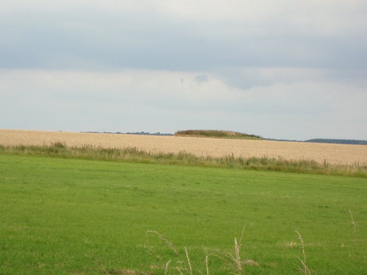
I was going to have a look at the barrow on Easton Clump, but after seeing the extent of the vegetation, I decided against it at this time.
Details of Disc Barrow on Pastscape
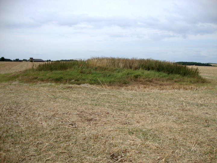
A disc barrow with an external ditch which has in the past been interpreted as a tree ring.
(SU 21085927(1)) Easton 1a, a disc barrow at Easton Clump. Dimensions: mound 68ft in diameter X 3ft high, berm 51ft wide, bank 12ft X 1ft high, outer ditch 12ft wide X 1ft deep. (2)
The barrow has the almost unique feature of an external ditch 12ft wide X 1ft deep; it looks original (1) despite the
resemblance – as it is shown on OS 6” to a tree-ring. (1-2)
The disc barrow has an overall diameter of 67.0m and a central tump 0.8m high. A modern tree ring overlies the perimeter ditch in the SE. Surveyed at 1: 2/500. (3)
Originally recorded as Easton Royal 1a by Goddard. (4)
--------------------------------------------------------------------------------
SOURCE TEXT
--------------------------------------------------------------------------------
( 1) General reference Pte 6” (LV Grinsell, 2.6.40)
( 2) General reference VCH Wilts, 1, pt 1, 1957, 218 (L.V Grinsell)
( 3) Field Investigators Comments F1 MHB 05-JUL-72
( 4) General reference Wilts Archaeol. Natur. Hist. Mag. 38, 1913-14. 249 (E.H Goddard)
Old Hat Barrow – Fieldnotes
Visited – End July 2012
Although there are a lot of round barrows around these parts, this one was the only one given a “title”. The description on Pastscape painted a picture of an overgrown mound dug into by wildlife, but it appears the site has seen some TLC since the record was made. Today the barrow looked in excellent condition, complete with protection stakes and warning signs against trenching by MOD employees.
Like most site visits, I used my bike, leaving the Marlborough road opposite Summer Down Farm and continuing down the byway past Hogdown wood and up to the Scrubs. Leaving the track, I walked along the headland, (the field boundary) and up to the edge of the wood and the barrow. The barrow was easy to see from the field, as stated, looked in very good condition.
I met a local walking his dog and asked about the second site of my visit, Godsbury. He told me that the landowner had created a “permissive path” not shown on the map and I should be able to follow this on my bike as it was wide enough for a horse, down the hill and back out onto the byway. This path follows the parish boundary, which is the dotted line shown on the O.S. map. Although the map shows several other barrows around Milton Hill Farm, I fear that they have been ploughed out but I couldn’t really visit them on this occasion as the fields were all in corn and about to be combined.
After reaching the end of the “permissive path”, I came out by a gate onto the byway and found a notice board giving details of the paths created in the area. It showed the paths connected up to The Giants Grave on Milton Hill, so you could explore a lot of the prehistoric sites from there.


