Chance

Chance

All posts expand_more 501-550 of 2,683 posts

Miscellaneous

Lark Barrow
Round Barrow(s)

Details of barrow on Pastscape

At SS 82304145 a mound is shown (2) (4) and named Lark Barrow (1) (4). The Barrow must have been destroyed and the material used in making the stone banks when the fields were enclosed in the 1850s. (3) (1-4)
There are no certain remains of this barrow, but it is possible that a segment of it survives in the angle subdivided by two field walls at SS 82284147. Here there is a grass covered mound 0.9m high, but its date relative to the field walls cannot be determined by visual inspection.Surveyed at 1:2500. (5)
SS 82284147: Exford 7. Lark Barrow listed. A segment is left in the NE angle of wall junction and the surviving part, about a quarter, is 8 yds across. (5) MacDermot (6) in 1911 wrote that there was no sign of Lark Barrow but
it formerly stood not far from the head of Spraccombe or Orchard Bottom. It was mentioned by Thomas Pearse in 1678 as one of the principal boundaries of Exmoor Forest. (6-7)
The remains of Lark Barrow are centred at SS 8229 4146. They are now overlain by a junction of field boundaries, one of which marks the parish boundary separating Exford from Exmoor.
The remains lie predominantly within Exford parish and now consist of a very slight swelling some 22 m in diameter and 0.4 m high. The mound is overlain by a farm track running adjacent to the parish boundary, south-westwards from Larkbarrow Corner. The mounding described by source 5 within the north-east angle of the field junction, may be partly caused by the field boundaries themselves, but undoubtedly contains barrow fabric. (8)

Miscellaneous

Quarter Barrow
Round Barrow(s)

Quarter Barrow

Details of barrow on Pastscape

[SS 82804748] Quarter Barrow (NR) Oare 3. A gutted bowl barrow, 17 paces in diameter and 2 1/2 ft.high. (2)
Only a rim of this barrow now remains. 1/2500 survey revised. SS 82794748. Oare 3. Gutted bowl barrow listed as Authy 2. SS 82793 47491 The remains of this barrow are in a deplorable condition. It is encroached on around the western side by thick coniferous plantation; stumps of old felled trees lie across it in the north-east and south west; its south east side is abutted by a fence and trackway and its interior is overgrown with reeds. This now makes it extremely difficult to assess and to obtain precise measurements.
It is situated on Twitchen Plain about 405m above OD on a slight saddle on the Culbone hill ridge roughly halfway between Yenworthy Common and Pittcombe Head. It is shown annotated Quarter Barrow in thick coniferous woodland on the 1889 Ordnance Survey map.
The remains now consist of a circular turf and heather-covered stoney bank about 2.2m to 3m, 0.4m high externally and 0.7m high internally, enclosing an area approximately 7.6m diameter. Several large stones are evident protruding through the bank and there is a break, about 1.7m wide in the south. Probing showed the central area was stoney and as far as can be ascertained under its present condition, it apperas to have been robbed very cleanly (through the narrow break in the south) leaving a rather neat appearnace to the inside of bank. There is no evidence of, or further information about a cist, revealed by uprooting of trees during storms and there is no evidence of the spoil.

Miscellaneous

Wick Barrow
Round Barrow(s)

Details of barrow on Pastscape

(ST 2090 4557) Pixies’ Mound (NAT) Tumulus (NR) Wick Barrow, also known as Pixies’ Mound or Burrow Sidwell, was excavated by H St G Gray in 1907. It was found to be a round mound, some 84 feet in diameter by 5 feet high, built mainly of large stones up to 2 1/2 feet in length. It contained a roughly circular walled enclosure built of dry stone, with maximum diameter of 31 1/2 feet, height 3’ 6” and thickness about 18” at the top. No central burial was found but there had been an earlier excavation at the centre, which showed as a depression. On re-excavation, it showed as a shaft, at the bottom of which was found a Roman mortarium rimsherd and a nearby coin of Constantine I. These finds are considered to be evidence of a Roman excavation into the mound, but could be the result of a later (say 19th cent.) excavation, disturbing the surface material containing the Roman objects. Three secondary crouched inhumations were found; one accompanied by a bell-beaker, a second by a necked-beaker and a third by a necked-beaker and a flint knife-dagger. Ashbee (3) describes these as eccentric cists containing, disarticulated skeletons, but there is no evidence of cists in the report. Nearer to the centre, at a depth of 18”, a mass of mixed and confused human bones was found packed close together in an oval area some 6 x 2 feet, the lias stones about them being much larger than elsewhere. This seems to be the only evidence for a possible cist in the mound. The bones represent some five adults and a child. Some of the long bones were broken and one skull was marked by impressions of woven fabric. The type of skull and unusually marked platycremism of ‘tibia’ bones in this group, led the excavator to suggest that they were
Neolithic and had been brought from elsewhere to be re-interred. A fragment of pottery found nearby and a similar fragment from
near one of the beaker burials, although thought to be Bronze Age, from the description, having finger tip and nail impressions, may well have been neolithic.
Other apparently disturbed human remains were found near the surface of the barrow, and some were found on the NE in 1880 and 1902-3. The latter were probably exposed by the tenant-farmer who began to demolish the barrow early in the 19th century but was stopped. The finds are in Taunton Museum. (2-3)
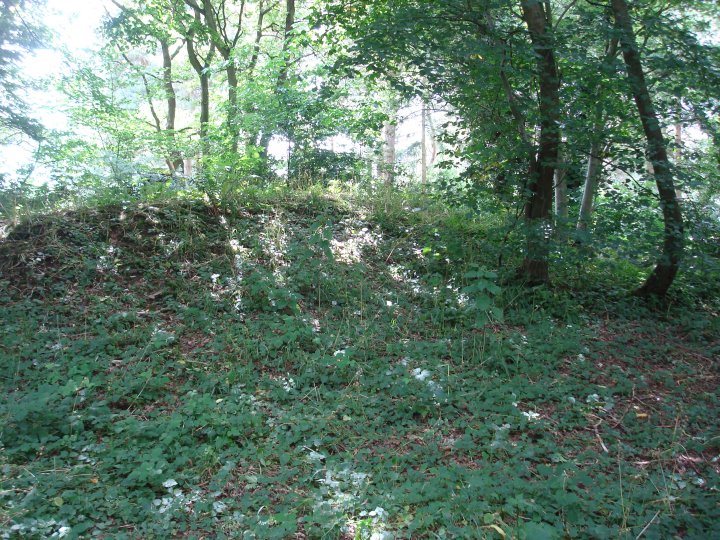
A ditchless mound now overgrown, surveyed at 1/2500. Finds seen on display at Taunton Museum. (4)
This barrow, diameter 27.0m, height 1.7m, is under an impenetrable cover of thorn. The survey of 22.10.64 has been accepted and transferred to the PFD.
An Early Bronze Age round barrow excavated by Harold St George Gray in April, August and September 1907. The excavation technique was very much of its time, and fairly typical of Gray, rendering interpretation difficult. The barrow had also suffered much disturbance – as well as ploughing and an unrecorded episode of excavation (see below), the tenant farmer in the early 19th century had attempted to level the mound before being “duly stopped”. The barrow appears to have been at least a two phase structure. At the centre, a primary mound was surrounded by a retaining drystone wall up to 3 feet 10 inches high and 31 feet in maximum diameter. The mound was subsequently enlarged to a diameter of circa 84 feet by the addition of large quantities of lias stone, some blocks up to 2.5 feet long. The central area had been disturbed by a previous episode of digging. Gray found a Roman sherd and a Roman coin within its backfill and suggested the excavation had occurred in the Roman period, suggesting that “they left the piece of mortarium and the coin as evidence that they had “rifled this part of the barrow”. It seems more likely that the excavation was of rather more recent date, the Roman finds suggesting that some deposit of that date had been disturbed as well as the earlier occupants. This earlier episode had clearly disturbed the burials within this central mound. Large quantities of fragmentary human remains were found throughout its fill, while 1.5 feet below the surface was a mass of mixed bones representing at least 6 individuals. 3 secondary crouched inhumations, all adult males and each accompanied by a Beaker, were found within the central area at relatively shallow depths, but undisturbed by the earlier excavation. One was also accompanied by a flint dagger and flint knife; another by a group of flints including 4 scrapers. Other finds fromthe mound included potsherds, flints and further fragmentary human bones. Human remains had been found on and around the barrow on at least three occasions prior to the excavation – circa 1880 a Mr Rawlins found part of a skeleton beneath a large slab of lias; in 1902-3 a Mr House found further human bones, and according to Gray he “authenticated his previous ‘find’ by digging out, with our permission, other bones close to the surface, in the same position, during the time of the excavations”; and Gray also adds that “human bones were found in draining the field”. (2)

Miscellaneous

Rexy Barrow
Round Barrow(s)

Details of barrow on Pastscape

[SS 77024196] Tumulus (NR) SS 770419 Rexy Barrow, round barrow, Little Buscombe. Scheduled. This is a large undisturbed bowl barrow (Grinsell’s Exmoor No. 5) See GP AO/65/128/6 1/2500 survey revised. (3)
Rexy Barrow (NR) (4) SS 77024195. Exmoor 5. Bowl barrow 20 paces diameter 3.5 ft high. Visited by Grinsell and Charles Whybrow 22 May 1961. It is marked as Rexy Barrow on the 1 in. OS Exmoor Tourist Map 1967, which may possibly be another form of Exaborough on a 17th century name.
Rexy Barrow is centred at SS 7702 4196. It lies on the spine of Great Buscombe ridge at 441m above OD, and has extensive visibility to the east, and also southwards towards Ashcombe. To the north-east it has an open aspect towards Lanacombe, whilst to the north views are obscured. Westwards the peat covered plateau known as “The Chains” is visible.
The barrow is well preserved, with a diameter of 18m and a summit diameter of 11.5m). It has steep, well defined sides 1.2m in height and a flat top. There is no evidence for any excavation or robbing, although the surface of the barrow is uneven, possibly due to the passage of animal and other traffic over and around it – there are certainly marked tracks leading to the barrow from the north-east and south-south-west.
It is covered in a mixture of moor grass and reeds, and a pronounced swathe of reeds around the mound may indicate the presence of a silted ditch, although there is now no earthwork evidence for it. (8-9)
The barrow described above is clearly visible on aerial photographs as a substantial mound surrounded by a crop mark ditch. It lies within an extensive area of 19th century drainage ditches constructed by the Knight family as part of their land improvement attempts, and it is not clear whether this activity has affected the monument (10).

Miscellaneous

Thorncombe Barrow
Round Barrow(s)

Details of barrow on Pastscape

[ST 1274 3941] THORNCOMBE BARROW [G.T.] Thorncombe Barrow, Bicknoller, round barrow, scheduled (2), one of the best specimens in the neighbourhood. A ditched bowl barrow, 1.7m high: the ditch is no more than, 0.2m deep. A shallow depression has been dug into its top. (See G.Ps AO/65/122/7 & 8) Published 1/2500 survey revised. The possible Bronze Age bowl barrow, described above, is situated on top of Thorncombe hill at 332m above OD. It has been recorded on aerial photographs and is visible as an amorphous mound with a diameter of 21m.
(5-7) Thorncombe Barrow is a large Bronze Age barrow on a spur to the northwest of the summit of Thorncombe Hill at ST 12732 39416. The barrow comprises a large circular mound, 17m in diameter and 1.3m high. The mound has a flat top which has a deep hollow in its centre, 6m x 4m x 0.9m deep. A ditch, 3.5m wide and 0.8m deep runs around the mound. A small causeway across the ditch on the southeast side of the barrow is probably a later feature. The barrow lies in an area of early post-medieval relict field system. The barrow was recorded using differential GPS as part of the EH survey of the Quantock Hills AONB (8).

Miscellaneous

Hangley Cleave
Round Barrow(s)

Details of barrows on Pastscape

(SS 74753620 & SS 74863622) Two Barrows (NR) (SS74713631) Tumuli (NR) (One of two, the other in Devon, SS 73 NW 12) (1)
Exmoor No 16, SS 74713621, a bowl barrow 22 paces diameter and 2 ft. high.
Exmoor No 17, SS 74753620, a bowl barrow with OS trig pillar on top.
Exmoor No 18, SS 74863622, a bowl barrow 18 paces diameter and 1 ft. high, small hollow in centre. (2)
Grinsell’s 16 and 18 are both truncated bowl barrows. 17 is a bowl barrow with a hollow in the centre. An excavation trench runs across it from SW to NE. Published survey 1/2500 revised. (3)
Exmoor 16, 17 and 18. Bowl barrows listed, details as Authy 2,among Two Barrows group. Exmoor 16 visited by Grinsell 23 May 1961, Exmoor 17 and 18 Visited April 1949. Named Twoburroughs in 1632. (4)
SS 74783622. A group of three barrows is situated about 482m above OD on the summit of the ridge between Hangley Cleave on the north and Fyldon Common on the south. The road from Kinsford Gate to Sandyway Cross crosses the southern part of the ridge and the Devon/Somerset County Boundary runs along the northern side of this minor road. The fairly level summit of the ridge is covered with rough grass and reeds; there are excellent views; southwards across to Dartmoor, westwards to Barnstaple Bay, north to the Chains ridge and eastwards to Dunkery Beacon.
SS 7470236210. Barrow A, nearest the road, is visible as a rather amorphous turf-covered earth and stone flat-topped mound about 21m NW/SE by 13m and 0.9m in maximum height. The SW side has been truncated by the boundary wall, its ditch and the road, so the barrow is not complete. There are at least three quarry holes in the interior of the barrow which suggest robbing, possibly for the wall. There in no evidence of a surrounding ditch to the barrow. The barrow was used as a marker for the County Boundary and the Exmoor Forest (5).
SS 74743 36208. Barrow B, the most apparent of the group, is evident as a mutilated earthen mound varying in diameter from about 18m NW/SE to 19.8m NE/SW and 2.1m in maximum height. The barrow has a central ‘excavation’ hollow , 2m in diameter and 0.4m deep. Spoil from this hollow has been dumped around the summit creating an irregular false top which obscures the original flat top which must have been about 1.7m high. As well as the central hollow an excavation trench, 2m wide and 0.8m deep, has been cut into the barrow from the WSW. A similar though less well defined linear hollow, 1.5m wide, 0.4m deep, through the east side suggests a continuation for this excavation across the barrow. An apparent backfilled trench, 1m wide and 0.2m deep, in the NNE may be no more than a path over the barrow. The trenches do not appear to have sectioned the ditch, which is visible as a band of reeds about 2.5m wide around most of the perimeter. The barrow has been used as a viewpoint and there is some erosion caused by walkers up its south side.
On the 1889 (6) and 1904 (7) Ordnance Survey maps a Triangulation Point is shown on the SE summit of the barrow although there is now no evidence of one as stated by authority 2.
SS 7485636225. Barrow C, the most easterly, is visible as a low earthen grass and reed-covered flat-topped mound varying in diameter from 15.5m NE/SW up to 16.5m E/W and 0.5m in maximum height. The southern half of the barrow is mainly covered by dense reeds. A small hollow, about 2m in diameter and 0.4m deep, near centre in the NW suggests it has been dug and the spoil spread around giving a rather uneven surface. There is no trace of an accompanying ditch, however probing revealed softer peat around the periphery suggesting that there was one which has now become completely silted.
Barrows A and C are clearly disc type barrows whilst B is distinctly of the flat-topped bowl type. The barrows are a Scheduled Monument: Somerset County No: 170. (7)
*Note: On the 1889 (5) and 1904 (6) editions of the Ordnance Survey maps the name Two Barrrows appears between barrows B and C. This has, unfortunately, given the name to the whole group which is a misnomer as it actually contains four barrows; A,B & C, as above, on the Somerset side of the boundary and a fourth barrow at SS 7463 3621 treated separately as SS 73 NW 12) on the Devon side. (5-9)
The barrows described above are clearly visible on aerial photographs as earthwork mounds either side of the Devon/Somerset county boundary. A fourth barrow (see NMR UID 35046) which lies in Devon has been recorded separately as a result of this, but is more than likely to be part of the same group (10).
NB. The Somerset HER has numbered the barrows individually. The HER numbers are as follows; barrow A; 33020, barrow B; 33018 and barrow C; 33019.

Miscellaneous

Chains Barrow
Round Barrow(s)

Details of the barrow on Pastscape

[SS 73454190] Chains Barrow (NR) Chains Barrow (Exmoor No. 2), is 25 paces in diameter and 6 ft high: there is an OS trig pillar on top. Scheduled (3). (2,3)A large bowl barrow apparently undisturbed except by the OS trig pillar. See GP AO/65/129/3 Published survey (1/2500) revised.
Exmoor 2. Chains Barrow listed, details as Authy 2. Visited by Grinsell 8th Sept 1959. This or Exmoor 3(SS 74SW 5) may have been called Exaborough in the 17th century (7). It is known as Cheyne Barrow in 1653. (6,7)
SS 7345741904. Chains Barrow is prominently situated in an area of grassland on the summit of The Chains ridge about 485m above OD. There are panoramic views; NW to the Chapman, Longstone and Wood Barrows, E to Alderman’s Barrow and Dunkery Beacon, and triangulation pillar is set into the summit slightly SW of its centre and the base is eroded to a depth of about 0.2m into the barrow.
The barrow is evident as a turf-covered, flat-topped earth and stone mound of 1.7m maximum height and varying in overall diameter from 23.6m N/S to 24.8m E/W. Its sides are badly eroded in places probably by sheep. There is a distinct change of profile at the edge of the flat top which is some 15.5m in diameter. Although there is no documentary evidence for excavation the uneven surface of the summit area suggests spoil may have been backfilled and consolidated to support the trig pillar. There are traces of a surrounding ditch, about 2m wide and 0.2m maximum depth, evidenced by a shallow rush-filled hollow around the periphery.
The barrow is a Scheduled monument (a) and is surrounded by peat cuttings which have come close to the ditch on the SW side. It has been enclosed by a fence to protect it from sheep and cattle however this is too close to the rim of the barrow, actually encroaching on the outer lip of the ditch, and it is causing an erroneous edge to the feature, especially around the S arc.

Miscellaneous

Black Barrow
Round Barrow(s)

Details of the barrow on Pastscape

Black Barrow, centred at SS 8321 4421, is a substantial, circular, earth and stone mound, now mutilated by a field wall. The barrow has panoramic views, especially in a westerly direction. It is 22 m in diameter and 1.5 m high.
The barrow has been considerably damaged by a west-east field wall which approaches it from the west, and turns northwards at its centre. The wall has been created from the barrow fabric itself, whilst its flanking ditch has cut into the barrow. The result is that the southern arc of the barrow survives intact, and is probably the best preserved part. The north-western quadrant lies within the angle of the field wall and has been considerably reduced. The eastern arc tapers northwards to only 0.4 m high, and has probably been robbed. No trace of a flanking ditch around the barrow or kerbing is visible.

Miscellaneous

Bendels Barrows
Round Barrow(s)

Details of the barrows on Pastscape

((SS 85494106 & SS 85374093) Bendels Barrows (NR). Exford 3. At SS 85354093 is a mutilated bowl barrow 25 paces across by 2ft. high. Exford 4. At SS 85484106 is a bowl barrow 12 paces across by 2ft. high. Scheduled.
Two round barrows, both of turf construction, are situated on a broad hilltop at about 460 metres O.D., but due to their very low profile, neither can be seen from a distance.
SS 8538 4092. Exford 3. Not published on O.S. maps after 1965, this barrow has a diameter of 22 metres and is 0.4 metres high. A perimeter cropmark suggests that it might originally have been 26 metres across. The sides and top have been dug into by peat cutters whose former activities are much in evidence all over the hilltop, and a cutting for 12 metres around the northern side has produced a ditch, 5 metres wide and 0.2 metres deep.
SS 8549 4107. Exford 4. A cropmark suggests the possibility of an original diameter of 20 metres but there is now only a platform measuring 13 metres across east to west, and 15 metres north to south. It is 0.2 metres high, with a mound 6 metres in diameter and 0.5 metres high set off-centre and towards the southern part of the platform. It is uncertain whether there has been turf digging around this barrow or not but the structure itself certainly seems unmolested. Neither barrow is to be classified as a disc barrow (the platform and mound is a fairly common south-western type), and the S.M.R. field observations and descriptions (S.M.R. source 5) have been transposed.
Both are known locally as Bendels Barrows. (11)

The remains of a two round barrows on Exford Common, known as Bendels Barrows, are visible as earthworks on aerial photographs of the 1940s onwards. Using the terms employed by the above authorities, the Exford 3 barrow is centred on circa SS 85374092 and on aerial photographs of 1947 appears to be circa 22 metres in diameter. It is less visible on later aerial photographs. The Exford 4 barrow is centred on circa SS 85494107 and is visible as an earthwork 13 metres in diameter on aerial photographs of 1947, although as suggested above, disturbed vegetation within 5 metres of the mound may indicate a cropmark suggestive of a berm, potentially extending the monuments original diameter to 22 metres. Damage to the mounds by peat cutting is not apparent on the aerial photographs, but extensive turbaries are evident in the immediate area. (13, 14)

Miscellaneous

Alderman’s Barrow
Round Barrow(s)

Details of barrow on Pastscape

[SS 83674233] Alderman’s Barrow (NR) Alderman’s Barrow, round barrow. Scheduled. Grinsell’s Exford No 1, a bowl barrow 29 paces in diameter and 4.5 ft high. This is a disturbed bowl barrow. It is 1.4m high and has had a hole 0.7m deep dug into its top. (See GPs AO/65/138/7 & 8 Stereo pair). Resurveyed at 1:2500.
The name Alderman’s Barrow is a corruption of Owlaman’s Barrow, and before that it was known as Osmund’s Barrow. (4-5)Exford 1. Alderman’s Barrow listed, details as Authy 3. It was named Osmundesburgh and variants in boundary perambulations 1219 – 1301, known as Owlaman’s Burrow from 1651 to 1815 and as Alderman’s Burrow or Barrow from 1782 onwards. (6)
Alderman’s Barrow lies at the north-west end of Almsworthy Common, on the boundary of the parishes of Luccombe, Porlock, Exford and Exmoor. It comprises a turf-covered, circular, flat-topped, earth and stone mound, 24 m in diameter, north-south, by 22 m; it is 1.4 m high. The barrow is largely intact and in good condition, and is now covered in dense heather and bracken.
Several activities have taken place to disturb the original form of the barrow:
1. The creation of a road on its north side has clipped the edge of the barrow.
2. A sharp-sided, irregular pit, some 8 m across and 0.7 m deep has been dug into its centre.
3. There is an area of disturbance in the area of the south-west quadrant, in the form of a narrow trench which follows the base of the barrow scarp.
Both 2 and 3 are probably the result of undocumented antiquarian activity, but may also be the product of robbing. Certainly 3 appears to be an attempt to ascertain whether the barrow has an encircling kerb.
Some 4 m from the barrow on its north-west side is an Antiquity Star put up during WW2 to alert gunnery crews on the nearby ranges to the fact that an archaeological monument existed.
Alderman’s Barrow was surveyed during July 1996 as part of RCHME’s West Exmoor Project.(7-8)

Aldermans Barrow is a substantial earthwork clearly visible on many of the aerial photographs assessed as part of the Exmoor National Park National Mapping Programme (NMP) survey.
The truncation of the northern edge of the earthwork and the central depression are apparent from the air, but the more subtle damage described above is obscured by the pervasive vegetation cover. (9-10)

West Kennet Long Barrow

Long Barrow

Equinox Sunbeams in WKLB

Twice yearly, around the time of the Spring and Autumn Equinoxes, the rising sun sends a ray of light into this 5,650 year-old monument.

The spectacle is visible for a week or more either side of the actual Equinox and the light takes a slightly different course through the barrow each day.

Clear sunrises are not common: this was the only one of September 2013.

Video by Steve Marshall

Link

Stonehenge and its Environs
Travelling to Stonehenge – The wheels go round and round

Connecting Wiltshire web site with pdf download map of Salisbury to Stonehenge area.

connectingwiltshire.co.uk/wp-content/uploads/2014/05/Salisbury-to-Stonehenge_web.pdf

Contains detailed information of all bus stops, service times and routes, together with cycle routes, walking routes, cafe/restaurants and toilets.

Covers Salisbury, Old Sarum, Amesbury, Durrington, Larkhill, Strangeways and Stonehenge.

Get to see what Obama missed – for free

As part of the national heritage open days scheme, Wiltshire Museum will be open for free to the public this Saturday, 13 September between 1000-1700

heritageopendays.org.uk/directory/wiltshire-museum

The Museum and Library have been at their current location in Long Street since 1873, occupying first the old Victorian Devizes Grammar School, then the two Georgian houses on either side of the Entrance Hall. Further extensions have increased its size to the present day. It has overseen many of the famous excavations on Salisbury Plain and the Marlborough Downs made by the Cunnington family and is a repository of the artefacts and writings of earlier antiquaries such as Sir Richard Colt Hoare of Stourhead House.

Wiltshire Museum
Long Street, Devizes, Wiltshire, SN10 1NS

Free open Days – 11 to 14 Sep – UK Wide

Find out what’s open in your local area – Every where listed is free for the day!

heritageopendays.org.uk/directory/advanced-search

For more information about the European Heritage Days, visit www.ehd.coe.int

In the UK, there are altogether five open day schemes that are part of European Heritage Days:

England: Heritage Open Days (11-14 September 2014)
London: Open House London (20-21 September 2014)
Scotland: Doors Open Days (every weekend in September)
Wales: Open Doors (every weekend in September)
Northern Ireland: European Heritage Open Days (13-14 September 2014)

Heritage Open Days was established in 1994 as England’s contribution to the European Heritage Days.

A joint action by the Council of Europe and the European Commission, the scheme was initiated in 1991 by the Council of Europe to raise appreciation for Europe’s rich and diverse cultural assets and their need for care and protection. The central principle was as simple as it was compelling: to throw open the doors to historic monuments and buildings, in particular those normally closed to the public. One of the key requirements was to offer free access to all properties taking part in the European Heritage Days.

Today, European Heritage Days are held annually in September in 50 signatory states to the European Cultural Convention. From the Baltic to the Balkans, from Iceland to the Iberian Peninsula, thousands of events not only highlight the dazzling diversity of Europe’s heritage, but also its intercultural links. As varied as the cultural landscapes are the approaches in putting the idea into practice.

Hartshill Barrow

Visited July 2014

Not much more to add to the fieldnotes below. Very neglected round barrow with rabbit burrows on one side. Center clearly dug into with no attempt to repair. Barrow made up of stones and loose earth. On an old O.S. map of the area, two tumuli are marked, the other being further down the hill, next to the road, but this is not recorded on pastscape or the later O.S. maps.