The Devils Ditch as it runs up through Tidworth area

The Devils Ditch as it runs up through Tidworth area

The Devils Ditch as it runs up through Tidworth area

The Devils Ditch as it runs up through Tidworth area

The Devils Ditch as it runs up through Tidworth area


Although most of the barrows survive, some have suffered damage from tree roots and others have been dug into by the wildlife.

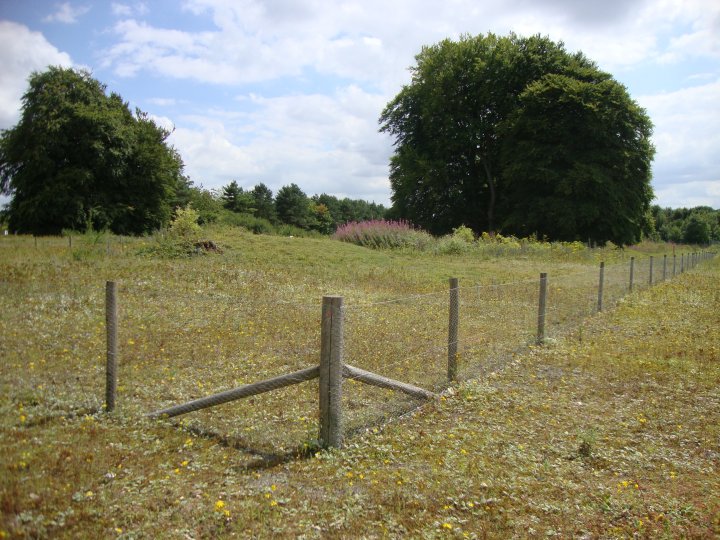
The barrows are now protected by a rabbit proof fence and “no trenching” signs.
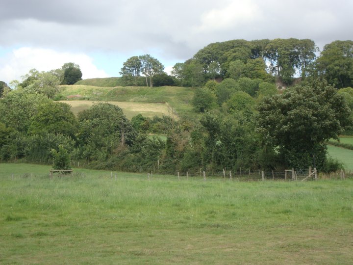
Overall view looking down the line of barrows

The barrows are just visable above the surrounding vegitation.

Sidbury hill from the old coach road and the barrows

View looking down the valley from the top of the Barrow.

View showing the extent of the surrounding ditch. The original ditch was probably re-dug when the parkland was ‘landscaped’ and the barrow added to.

The profile of the mound displays a distinctly stepped line, the result of the construction of a second conical mound on top of the original rounded mound. This alteration may be associated with the gentrification of the area, and was intended to provide a prospect mound from which to view Lake House and its parkland.

The profile of the mound displays a distinctly stepped line, the result of the construction of a second conical mound on top of the original rounded mound. This alteration may be associated with the gentrification of the area, and was intended to provide a prospect mound from which to view Lake House and its parkland.


View looking towards the Long Barrow from the East

Overall view of the 182 ft Long Barrow from the West

View of the Western side ditch with the perimeter of posts

View of the Eastern side ditch with the perimeter of posts

View of the Western side ditch with the perimeter of posts

View of the concrete Trig Point and red firing range warning flag

View of the Eastern side ditch with the perimeter road. Park on this side of the Barrow to avoid the convoy traffic

View of the Eastern side of the Barrow looking towards the training area

View of the past damage caused by a tracked vehicle riding up the spine of the barrow before any protected posts were installed.

Detail of the northern part of the complex from the report, Excavations at Dorchester, Oxon 1951.

The Big Rings Henge and other crop marks In the 1930’s prior to the areas destruction.

View of the Dykes and crop marks plotted onto a map of the area in the 1930’s

View of the northern end of the cursus and site I in 1933

The cursus, big rings henge and other crop marks plotted onto a map of the area in the 1930’s prior to the areas destruction.

“In the accompanying plan the stones above ground are shaded; and (for the sake of distinctness) all the stones are given on a much larger scale than they really are, in reference to the diameter of the circle, which is drawn on the scale of a quarter of an inch to sixteen feet.”
From “Guide to the British and Roman Antiquities of the North Wiltshire Downs” by Revd. A. C. Smith, M.A. – 1884

Veiw of the Henge from the old coach road. Since being fenced off by the posts, it has become a bit more definded, but there is still not much to see here.

Since being fenced off by the posts, it has become a bit more definded, but there is still not much to see here.

Neo
Salisbury & South Wiltshire Museum’s Neolithic Man. Poor example, not a heavy worker this one.

Memorising the Landscape – 8500-7650 BC Mesolithic Hunter gathers
An artistic representation of the Stonehenge Totem Poles as displayed in Salisbury & South Wiltshire Museum. Each of the three postholes has a different version of what the site might have looked like. This may have been over a long period of time and several generations of different people, perhaps as a migration point when following herds of ancient animals.

The Ancestor and the Stonehenge Holiday Inn
www.armetalcraft.co.uk
hisalisbury-stonehenge.co.uk/?src=ppc_googleuk_brand

The Little Cressingham barrow gold plate – 3.5 x 2.25 inches c.1,700 BC

Drawing of the Clandon Barrow Lozenge

Gold rectangular plate as shown in Ancient Wiltshire, Vol.1
On display in the Wiltshire heritage Museum, Devizes.
Stourhead Collection – Accession number: DZSWS:STHEAD.53
Plaque / ornament
1 ornament (?) of thin gold leaf, engraved with chevron and parallel lines in bands with cross-hatched lines forming margins, originally covering a plate of wood, found with a secondary (?) cremation in bowl barrow Upton Lovell G2e, excavated by William Cunnington
Length 144 mm; width 68 mm; height 2 mm
For a colour picture see –
wiltshireheritagecollections.org.uk/index.asp?page=image&id=41192


The well presented and neatly trimed side of Ratfyn Barrow

Ratfyn Barrow as viewed from London Road