Slewcairn Long Cairn

markj99

The River Camel flows past the Slaughter Bridge Stone.
Image credit: Mark Johnstone

The Slaughter Bridge Stone lies beside the River Camel.
Image credit: Mark Johnstone

A recumbent triangular stone located within 5 yards of the earthfast triangular stone. Are they stones shaped by man?
Image credit: Mark Johnstone

A squat triangular stone located in the vicinity of Sibleyback Menhir.
Image credit: Mark Johnstone

The narrow edge of Sheffield Menhir.
Image credit: Mark Johnstone

The boundary wall is built around Sheffield Menhir.
Image credit: Mark Johnstone

Sheffield Menhir overgrown by ivy.
Image credit: Mark Johnstone

A cluster of small Cup Markings on Rubha Charnain Panel.
Image credit: Mark Johnstone

Double Cup Marking found on Rubha Charnain panel.
Image credit: Mark Johnstone

Interpretation panel of Roches Moutonnees at Dulnain Bridge.
Image credit: Mark Johnstone

A line of Roches Moutonnees viewed along the shallow slopes.
Image credit: Mark Johnstone

The broad humpback top of a Roche Moutonnee.
Image credit: Mark Johnstone
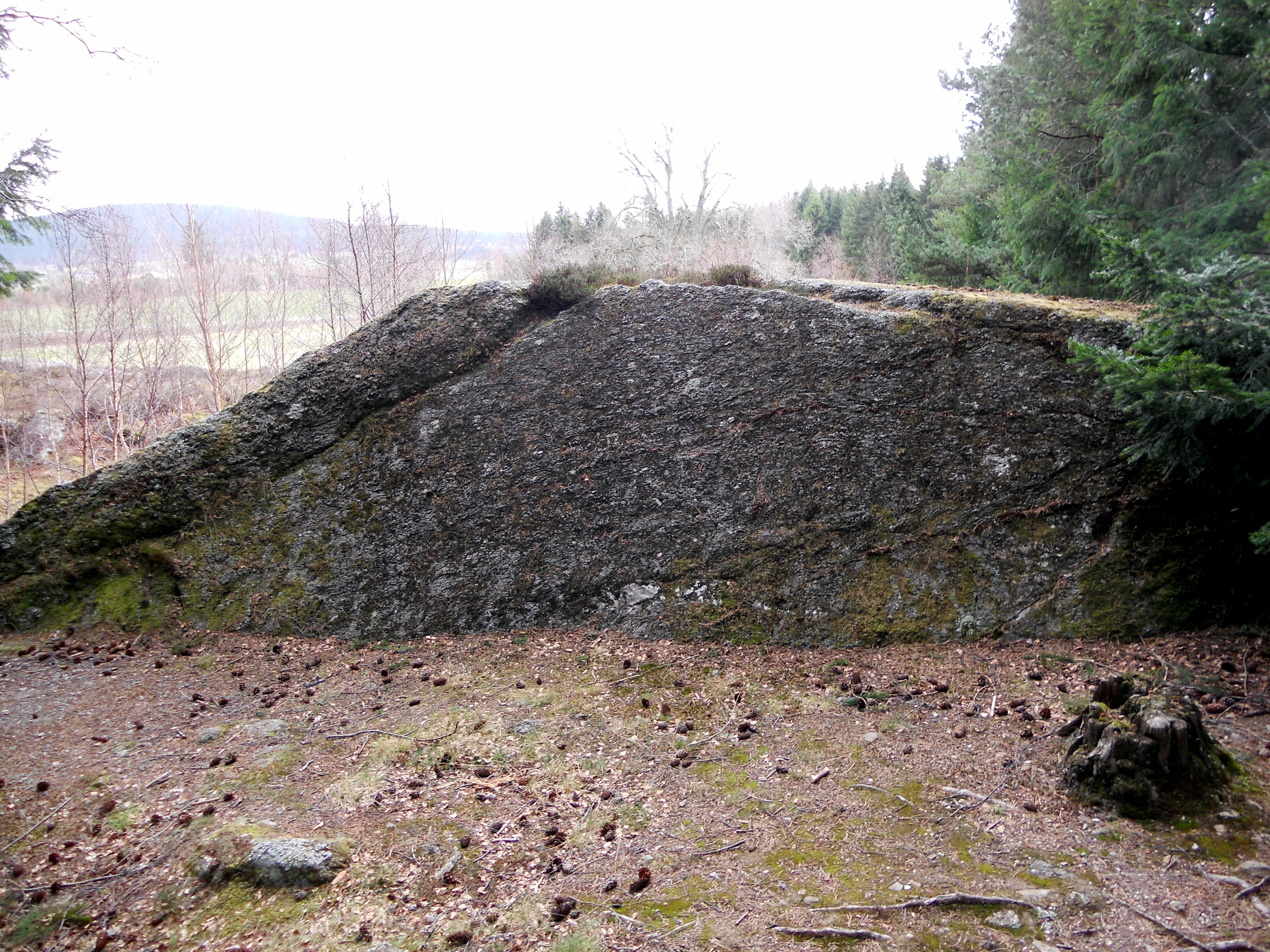
A view of the steep lee side of a Roche Moutonnee.
Image credit: Mark Johnstone
On the Eastern edge of Dulnain Bridge, a village in Strathspey, there are some unusually shaped rocks known as Roches Moutonnees. The term describes rocks which have been shaped by the passage of a glacier. The characteristic shape is a smooth shallow slope in the direction of the glaciers advance with a steep edge in the lee of the glacier. About 18000 years ago Dulnain Bridge was covered by a vast ice sheet moving E and measuring up to 700m deep.
These rocks are small examples of the form which is found throughout the Cairngorm area. Ord Ban near Aviemore is a massive example, reaching up to 428 metres high.
Directions: There is a lay-by at NJ 0021 2497 on the E edge of Dulnain Bridge. A short path leads to the Roches Moutonnees.

Several Cup and Ring Marks are evident on Robin Hood’s Stone directly above the plaque.
Image credit: Mark Johnstone

The narrow edge of Redhouse NE, measuring up to 1.5 feet, supports the capstone theory.
Image credit: Mark Johnstone

The broad face of Redhouse NE resembles a capstone.
Image credit: Mark Johnstone


The narrow side of Redhouse SW measures almost 2 feet.
Image credit: Mark Johnstone

Redhouse SW is a squat classically shaped standing stone, tapering to a thin rounded point.
Image credit: Mark Johnstone
Redhouse Standing Stones are c. 100 yards apart in adjacent fields. There is no line of sight between them and they are dissimilar types of stones. They lie at SW and NE on the compass.
Redhouse SW is a classic standing stone shape with a large cross-section tapering to a thin rounded top.
Redhouse NE is a broad thin earthfast slab. Bladup thought it was originally a capstone which has been erected upright. I would agree with this theory. It could be the only remaining stone of a ploughed out chambered cairn set upright as a rubbing stone.

A large, probably natural, hollow near the top of Ravenswood Avenue Standing Stone.
Image credit: Mark Johnstone
Street View of Rangag West

Rangag West Standing Stone viewed from W.
Image credit: Mark Johnstone

Rangag West Standing Stone viewed from N. The c. 10 degree lean and the ovine guards are evident.
Image credit: Mark Johnstone

Rangag West Standing Stone viewed from E. Note the packing stones at the base.
Image credit: Mark Johnstone
Rangag East (Rhianacoil) Standing Stone
Rangag West Standing Stone
Rangag West Standing Stone is erected c. 30 yards N of Rangag Farm on the A9, about 7.5 miles N of Latheron on the A9. The tall stone can easily be seen from the A9, 40 yards to the E.
The stone is a square pillar measuring c. 9.5 feet high with a 2.75 x 2.75 feet cross-section according to Canmore ID 8274 (go to Links). It has a c. 10 degree lean to the E. Some packing stones have been placed on the E base to support the heavy stone which is securely earthfast.
My visit was in 2012 however it is still visible on Google Maps Street View so I assume the leaning Rangag West Standing Stone is still standing.
Rangag East lies 0.5 mile E up the track which starts at Rangag Farm. It is listed under Canmore ID 8222 (go to Links) as Rhianacoil.
Directions: The stone is on the A9 7.5 miles N of Latheron beside Rangag Farm. There is room to park near the farm to take a closer look. To reach Rangag East follow the straight track at the N end of Rangag Farm for about 0.5 mile. Rangag East is within 10 yards of the track on the right c. 30 yards before a fork in the track. (I haven’t visited Rangag East. The directions were taken from OS mapping using Canmore’s Grid Reference.)

The vertical cliffs of Peter’s Stone.
Image credit: Mark Johnstone

Steps to Heaven: rock steps cut into Peter’s Stone.
Image credit: Mark Johnstone


Cressbrook Dale viewed from the dome of Peter’s Stone.
Image credit: Mark Johnstone

The Pulpit Stone (Loch Lomond) as viewed from the roadside.
Image credit: Mark Johnstone

The pulpit of The Pulpit Stone (Loch Lomond) with an offering. The iron bars presumably supported a wooden door to the vestry.
Image credit: Mark Johnstone
I agree with Canmore ID 38030 regarding the mismatch of the two stones. They are as much Twins as Arnold Schwarzenegger and Danny DeVito!
Clachan Cean Ile I has a tall slender profile with a dressed flat surface opposite a natural round surface. Traditionally such stones are part of a stone circle with the smooth surface facing inwards.
Clachan Cean Ile II is a large squat boulder seeming to be a marker rather than part of a stone setting.


There should be a reason for a standing stone to be sited in its particular location. Looking at Peatshiel Sike I thought the profile of the stone viewed from SW mimics the summit profile of Bodesbeck Law.
Alternatively the stones E-W orientation may suggest a lunar standstill in between Saddle Yoke and Carrifran Gans summits.

A possible broken top of a recumbent standing stone in the vicinity of Peatshiel Sike.
Image credit: Mark Johnstone


Oldpark Menhir, a classic playing card shape viewed edge-on.
Image credit: Mark Johnstone

An overview of the Ness of Brodgar Excavation as at 07.08.12.
Image credit: Mark Johnstone
Corrie Farm on BRAC
Clauchendolly on BRAC
In 1979, Morris named this site ‘Culdoach’ and Coles, who reported the panel first in 1895, named it the ‘Little Stockerton Group’. The official (RCAHMS) name is now: ‘Brockcleugh’.
Penkiln on BRAC
Malling on BRAC