

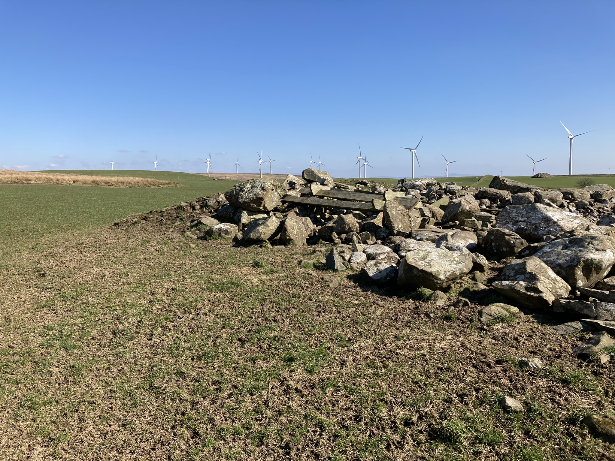

Large Clearance Stone Set Upright on W Arc of Benlaight S Cairn.

Benlaight South Cairn is a robbed out cairn on a natural knoll in a pasture field c. 2 miles N of Glenluce. The circular footprint of the cairn measures c. 25 yards in diameter and c. 5 feet high. It has been converted into a clearance cairn with large stones concentrated on the N and W Arcs. There is a bed of small stones in the centre. There are also several wooden feed troughs dumped on the N Arc. Canmore ID 62412 (go to Links) has a detailed listing of Benlaight South Cairn.
Benlaight South Cairn is c. 500 yards W of Ballach-a-Heathry cairn, a large robbed out cairn which has been similarly mistreated. Benlaight North Cairn is a small robbed out cairn, a green spot in brown moorland c. 500 yards N.
Directions: Take the minor road for Anwoth off the A75 c. 0.5 miles W of the Cardoness Castle Gatehouse of Fleet junction with the A75. Stay on this narrow road for c. 0.6 mile passing by the current Anwoth Church to reach the ruins of Anwoth Old Kirk. A path heads E from the car park S of the graveyard. Follow the path across a field to the edge of the wood. Rutherford’s Well is visible c. 40 yards N of here.


Rutherford’s Well on Canmore.
Rutherford’s Well is a natural spring associated with Samuel Rutherford who was appointed Minister of Anwoth Old Kirk in 1627. It rises c. 100 yards E of Anwoth Old Kirk on the W margin of Bog Hall Wood. According to Canmore ID 63639 (go to Links) a 19th Century Well House with modern repairs and a turfed roof covers the spring. It reaches a height of c. 6 feet.


Peristalith Stone on S Arc of Reineval Chambered Cairn.


Peristalith Stone on W Arc of Reineval Chambered Cairn.

Peristalith Stone on NW Arc of Reineval Chambered Cairn.

Exposed Capstone E of Centre of Reineval Chambered Cairn.


Possible Kerb Stones on NW Arc of Lingdowey Burn E Cairn


Possible Kerb Stone on SW Arc of Lingdowey Burn Cairn

Possible Kerb Stone on W Arc of Lingdowey Burn Cairn.

Irregular stony centre of Lingdowey Burn Cairn.
Lingdowey Burn E Cairn on Canmore.
Lingdowey Burn E Cairn is a robbed-out cairn c. 0.3 miles SSW of Cairnerzean Farm SW Cairn. All stones have been removed leaving a grassy circular footprint in open moorland. It is “situated on top of a natural knoll” as described in Canmore ID 61552 (go to Links). The cairn has a diameter of c. 18 yards with a central platform c. 12 yards across and up to c. 1 foot in the centre. There is an intermittent earth bank up to c. 1 foot high in the W half of the cairn but the E half has an outer ring of reeds obscuring the perimeter. In the E Arc there is a gap in the reeds. There are several earthset possible kerb stones on the edge of the 12 yard platform on the SW, W and NW points of the circle. The platform has an irregular grassy surface with a concentration of grassed over stones c. 1 foot high in the centre. These stones may be the protruding cist stones noted in the 1985 visit by RCAHMS.
Lingdowey Burn E Cairn is c. 0.4 miles NE of Lingdowey Burn N Cairn over rough moorland.


I have made an alternative shorter route including a new cairn, Cairnerzean Fell E, which I propose to visit soon. Cairnerzean Cairns II is 3.3 miles long, starting at the Cairnerzean Farm Cairns. It is viewable at osmaps.ordnancesurvey.co.uk/route/11462554/Cairenzean-Cairns-II
Directions: Take the A77 S from Ayr to Cairnryan. Drive 2.5 miles S from the 30mph speed limit on the S of Cairnryan. There is an unsigned left turn into a single track road to New Luce in the middle of a long straight at NX 0859 6374. Travel on this narrow road for c. 7.5 miles to a parking place at NX 1503 6754. This large parking space is c. 0.25 miles S of Cairnernerzean Farm Track on the right.
Directions: Take the New Luce turn off the A75 at the E End of Castle Kennedy. After c. 5.5 miles you reach the 30 mph speed limit on the NW edge of New Luce. Continue straight on the minor road , avoiding New Luce, for c. 2.5 miles to reach a lay-by on the left at NX 1502 6755. The access road to Cairnerzean Farm is c. 0.25 miles further N. The Cairnerzean Farm Cairns lie c. 75 yards S of here up a grassy slope.
Directions: Take the New Luce turn off the A75 at the E End of Castle Kennedy. After c. 5.5 miles you reach the 30 mph speed limit on the NW edge of New Luce. Continue straight on the minor road , avoiding New Luce, for c. 2.5 miles to reach a lay-by on the left at NX 1502 6755. The access road to Cairnerzean Farm is c. 0.25 miles further N. The Cairnerzean Farm Cairns lie c. 75 yards S of here up a grassy slope.
Directions: Take the A77 S from Ayr to Cairnryan. Drive 2.5 miles S from the 30mph speed limit on the S of Cairnryan. There is an unsigned left turn into a single track road to New Luce in the middle of a long straight at NX 0859 6374. Travel on this narrow road for c. 3.5 miles to a parking place beside an old WWII bombing target at NX 1142 6753. Cairnerzean Fell lies c. 2.5 miles E of here. My walking route is viewable on osmaps.ordnancesurvey.co.uk/route/11356088/Cairnerzean-cairns
Good walking boots, a GPS device and good stamina are requirements for this 5 mile walk over pathless open moorland.
Giant’s Dike Hillfort on Canmore


Visited 14.02.22
Giant’s Dike Hillfort consists of a ruined wall surrounding the upper slopes of Barstobrick Hill c. 1.75 miles N of Ringford in Dumfries and Galloway. According to Canmore ID 64189 (go to Links) there are remnants of the wall running from N to S on the hill, the E Flank relying on a steep craggy slope for natural defence. The internal area of the fort has no significant features beyond the modern addition of Nielson’s Monument on the summit of Barstobrick Hill.

Cairnerzean Farm SW & NE Cairn viewed from SW.
